 |
|
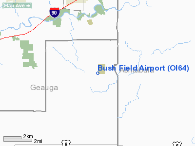
Location & QuickFacts
| FAA Information Effective: | 2008-09-25 |
| Airport Identifier: | OI64 |
| Airport Status: | Operational |
| Longitude/Latitude: | 081-01-48.8450W/41-40-50.1930N
-81.030235/41.680609 (Estimated) |
| Elevation: | 1145 ft / 349.00 m (Estimated) |
| Land: | 0 acres |
| From nearest city: | 1 nautical miles NW of Thompson, OH |
| Location: | Geauga County, OH |
| Magnetic Variation: | 07W (1985) |
Owner & Manager
| Ownership: | Privately owned |
| Owner: | Carl S. Bush |
| Address: | 7071 Ledge St.
Thompson, OH 44086 |
| Phone number: | 216-298-3523 |
| Address: |
|
Airport Operations and Facilities
| Airport Use: | Private |
| Segmented Circle: | No |
| Control Tower: | No |
| Sectional chart: | Detroit |
| Region: | AGL - Great Lakes |
| Boundary ARTCC: | ZOB - Cleveland |
| Tie-in FSS: | CLE - Cleveland |
| FSS on Airport: | No |
| FSS Toll Free: | 1-800-WX-BRIEF |
Runway Information
Runway 10/28
| Dimension: | 2100 x 150 ft / 640.1 x 45.7 m |
| Surface: | TURF, |
| |
Runway 10 |
Runway 28 |
| Traffic Pattern: | Left | Left |
|
Radio Navigation Aids
| ID |
Type |
Name |
Ch |
Freq |
Var |
Dist |
| LQL | NDB | Lakeland | | 263.00 | 08W | 15.7 nm |
| BKL | NDB | Burke Lakefront | | 416.00 | 07W | 29.9 nm |
| EZE | NDB | Engel | | 226.00 | 07W | 33.2 nm |
| HBD | NDB | Hubbard | | 408.00 | 08W | 38.9 nm |
| AK | NDB | Akron | | 362.00 | 07W | 40.1 nm |
| CL | NDB | Harri | | 344.00 | 07W | 46.8 nm |
| UCP | NDB | Castle | | 272.00 | 09W | 48.3 nm |
| CQD | NDB | Cascade | | 372.00 | 08W | 49.1 nm |
| CXR | VOR/DME | Chardon | 074X | 112.70 | 05W | 11.5 nm |
| JFN | VOR/DME | Jefferson | 099X | 115.20 | 05W | 13.5 nm |
| LNN | VOR/DME | Lost Nation | 039X | 110.20 | 08W | 16.1 nm |
| ACO | VOR/DME | Akron | 091X | 114.40 | 04W | 35.3 nm |
| YNG | VORTAC | Youngstown | 027X | 109.00 | 05W | 26.4 nm |
| ERI | VORTAC | Erie | 031X | 109.40 | 06W | 38.7 nm |
| CLE | VOT | Cleveland | | 110.40 | | 40.2 nm |
| CAK | VOT | Akron/canton Regional | | 110.60 | | 49.6 nm |
Remarks
- (E111-2) E111 CONT'D: SLOPE SFCS WHICH CANNOT BE LOWERED OR REMOVED; THRS SHOULD BE DSPLCD & CLEARLY MKD SO AS TO PRVD A MIN 20:1 APCH CLNC OVER OBSTNS...
- (E111-3) E111 CONT'D: WITH SUF RMNG USBL RWY LENGTH AVBL TO PERMIT SAFE LNDGS & TKOFS BY TYPE ACFT USING THE RWY.
- E111: PRVDD ALL TFC PATTERN OPNS AT BUSH FLD ARE CONDUCTED ON THE NORTH SIDE OF THE E/W RWY AND ALL TFC PATTERN OPNS AT WHISPERING PINES ARPT... E111 CONT'D: ARE CONDUCTED ON THE WEST SIDE OF THE N/S RWY AS STIPULATED IN LTR OF AGRMT BTN OWNERS OF BOTH ARPTS; IF THERE ARE OBSTNS IN RWY APCH...
Images and information placed above are from
http://www.airport-data.com/airport/OI64/
We thank them for the data!
| General Info
|
| Country |
United States
|
| State |
OHIO
|
| FAA ID |
OI64
|
| Latitude |
41-40-50.193N
|
| Longitude |
081-01-48.845W
|
| Elevation |
1145 feet
|
| Near City |
THOMPSON
|
We don't guarantee the information is fresh and accurate. The data may
be wrong or outdated.
For more up-to-date information please refer to other sources.
|
|


