|
|
Coordinates: 41°31′03″N 081°41′00″W / 41.5175°N 81.6833333°W / 41.5175; -81.6833333
| Cleveland Burke Lakefront Airport |
 |
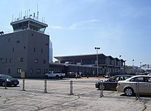 |
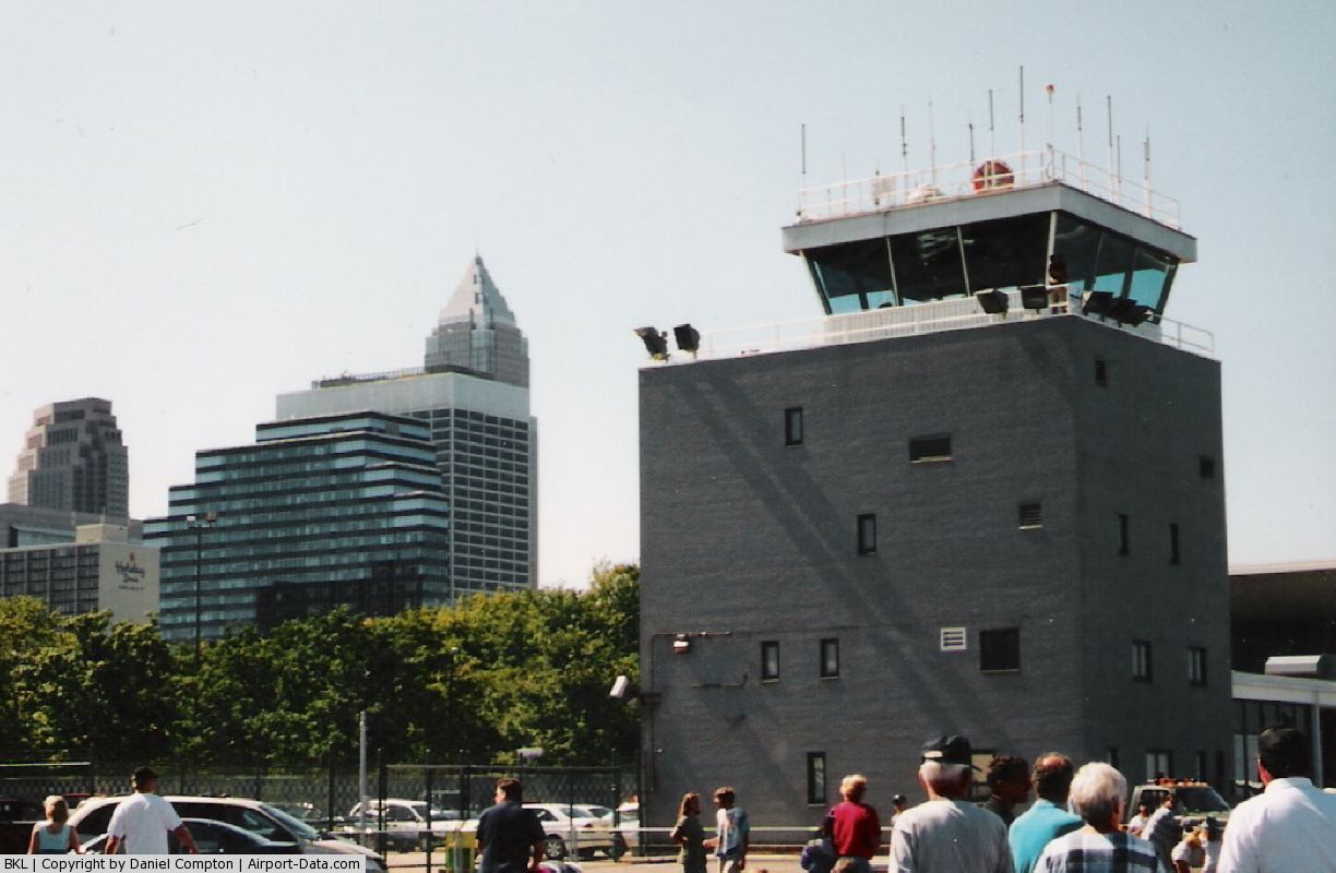
| Cleveland Burke Lakefront Airport control tower and terminal as seen from the tarmac. |
| IATA: BKL – ICAO: KBKL – FAA LID: BKL |
| Summary |
| Airport type |
Public |
| Owner |
City of Cleveland |
| Serves |
Cleveland, Ohio |
| Elevation AMSL |
583 ft / 178 m |
| Runways |
| Direction |
Length |
Surface |
| ft |
m |
| 6L/24R |
6,198 |
1,889 |
Asphalt |
| 6R/24L |
5,197 |
1,584 |
Asphalt |
| Statistics (2004) |
| Aircraft operations |
84,101 |
| Based aircraft |
72 |
| Sources: FAA & airport website |
Cleveland Burke Lakefront Airport (IATA: BKL, ICAO: KBKL, FAA LID: BKL) is a public airport situated on the shore of Lake Erie, in the northeast part of downtown Cleveland, in Cuyahoga County, Ohio, United States. It classified as a general aviation airport and is an FAA designated reliever to Cleveland Hopkins International Airport (CLE), which is Greater Cleveland's primary airport. In 2008, based on FAA data, BKL was the fourth busiest airport in the state of Ohio (after, in order, CLE, CMH, and CAK), up from 7th in 2007. It is named after former Cleveland mayor and U.S. senator Thomas A. Burke.
The airport is owned and operated by the city of Cleveland, which also operates Hopkins. It serves a growing number of corporate jets and air taxi services. Burke handled 20,618 air taxi operations in 2005, and 23,370 in 2006. BKL handled 18,595 air taxi operations in the first ten months of 2007. Burke Lakefront handles approximately 87,000 operations per year (average of 2000 to 2006). (60,013 for the first ten months of 2007). Recent commercial air service
Since late 2006, there has been no commercial air service at the airport. The airline Destination One, briefly provided scheduled charter service between BKL and airports near the downtowns of Detroit and Cincinnati, as well as to Hilton Head, SC. However, this service was short-lived. Wright Airlines was based at BKL in the 1970s and 1980s, before declaring bankruptcy. In 1979, Midway Airlines operated service from BKL to MDW in Chicago, before moving their operations to Hopkins.
Events
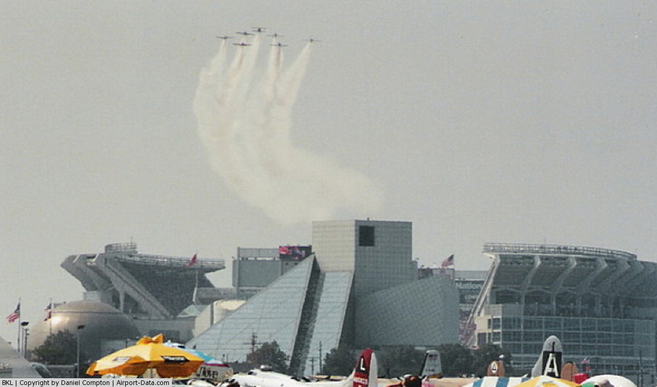
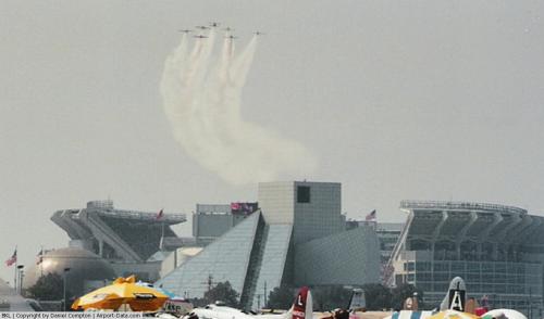
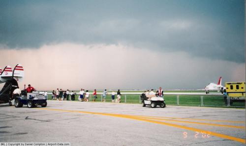
The airport was the site of the annual Grand Prix of Cleveland, last held in 2007, a Champ Car race which required the airport to be briefly shut down. Burke Lakefront Airport was the only airport in the country to host such a major car race which required careful maintenance of the runways in order to keep them safe for cars at high speeds. The airport is also the site of the annual Cleveland National Air Show, usually held over the Labor Day weekend.
Accidents
- In early 2008 there was a small twin-engined aircraft that crashed shortly after takeoff into Lake Erie. The 68-year-old pilot was rumored to have had a heart attack as he made a turn to Niagara Falls.
- In September 2009 a TS-11 Iskra practicing for the air show made a gear up landing. The pilot was unharmed and damage to the aircraft was minimal, only receiving light damage to the cowling and left wing.
Facilities and aircraft
Facilities
Cleveland Burke Lakefront Airport covers an area of 450 acres (182 ha) which contains two asphalt paved runways: 6L/24R measuring 6,198 x 150 ft (1,889 x 46 m) and 6R/24L measuring 5,197 x 100 ft (1,584 x 30 m). The airfield is fully capable of handling 737's, 757's, A320's, and smaller aircraft for normal operations.
The airport has two fixed-base operators on the grounds.
For the 12-month period ending December 31, 2004, the airport had 84,101 aircraft operations, an average of 230 per day: 76% general aviation, 24% air taxi, 1% military and <1% scheduled commercial.
Aircraft
There are 72 aircraft based at this airport: 53% single-engine, 18% multi-engine, 18% helicopter and 11% jet.
The above content comes from Wikipedia and is published under free licenses – click here to read more.
 |
(Click on the photo to enlarge) |
 |
(Click on the photo to enlarge) |
 |
(Click on the photo to enlarge) |
 |
(Click on the photo to enlarge) |
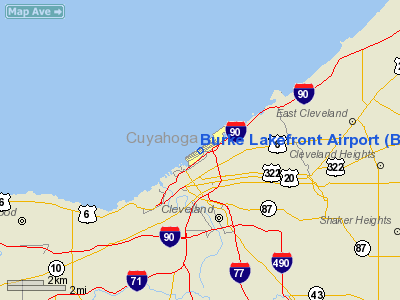
Location & QuickFacts
| FAA Information Effective: | 2008-09-25 |
| Airport Identifier: | BKL |
| Airport Status: | Operational |
| Longitude/Latitude: | 081-41-00.0000W/41-31-03.0000N
-81.683333/41.517500 (Estimated) |
| Elevation: | 583 ft / 177.70 m (Surveyed) |
| Land: | 450 acres |
| From nearest city: | 1 nautical miles N of Cleveland, OH |
| Location: | Cuyahoga County, OH |
| Magnetic Variation: | 07W (1990) |
Owner & Manager
| Ownership: | Publicly owned |
| Owner: | City Of Cleveland |
| Address: | 1501 N Marginal Road
Cleveland, OH 44114 |
| Phone number: | 216-781-6411 |
| Manager: | Khalid Bahhur |
| Address: | 1501 N Marginal Road
Cleveland, OH 44114 |
| Phone number: | 216-781-6411 |
Airport Operations and Facilities
| Airport Use: | Open to public |
| Wind indicator: | Yes |
| Segmented Circle: | No |
| Control Tower: | Yes |
| Lighting Schedule: | DUSK-DAWN
WHEN ATCT CLSD HIRL RY 06L/24R PRESET MED INTST; TO INCREASE INTENSITY RDO-REQ ON UNICOM. ACTVT MALSF RY 24R - CTAF. |
| Beacon Color: | Clear-Green (lighted land airport) |
| Landing fee charge: | Yes
FEE SCHEDULE BASED ON NUMBER OF ENGINES AND GWT. |
| Sectional chart: | Detroit |
| Region: | AGL - Great Lakes |
| Boundary ARTCC: | ZOB - Cleveland |
| Tie-in FSS: | CLE - Cleveland |
| FSS on Airport: | No |
| FSS Toll Free: | 1-800-WX-BRIEF |
| NOTAMs Facility: | BKL (NOTAM-d service avaliable) |
| Certification type/date: | IV A U 05/197
PPR FOR UNSCHEDULED AIR CARRIER OPNS WITH MORE THAN 30 PSGR SEATS CONTACT 216-781-6411. |
| Federal Agreements: | NGY |
Airport Communications
| CTAF: | 124.300 |
| Unicom: | 122.950 |
Airport Services
| Fuel available: | 100LLA |
| Airframe Repair: | MAJOR |
| Power Plant Repair: | MAJOR |
| Bottled Oxygen: | NONE |
| Bulk Oxygen: | HIGH/LOW |
Runway Information
Runway 06L/24R
| Dimension: | 6198 x 150 ft / 1889.2 x 45.7 m |
| Surface: | ASPH, Good Condition |
| Surface Treatment: | Saw-cut or plastic Grooved |
| Weight Limit: | Single wheel: 93000 lbs.
Dual wheel: 113000 lbs.
Dual tandem wheel: 170000 lbs. |
| Edge Lights: | High |
| |
Runway 06L |
Runway 24R |
| Longitude: | 081-41-33.5617W | 081-40-24.5421W |
| Latitude: | 41-30-49.8599N | 41-31-22.3875N |
| Elevation: | 581.00 ft | 582.00 ft |
| Alignment: | 58 | 127 |
| ILS Type: | | ILS/DME
|
| Traffic Pattern: | Left | Right |
| Markings: | Precision instrument, Good Condition | Precision instrument, Good Condition |
| Crossing Height: | 32.00 ft | 26.00 ft |
| Displaced threshold: | 265.00 ft | 0.00 ft |
| VASI: | 4-box on left side | 4-box on left side |
| Visual Glide Angle: | 3.00° | 3.35° |
| Approach lights: | | MALSF |
| Runway End Identifier: | Yes | |
| Obstruction: | , 50:1 slope to clear
APCH RATIO 20:1 FROM DSPLCD THR. | 122 ft bldg, 3364.0 ft from runway, 837 ft left of centerline, 25:1 slope to clear |
|
Runway 06R/24L
| Dimension: | 5197 x 100 ft / 1584.0 x 30.5 m |
| Surface: | ASPH, Good Condition |
| Surface Treatment: | Saw-cut or plastic Grooved |
| Weight Limit: | Single wheel: 43000 lbs.
Dual wheel: 50000 lbs.
Dual tandem wheel: 82000 lbs. |
| Edge Lights: | High |
| |
Runway 06R |
Runway 24L |
| Longitude: | 081-41-30.0712W | 081-40-32.1891W |
| Latitude: | 41-30-45.6762N | 41-31-12.9521N |
| Elevation: | 581.00 ft | 583.00 ft |
| Alignment: | 58 | 127 |
| Traffic Pattern: | Left | Right |
| Markings: | Basic, Good Condition | Basic, Good Condition |
| Displaced threshold: | 267.00 ft | 0.00 ft |
| Runway End Identifier: | | Yes |
| Obstruction: | , 50:1 slope to clear
APCH RATIO 19:1 FM DSPLCD THR; 126 FT CRANE 2238 FT FM RY END 204 FT L. | 274 ft ant, 6560.0 ft from runway, 1222 ft left of centerline, 23:1 slope to clear |
|
Radio Navigation Aids
| ID |
Type |
Name |
Ch |
Freq |
Var |
Dist |
| BKL | NDB | Burke Lakefront | | 416.00 | 07W | 1.1 nm |
| EZE | NDB | Engel | | 226.00 | 07W | 2.5 nm |
| CL | NDB | Harri | | 344.00 | 07W | 16.6 nm |
| LQL | NDB | Lakeland | | 263.00 | 08W | 16.9 nm |
| AK | NDB | Akron | | 362.00 | 07W | 30.0 nm |
| AAU | NDB | Ashland | | 329.00 | 07W | 42.1 nm |
| PT | NDB | Pelee Island | | 283.00 | 05W | 47.0 nm |
| LNN | VOR/DME | Lost Nation | 039X | 110.20 | 08W | 16.6 nm |
| CXR | VOR/DME | Chardon | 074X | 112.70 | 05W | 23.4 nm |
| DJB | VOR/DME | Dryer | 083X | 113.60 | 05W | 23.6 nm |
| ACO | VOR/DME | Akron | 091X | 114.40 | 04W | 32.9 nm |
| SKY | VOR/DME | Sandusky | 029X | 109.20 | 04W | 44.0 nm |
| JFN | VOR/DME | Jefferson | 099X | 115.20 | 05W | 44.5 nm |
| BSV | VOR/DME | Briggs | 071X | 112.40 | 04W | 48.1 nm |
| YNG | VORTAC | Youngstown | 027X | 109.00 | 05W | 46.8 nm |
| CLE | VOT | Cleveland | | 110.40 | | 9.8 nm |
| CAK | VOT | Akron/canton Regional | | 110.60 | | 37.7 nm |
Remarks
- BIRDS AND WATERFOWL ON & INVOF ARPT.
- FLIGHT NOTIFICATION SERVICE (ADCUS) AVBL 24 HRS MON-FRI REQ FOR SERVICE ON SAT; SUN & HOLS MUST BE MADE PRIOR TO 1630 ON FRI; 2 HRS ADVANCE NOTICE REQUIRED CALL 216-522-4781. PRIVATE ACFT & GENERAL AVIATION ONLY.
- TWY G EAST OF TWY F CLSD.
- 72 FT SHIP CRANE 1300 FT SW OF RY 06R.
- OR LOCAL CALL 267-3700.
- BANNER TOWING OPNS NOT AUTHORIZED.
- RY 06R/24L NOT AUTHORIZED FOR OPNS INVOLVING ACR ACFT WITH MORE THAN 30 PSGR SEATS.
- HEL ASP: PRIOR TO PART 157.
Images and information placed above are from
http://www.airport-data.com/airport/BKL/
We thank them for the data!
| General Info
|
| Country |
United States
|
| State |
OHIO
|
| FAA ID |
BKL
|
| Latitude |
41-31-03.000N
|
| Longitude |
081-41-00.000W
|
| Elevation |
583 feet
|
| Near City |
CLEVELAND
|
We don't guarantee the information is fresh and accurate. The data may
be wrong or outdated.
For more up-to-date information please refer to other sources.
|
|