 |
|
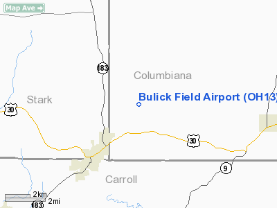
Location & QuickFacts
| FAA Information Effective: | 2008-09-25 |
| Airport Identifier: | OH13 |
| Airport Status: | Operational |
| Longitude/Latitude: | 081-03-29.3420W/40-46-05.2120N
-81.058151/40.768114 (Estimated) |
| Elevation: | 1285 ft / 391.67 m (Estimated) |
| Land: | 4 acres |
| From nearest city: | 3 nautical miles NE of Minerva, OH |
| Location: | Columbiana County, OH |
| Magnetic Variation: | 07W (1985) |
Owner & Manager
| Ownership: | Privately owned |
| Owner: | George & Lisa Bulick |
| Address: | 9383 Hanson Road
Minerva, OH 44657 |
| Phone number: | 216-894-2733 |
| Manager: | Lisa Bulick |
| Address: | 9383 Hanson Road
Minerva, OH 44657 |
| Phone number: | 216-894-2733 |
Airport Operations and Facilities
| Airport Use: | Private |
| Wind indicator: | No |
| Segmented Circle: | No |
| Control Tower: | No |
| Landing fee charge: | No |
| Sectional chart: | Detroit |
| Region: | AGL - Great Lakes |
| Boundary ARTCC: | ZOB - Cleveland |
| Tie-in FSS: | CLE - Cleveland |
| FSS on Airport: | No |
| FSS Toll Free: | 1-800-WX-BRIEF |
Airport Services
| Airframe Repair: | NONE |
| Power Plant Repair: | NONE |
| Bottled Oxygen: | NONE |
| Bulk Oxygen: | NONE |
Runway Information
Runway 09/27
| Dimension: | 1985 x 50 ft / 605.0 x 15.2 m |
| Surface: | TURF, Fair Condition |
| |
Runway 09 |
Runway 27 |
| Longitude: | 082-23-42.4800W | 082-23-16.6900W |
| Latitude: | 40-46-05.1900N | 40-46-05.1900N |
| Elevation: | 1285.00 ft | 1285.00 ft |
| Traffic Pattern: | Right | Left |
| Markings: | None, | None, |
| Runway End Identifier: | No | No |
| Centerline Lights: | No | No |
| Touchdown Lights: | No | No |
| Obstruction: | 50 ft trees, 300.0 ft from runway, 75 ft left of centerline | 30 ft pline, 0.0 ft from runway, 85 ft left of centerline |
|
Radio Navigation Aids
| ID |
Type |
Name |
Ch |
Freq |
Var |
Dist |
| TSO | NDB | Tolson | | 395.00 | 07W | 12.4 nm |
| AK | NDB | Akron | | 362.00 | 07W | 23.5 nm |
| CFX | NDB | Cadiz | | 239.00 | 07W | 32.0 nm |
| UCP | NDB | Castle | | 272.00 | 09W | 33.0 nm |
| HBD | NDB | Hubbard | | 408.00 | 08W | 33.3 nm |
| MLR | NDB | Millersburg/dcmsnd | | 382.00 | 06W | 39.6 nm |
| BSV | VOR/DME | Briggs | 071X | 112.40 | 04W | 17.1 nm |
| ACO | VOR/DME | Akron | 091X | 114.40 | 04W | 21.4 nm |
| CTW | VOR/DME | Newcomerstown | 055X | 111.80 | 07W | 37.6 nm |
| HLG | VOR/DME | Wheeling | 059X | 112.20 | 07W | 37.9 nm |
| CXR | VOR/DME | Chardon | 074X | 112.70 | 05W | 45.3 nm |
| AIR | VOR/DME | Bellaire | 118X | 117.10 | 07W | 46.5 nm |
| YNG | VORTAC | Youngstown | 027X | 109.00 | 05W | 38.0 nm |
| EWC | VORTAC | Ellwood City | 105X | 115.80 | 08W | 38.7 nm |
| MMJ | VORTAC | Montour | 057X | 112.00 | 08W | 42.9 nm |
| CAK | VOT | Akron/canton Regional | | 110.60 | | 19.6 nm |
Remarks
- RWY SFC IS ROLLING.
- VFR ONLY.
Images and information placed above are from
http://www.airport-data.com/airport/OH13/
We thank them for the data!
| General Info
|
| Country |
United States
|
| State |
OHIO
|
| FAA ID |
OH13
|
| Latitude |
40-46-05.212N
|
| Longitude |
081-03-29.342W
|
| Elevation |
1285 feet
|
| Near City |
MINERVA
|
We don't guarantee the information is fresh and accurate. The data may
be wrong or outdated.
For more up-to-date information please refer to other sources.
|
|


