 |
|
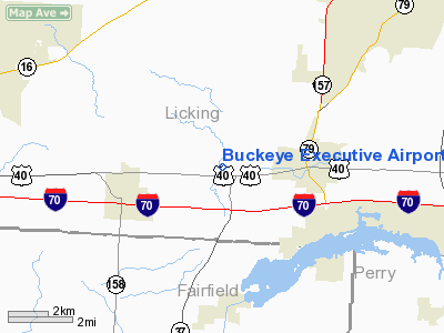
Buckeye Executive Airport |
Location & QuickFacts
| FAA Information Effective: | 2008-09-25 |
| Airport Identifier: | 9OA5 |
| Airport Status: | Operational |
| Longitude/Latitude: | 082-32-26.3730W/39-57-42.1290N
-82.540659/39.961702 (Estimated) |
| Elevation: | 914 ft / 278.59 m (Surveyed) |
| Land: | 58 acres |
| From nearest city: | 2 nautical miles W of Hebron, OH |
| Location: | Licking County, OH |
| Magnetic Variation: | 06W (1990) |
Owner & Manager
| Ownership: | Privately owned |
| Owner: | Jim Carter |
| Address: | 2197c Refugee Road
Hebron, OH 43025 |
| Phone number: | 740-928-7412 |
| Address: |
|
Airport Operations and Facilities
| Airport Use: | Private |
| Wind indicator: | Yes |
| Segmented Circle: | No |
| Control Tower: | No |
| Lighting Schedule: | RDO-CTL
ACTVT MIRL RY 01/19 & NSTD VASI RY 01 - 118.5. |
| Landing fee charge: | Yes |
| Sectional chart: | Cincinnati |
| Region: | AGL - Great Lakes |
| Boundary ARTCC: | ZID - Indianapolis |
| Tie-in FSS: | DAY - Dayton |
| FSS on Airport: | No |
| FSS Toll Free: | 1-800-WX-BRIEF |
Airport Communications
| Unicom: | 123.000
FREQ 123.5 USED BY TRAINING SCHOOL. |
Airport Services
| Bottled Oxygen: | NONE |
| Bulk Oxygen: | NONE |
Runway Information
Runway 01/19
| Dimension: | 2764 x 25 ft / 842.5 x 7.6 m
5'TAR/CHIP SHOULDER ON EACH SIDE OF RWY. |
| Surface: | ASPH, Good Condition |
| Edge Lights: | Medium |
| |
Runway 01 |
Runway 19 |
| Longitude: | 082-32-27.2190W | 082-32-25.5160W |
| Latitude: | 39-57-28.5030N | 39-57-55.7880N |
| Elevation: | 905.00 ft | 914.00 ft |
| Alignment: | 3 | 127 |
| Traffic Pattern: | Left | Left |
| Markings: | Basic, Good Condition | ,
NO NUMBERS. |
| Displaced threshold: | 189.00 ft
& 19 THRS DSPLCD NGTS ONLY. | 177.00 ft |
| VASI: | nonstandard system
VASI OPERS NIGHTTIME ONLY. | |
| Runway End Identifier: | No | No |
| Centerline Lights: | No | No |
| Touchdown Lights: | No | No |
| Obstruction: | , 50:1 slope to clear
+14' ROAD 55' FM RY END. | 67 ft trees, 201.0 ft from runway, 15 ft left of centerline
APCH RATIO 5:1 TO DSPLCD THR.
+68' TREE 137' FM RY 80'L. +10' RD 150' FM RY END. |
|
Radio Navigation Aids
| ID |
Type |
Name |
Ch |
Freq |
Var |
Dist |
| HEH | NDB | Newark | | 524.00 | 06W | 5.2 nm |
| CM | NDB | Sumie | | 391.00 | 05W | 10.0 nm |
| CHC | NDB | Grens | | 272.00 | 04W | 22.7 nm |
| DKG | NDB | Don Scott | | 348.00 | 05W | 25.8 nm |
| HRA | NDB | Zanesville | | 204.00 | 06W | 28.8 nm |
| OS | NDB | Fuler | | 515.00 | 05W | 31.0 nm |
| BU | NDB | Boutn | | 230.00 | 05W | 31.8 nm |
| DLZ | NDB | Delaware | | 215.00 | 06W | 32.1 nm |
| CYO | NDB | Circleville | | 366.00 | 05W | 33.3 nm |
| RZT | NDB | Ross County | | 236.00 | 05W | 38.7 nm |
| MRT | NDB | Marysville | | 403.00 | 05W | 40.5 nm |
| UYF | NDB | London | | 263.00 | 06W | 42.7 nm |
| CSS | NDB | Court House | | 414.00 | 05W | 44.9 nm |
| MNN | NDB | Marion | | 201.00 | 05W | 46.3 nm |
| MLR | NDB | Millersburg/dcmsnd | | 382.00 | 06W | 46.4 nm |
| UGS | NDB | University | | 250.00 | 06W | 46.5 nm |
| MF | NDB | Manns | | 372.00 | 06W | 48.5 nm |
| LCK | TACAN | Rickenbacker | 069X | | 05W | 20.1 nm |
| XUB | VOR | Yellow Bud | | 112.50 | 05W | 33.0 nm |
| BUD | VOR | Buckeye | | 109.80 | 05W | 46.1 nm |
| ZZV | VOR/DME | Zanesville | 051X | 111.40 | 06W | 29.9 nm |
| TVT | VOR/DME | Tiverton | 112X | 116.50 | 03W | 35.4 nm |
| APE | VORTAC | Appleton | 114X | 116.70 | 06W | 11.6 nm |
| CMH | VOT | Port Columbus | | 111.00 | | 16.0 nm |
Remarks
- DRAG STRIP 1/4 MI WEST HAS PVD NW/SE SFC, DO NOT CONFUSE WITH ARPT.
- 2402' X 75' TURF EAST OF & PARALLEL TO RY 01/19 IS USABLE AS A RY.
- ROAD 55 FT FROM RY 01 THR.
- CAMPING AVAILABLE.
- IN OPER PRIOR TO PART 157.
Images and information placed above are from
http://www.airport-data.com/airport/9OA5/
We thank them for the data!
| General Info
|
| Country |
United States
|
| State |
OHIO
|
| FAA ID |
9OA5
|
| Latitude |
39-57-42.129N
|
| Longitude |
082-32-26.373W
|
| Elevation |
914 feet
|
| Near City |
HEBRON
|
We don't guarantee the information is fresh and accurate. The data may
be wrong or outdated.
For more up-to-date information please refer to other sources.
|
|


