 |
|
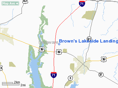
Brown's Lakeside Landings Airport |
Location & QuickFacts
| FAA Information Effective: | 2008-09-25 |
| Airport Identifier: | OH14 |
| Airport Status: | Operational |
| Longitude/Latitude: | 082-55-00.6510W/40-16-45.2230N
-82.916848/40.279229 (Estimated) |
| Elevation: | 970 ft / 295.66 m (Estimated) |
| Land: | 10 acres |
| From nearest city: | 3 nautical miles NW of Sunbury, OH |
| Location: | Delaware County, OH |
| Magnetic Variation: | 05W (1990) |
Owner & Manager
| Ownership: | Privately owned |
| Owner: | Roger R Brown |
| Address: | 1201 N Galena Rd
Sunbury, OH 43074 |
| Phone number: | 614-524-0128 |
| Manager: | Roger R Brown |
| Address: | 1201 N Galena Rd
Sunbury, OH 43074 |
| Phone number: | 614-524-0128 |
Airport Operations and Facilities
| Airport Use: | Private |
| Segmented Circle: | No |
| Control Tower: | No |
| Sectional chart: | Detroit |
| Region: | AGL - Great Lakes |
| Boundary ARTCC: | ZID - Indianapolis |
| Tie-in FSS: | DAY - Dayton |
| FSS Toll Free: | 1-800-WX-BRIEF |
Runway Information
Runway 09/27
| Dimension: | 2800 x 100 ft / 853.4 x 30.5 m |
| Surface: | TURF, |
| |
Runway 09 |
Runway 27 |
| Longitude: | 084-34-21.7900W | 084-33-27.8400W |
| Latitude: | 41-34-47.1700N | 41-34-47.1700N |
| Elevation: | 915.00 ft | 915.00 ft |
| Traffic Pattern: | Left | Left |
|
Radio Navigation Aids
| ID |
Type |
Name |
Ch |
Freq |
Var |
Dist |
| DLZ | NDB | Delaware | | 215.00 | 06W | 8.5 nm |
| DKG | NDB | Don Scott | | 348.00 | 05W | 14.1 nm |
| CHC | NDB | Grens | | 272.00 | 04W | 17.0 nm |
| OS | NDB | Fuler | | 515.00 | 05W | 17.9 nm |
| CM | NDB | Sumie | | 391.00 | 05W | 19.1 nm |
| MRT | NDB | Marysville | | 403.00 | 05W | 20.1 nm |
| MNN | NDB | Marion | | 201.00 | 05W | 21.5 nm |
| HEH | NDB | Newark | | 524.00 | 06W | 25.8 nm |
| BU | NDB | Boutn | | 230.00 | 05W | 30.7 nm |
| UYF | NDB | London | | 263.00 | 06W | 32.7 nm |
| RUV | NDB | Rushsylvania | | 326.00 | 05W | 36.1 nm |
| MF | NDB | Manns | | 372.00 | 06W | 36.3 nm |
| EDJ | NDB | Bellefontaine | | 242.00 | 05W | 41.5 nm |
| CYO | NDB | Circleville | | 366.00 | 05W | 45.5 nm |
| CSS | NDB | Court House | | 414.00 | 05W | 46.3 nm |
| CCJ | NDB | Clark County | | 341.00 | 04W | 46.6 nm |
| LCK | TACAN | Rickenbacker | 069X | | 05W | 28.3 nm |
| BUD | VOR | Buckeye | | 109.80 | 05W | 21.4 nm |
| XUB | VOR | Yellow Bud | | 112.50 | 05W | 45.3 nm |
| TVT | VOR/DME | Tiverton | 112X | 116.50 | 03W | 37.7 nm |
| APE | VORTAC | Appleton | 114X | 116.70 | 06W | 16.9 nm |
| MFD | VORTAC | Mansfield | 025X | 108.80 | 03W | 38.4 nm |
| CMH | VOT | Port Columbus | | 111.00 | | 17.2 nm |
Remarks
- ARPT MAY BE CLOSED SOME IN SPRING DUE TO SOFT TURF.
- PROVIDED OBST IN RWY APCH SLOPE SFC REMOVED/LOWERED OR RWY THR DSPLCD AND MKD TO PROVIDE MIN 20:1 APCH CLNC OVER OBST; AREA 125' EITHER SIDE RWY CL AND 200' OFF RWY ENDS BE CLEAR OF OBST; OBST ADJACENT TO AND ALONGSIDE RWY REMOVED/LOWERED TO PROVIDE MIN 7:1 TRANSITIONAL CLNC OVER OBST.
Images and information placed above are from
http://www.airport-data.com/airport/OH14/
We thank them for the data!
| General Info
|
| Country |
United States
|
| State |
OHIO
|
| FAA ID |
OH14
|
| Latitude |
40-16-45.223N
|
| Longitude |
082-55-00.651W
|
| Elevation |
970 feet
|
| Near City |
SUNBURY
|
We don't guarantee the information is fresh and accurate. The data may
be wrong or outdated.
For more up-to-date information please refer to other sources.
|
|


