 |
|
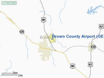
Location & QuickFacts
| FAA Information Effective: | 2008-09-25 |
| Airport Identifier: | GEO |
| Airport Status: | Operational |
| Longitude/Latitude: | 083-52-57.8520W/38-52-55.0041N
-83.882737/38.881946 (Estimated) |
| Elevation: | 958 ft / 292.00 m (Surveyed) |
| Land: | 42 acres |
| From nearest city: | 1 nautical miles NE of Georgetown, OH |
| Location: | Brown County, OH |
| Magnetic Variation: | 05W (2000) |
Owner & Manager
| Ownership: | Publicly owned |
| Owner: | Brown Co Comm |
| Address: | Brown County Courthouse
Georgetown, OH 45121 |
| Phone number: | 937-378-3956 |
| Manager: | Dan Van Antwerp |
| Address: | 8862 Airport Road
Georgetown, OH 45121 |
| Phone number: | 937-378-4848
STEVE R. MCKINNEY HOME 937-379-1634; BUS 937-379-1055. |
Airport Operations and Facilities
| Airport Use: | Open to public |
| Wind indicator: | Yes |
| Segmented Circle: | No |
| Control Tower: | No |
| Lighting Schedule: | DUSK-DAWN
ACTVT MIRL RY 17/35 - CTAF. |
| Beacon Color: | Clear-Green (lighted land airport) |
| Landing fee charge: | No |
| Sectional chart: | Cincinnati |
| Region: | AGL - Great Lakes |
| Boundary ARTCC: | ZID - Indianapolis |
| Tie-in FSS: | DAY - Dayton |
| FSS on Airport: | No |
| FSS Toll Free: | 1-800-WX-BRIEF |
| NOTAMs Facility: | DAY (NOTAM-d service avaliable) |
| Federal Agreements: | N |
Airport Communications
Airport Services
| Fuel available: | 100LL
SELF SERVICE FUEL AVBL 24 HRS WITH CREDIT CARD. |
| Bottled Oxygen: | NONE |
| Bulk Oxygen: | NONE |
Runway Information
Runway 17/35
| Dimension: | 3530 x 65 ft / 1075.9 x 19.8 m |
| Surface: | ASPH, Fair Condition |
| Edge Lights: | Medium |
| |
Runway 17 |
Runway 35 |
| Longitude: | 083-53-01.6527W | 083-52-54.0519W |
| Latitude: | 38-53-12.1940N | 38-52-37.8141N |
| Elevation: | 956.00 ft | 953.00 ft |
| Alignment: | 127 | 127 |
| Traffic Pattern: | Left | Left |
| Markings: | Non-precision instrument, Poor Condition
RWY 17 MARKINGS FADED. | Non-precision instrument, Poor Condition
RWY 35 MARKINGS FADED. |
| Runway End Identifier: | No | No |
| Touchdown Lights: | No | No |
| Obstruction: | 6 ft road, 236.0 ft from runway, 250 ft right of centerline, 6:1 slope to clear
+4 FT FENCE 0 FT FM TO 150 FT FM 200 FT L. | 15 ft road, 356.0 ft from runway, 274 ft left of centerline, 10:1 slope to clear |
|
Radio Navigation Aids
| ID |
Type |
Name |
Ch |
Freq |
Var |
Dist |
| AMT | NDB | West Union | | 359.00 | 04W | 15.0 nm |
| PWF | NDB | Sportys | | 245.00 | 04W | 19.5 nm |
| XW | NDB | Flmng | | 400.00 | 05W | 21.6 nm |
| HOC | NDB | Hillsboro | | 278.00 | 05W | 24.1 nm |
| PZO | NDB | Peebles | | 329.00 | 02W | 26.1 nm |
| LUK | NDB | Cincinnati | | 335.00 | 04W | 27.1 nm |
| HW | NDB | Cubla | | 299.00 | 04W | 28.3 nm |
| MDE | NDB | Madeira | | 379.00 | 04W | 30.1 nm |
| ISZ | NDB | Cincinnati-blue Ash | | 388.00 | 04W | 32.3 nm |
| IL | NDB | Airbo | | 407.00 | 04W | 37.3 nm |
| UR | NDB | Burln | | 321.00 | 04W | 42.8 nm |
| HAO | NDB | Hamilton | | 260.00 | 04W | 43.6 nm |
| HKF | NDB | Hook Field | | 239.00 | 04W | 45.5 nm |
| EOP | NDB | Waverly | | 385.00 | 06W | 47.6 nm |
| CSS | NDB | Court House | | 414.00 | 05W | 48.9 nm |
| PMH | NDB | Portsmouth | | 373.00 | 04W | 49.0 nm |
| IOB | NDB | Mount Sterling | | 210.00 | 04W | 49.6 nm |
| FLM | VOR/DME | Falmouth | 117X | 117.00 | 04W | 24.4 nm |
| MXQ | VOR/DME | Midwest | 076X | 112.90 | 04W | 33.1 nm |
| CVG | VORTAC | Cincinnati | 120X | 117.30 | 04W | 39.2 nm |
| YRK | VORTAC | York | 075X | 112.80 | 05W | 44.7 nm |
| LUK | VOT | Cincinnati Muni/lunken | | 108.40 | | 28.0 nm |
Remarks
- AEROBATIC PRACTICE SFC TO 4500 FT AGL ABOVE RY 17/35.
Images and information placed above are from
http://www.airport-data.com/airport/GEO/
We thank them for the data!
| General Info
|
| Country |
United States
|
| State |
OHIO
|
| FAA ID |
GEO
|
| Latitude |
38-52-55.048N
|
| Longitude |
083-52-57.838W
|
| Elevation |
957 feet
|
| Near City |
GEORGETOWN
|
We don't guarantee the information is fresh and accurate. The data may
be wrong or outdated.
For more up-to-date information please refer to other sources.
|
|


