 |
|
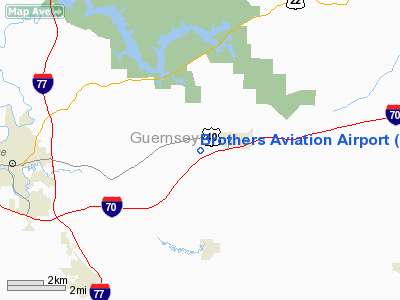
Brothers Aviation Airport |
Location & QuickFacts
| FAA Information Effective: | 2008-09-25 |
| Airport Identifier: | 9OI8 |
| Airport Status: | Operational |
| Longitude/Latitude: | 081-27-54.4260W/40-01-56.2560N
-81.465118/40.032293 (Estimated) |
| Elevation: | 1040 ft / 316.99 m (Estimated) |
| Land: | 10 acres |
| From nearest city: | 1 nautical miles E of Old Washington, OH |
| Location: | Guernsey County, OH |
| Magnetic Variation: | 06W (1985) |
Owner & Manager
| Ownership: | Privately owned |
| Owner: | Wayne P. Sicard |
| Address: | 64508 Slade Rd.
Cambridge, OH 43725-9697 |
| Phone number: | 614-432-5548 |
| Manager: | Wayne P. Sicard |
| Address: | 64500 Slade Rd.
Cambridge, OH 43725-9697 |
| Phone number: | 614-432-5548 |
Airport Operations and Facilities
| Airport Use: | Private |
| Wind indicator: | Yes |
| Segmented Circle: | No |
| Control Tower: | No |
| Landing fee charge: | No |
| Sectional chart: | Cincinnati |
| Region: | AGL - Great Lakes |
| Boundary ARTCC: | ZOB - Cleveland |
| Tie-in FSS: | CLE - Cleveland |
| FSS on Airport: | No |
| FSS Toll Free: | 1-800-WX-BRIEF |
Runway Information
Runway 17/35
| Dimension: | 1500 x 60 ft / 457.2 x 18.3 m |
| Surface: | TURF, |
| |
Runway 17 |
Runway 35 |
| Traffic Pattern: | Right | Left |
|
Radio Navigation Aids
| ID |
Type |
Name |
Ch |
Freq |
Var |
Dist |
| PKB | FAN MARKER | Marietta Ohio | | | 03W | 39.0 nm |
| HRA | NDB | Zanesville | | 204.00 | 06W | 22.2 nm |
| CFX | NDB | Cadiz | | 239.00 | 07W | 24.1 nm |
| MLR | NDB | Millersburg/dcmsnd | | 382.00 | 06W | 35.9 nm |
| TSO | NDB | Tolson | | 395.00 | 07W | 36.5 nm |
| HEH | NDB | Newark | | 524.00 | 06W | 46.0 nm |
| CTW | VOR/DME | Newcomerstown | 055X | 111.80 | 07W | 11.8 nm |
| ZZV | VOR/DME | Zanesville | 051X | 111.40 | 06W | 20.4 nm |
| AIR | VOR/DME | Bellaire | 118X | 117.10 | 07W | 29.8 nm |
| TVT | VOR/DME | Tiverton | 112X | 116.50 | 03W | 39.7 nm |
| BSV | VOR/DME | Briggs | 071X | 112.40 | 04W | 42.6 nm |
| HLG | VOR/DME | Wheeling | 059X | 112.20 | 07W | 43.4 nm |
| JPU | VORTAC | Parkersburg | 023X | 108.60 | 03W | 35.8 nm |
Remarks
- PRVDD OBSTNS IN APCH SFC ARE REMOVED/LOWERED OR THR DSPLCD TO PROVIDE A 20:1 CLRNC.
Images and information placed above are from
http://www.airport-data.com/airport/9OI8/
We thank them for the data!
| General Info
|
| Country |
United States
|
| State |
OHIO
|
| FAA ID |
9OI8
|
| Latitude |
40-01-56.256N
|
| Longitude |
081-27-54.426W
|
| Elevation |
1040 feet
|
| Near City |
OLD WASHINGTON
|
We don't guarantee the information is fresh and accurate. The data may
be wrong or outdated.
For more up-to-date information please refer to other sources.
|
|


