 |
|
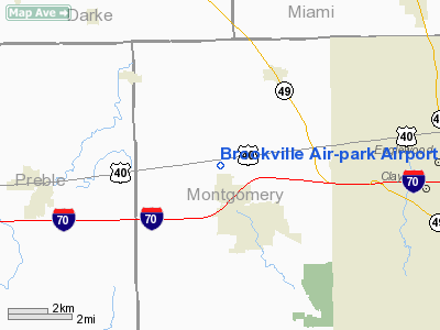
Brookville Air-park Airport |
Location & QuickFacts
| FAA Information Effective: | 2008-09-25 |
| Airport Identifier: | I62 |
| Airport Status: | Operational |
| Longitude/Latitude: | 084-25-59.8140W/39-51-45.1910N
-84.433282/39.862553 (Estimated) |
| Elevation: | 1037 ft / 316.08 m (Surveyed) |
| Land: | 100 acres |
| From nearest city: | 2 nautical miles NW of Brookville, OH |
| Location: | Montgomery County, OH |
| Magnetic Variation: | 04W (1985) |
Owner & Manager
| Ownership: | Privately owned |
| Owner: | Lowell Slatter |
| Address: | 9386 Natl Rd Rt 40
Brookville, OH 45309 |
| Phone number: | 937-833-4909 |
| Manager: | Lowell Slatter |
| Address: | 9386 Natl Rd Rt 40
Brookville, OH 45309 |
| Phone number: | 937-833-2590 |
Airport Operations and Facilities
| Airport Use: | Open to public |
| Wind indicator: | Yes |
| Segmented Circle: | No |
| Control Tower: | No |
| Lighting Schedule: | RDO-CTL
ACTVT LIRL RY 09/27 - 122.8. |
| Landing fee charge: | No |
| Sectional chart: | Cincinnati |
| Region: | AGL - Great Lakes |
| Boundary ARTCC: | ZID - Indianapolis |
| Tie-in FSS: | DAY - Dayton |
| FSS on Airport: | No |
| FSS Toll Free: | 1-800-WX-BRIEF |
| NOTAMs Facility: | DAY (NOTAM-d service avaliable) |
Airport Communications
| CTAF: | 122.800 |
| Unicom: | 122.800 |
Airport Services
| Fuel available: | 100LL
100LL FUEL AVAILABLE 24 HOUR A DAY BY CREDIT CARD. |
| Airframe Repair: | MAJOR |
| Power Plant Repair: | MAJOR |
Runway Information
Runway 09/27
| Dimension: | 2500 x 30 ft / 762.0 x 9.1 m |
| Surface: | ASPH, Poor Condition
RWY 09/27 PAVEMENT CONDITION POOR - WEATHERED, LOOSE AGGREGATE, BROKEN PAVEMENT. |
| Edge Lights: | Low |
| |
Runway 09 |
Runway 27 |
| Longitude: | 084-26-15.8100W | 084-25-43.8000W |
| Latitude: | 39-51-44.5400N | 39-51-45.8300N |
| Elevation: | 1040.00 ft | 1040.00 ft |
| Traffic Pattern: | Left | Left |
| Markings: | None, | None, |
| Obstruction: | 15 ft road, 289.0 ft from runway, 134 ft left of centerline, 5:1 slope to clear
RWY 09 +38 FT TREES 0 FT FM RY END 60 FT R. CULTIVATION. | 43 ft trees, 201.0 ft from runway, 100 ft left of centerline
RWY 27 +23 - 43 FT BRUSH & TREES 158-200 FT FM 71 FT R-125 FT L; +10 FT PVT RD 140 FT FM 125 FT R-125 FT L. |
|
Radio Navigation Aids
| ID |
Type |
Name |
Ch |
Freq |
Var |
Dist |
| VES | NDB | Versailles | | 356.00 | 04W | 21.1 nm |
| HKF | NDB | Hook Field | | 239.00 | 04W | 21.9 nm |
| XEN | NDB | Xenia | | 395.00 | 03W | 24.9 nm |
| OXD | NDB | Oxford | | 282.00 | 04W | 26.7 nm |
| HAO | NDB | Hamilton | | 260.00 | 04W | 30.1 nm |
| CCJ | NDB | Clark County | | 341.00 | 04W | 30.2 nm |
| ISZ | NDB | Cincinnati-blue Ash | | 388.00 | 04W | 36.9 nm |
| CQA | NDB | Lakefield | | 205.00 | 04W | 37.7 nm |
| MDE | NDB | Madeira | | 379.00 | 04W | 38.6 nm |
| IL | NDB | Airbo | | 407.00 | 04W | 39.2 nm |
| HW | NDB | Cubla | | 299.00 | 04W | 40.0 nm |
| UWL | NDB | New Castle | | 385.00 | 02W | 40.9 nm |
| EDJ | NDB | Bellefontaine | | 242.00 | 05W | 41.8 nm |
| LUK | NDB | Cincinnati | | 335.00 | 04W | 42.5 nm |
| PLD | NDB | Portland | | 257.00 | 03W | 43.6 nm |
| UYF | NDB | London | | 263.00 | 06W | 44.8 nm |
| PWF | NDB | Sportys | | 245.00 | 04W | 48.3 nm |
| HLB | NDB | Batesville | | 254.00 | 02W | 49.1 nm |
| FFO | TACAN | Patterson | 099X | | 04W | 17.6 nm |
| XSF | TACAN | Springfield | 065X | | 04W | 27.4 nm |
| DQN | VOR/DME | Dayton | 092X | 114.50 | 01W | 9.4 nm |
| SGH | VOR/DME | Springfield | 079X | 113.20 | 04W | 27.2 nm |
| MXQ | VOR/DME | Midwest | 076X | 112.90 | 04W | 39.1 nm |
| MIE | VOR/DME | Muncie | 091X | 114.40 | 03W | 49.6 nm |
| RID | VORTAC | Richmond | 043X | 110.60 | 03W | 19.8 nm |
| ROD | VORTAC | Rosewood | 122X | 117.50 | 05W | 31.2 nm |
| DAY | VOT | Dayton J M Cox-day | | 111.00 | | 10.1 nm |
| LUK | VOT | Cincinnati Muni/lunken | | 108.40 | | 44.9 nm |
Remarks
- DEER ON & INVOF ARPT.
- AIRSPACE DETERMINATION PENDING.
Images and information placed above are from
http://www.airport-data.com/airport/I62/
We thank them for the data!
| General Info
|
| Country |
United States
|
| State |
OHIO
|
| FAA ID |
I62
|
| Latitude |
39-51-45.191N
|
| Longitude |
084-25-59.814W
|
| Elevation |
1037 feet
|
| Near City |
BROOKVILLE
|
We don't guarantee the information is fresh and accurate. The data may
be wrong or outdated.
For more up-to-date information please refer to other sources.
|
|


