 |
|
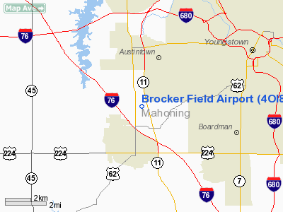
Location & QuickFacts
| FAA Information Effective: | 2008-09-25 |
| Airport Identifier: | 4OI8 |
| Airport Status: | Operational |
| Longitude/Latitude: | 080-45-16.2830W/41-03-28.2090N
-80.754523/41.057836 (Estimated) |
| Elevation: | 1170 ft / 356.62 m (Estimated) |
| Land: | 0 acres |
| From nearest city: | 2 nautical miles N of Canfield, OH |
| Location: | Mahoning County, OH |
| Magnetic Variation: | 07W (1985) |
Owner & Manager
| Ownership: | Privately owned |
| Owner: | R. J. Brocker, Md |
| Address: | 1616 Convington
Youngstown, OH 44510 |
| Phone number: | 216-747-9215 |
| Address: |
|
| Phone number: | 216-533-3743 |
Airport Operations and Facilities
| Airport Use: | Private |
| Wind indicator: | Yes |
| Segmented Circle: | No |
| Control Tower: | No |
| Landing fee charge: | No |
| Sectional chart: | Detroit |
| Region: | AGL - Great Lakes |
| Boundary ARTCC: | ZOB - Cleveland |
| Tie-in FSS: | CLE - Cleveland |
| FSS on Airport: | No |
| FSS Toll Free: | 1-800-WX-BRIEF |
Runway Information
Runway 09/27
| Dimension: | 3400 x 75 ft / 1036.3 x 22.9 m |
| Surface: | TURF, |
| |
Runway 09 |
Runway 27 |
| Traffic Pattern: | Left | Left |
|
Radio Navigation Aids
| ID |
Type |
Name |
Ch |
Freq |
Var |
Dist |
| HBD | NDB | Hubbard | | 408.00 | 08W | 11.6 nm |
| UCP | NDB | Castle | | 272.00 | 09W | 15.5 nm |
| AK | NDB | Akron | | 362.00 | 07W | 28.7 nm |
| TSO | NDB | Tolson | | 395.00 | 07W | 33.2 nm |
| LQL | NDB | Lakeland | | 263.00 | 08W | 46.9 nm |
| BKL | NDB | Burke Lakefront | | 416.00 | 07W | 49.9 nm |
| FKL | VOR | Franklin | | 109.60 | 06W | 46.6 nm |
| ACO | VOR/DME | Akron | 091X | 114.40 | 04W | 20.5 nm |
| CXR | VOR/DME | Chardon | 074X | 112.70 | 05W | 33.2 nm |
| BSV | VOR/DME | Briggs | 071X | 112.40 | 04W | 36.2 nm |
| JFN | VOR/DME | Jefferson | 099X | 115.20 | 05W | 42.2 nm |
| LNN | VOR/DME | Lost Nation | 039X | 110.20 | 08W | 47.3 nm |
| HLG | VOR/DME | Wheeling | 059X | 112.20 | 07W | 48.7 nm |
| YNG | VORTAC | Youngstown | 027X | 109.00 | 05W | 16.8 nm |
| EWC | VORTAC | Ellwood City | 105X | 115.80 | 08W | 28.3 nm |
| MMJ | VORTAC | Montour | 057X | 112.00 | 08W | 42.7 nm |
| CAK | VOT | Akron/canton Regional | | 110.60 | | 32.3 nm |
Remarks
- BASED ON LACK OF SUFFICIENT AVAILABLE AIRSPACE TO ESTABLISH AN AIRPORT TRAFFIC PATTERN AIRSPACE AREA ASSOCIATED WITH THE EXISTING BRIEL ARPT LOCATED 1800' SOUTH OF BROCKER FIELD ARPT.
Images and information placed above are from
http://www.airport-data.com/airport/4OI8/
We thank them for the data!
| General Info
|
| Country |
United States
|
| State |
OHIO
|
| FAA ID |
4OI8
|
| Latitude |
41-03-28.209N
|
| Longitude |
080-45-16.283W
|
| Elevation |
1170 feet
|
| Near City |
CANFIELD
|
We don't guarantee the information is fresh and accurate. The data may
be wrong or outdated.
For more up-to-date information please refer to other sources.
|
|


