 |
|
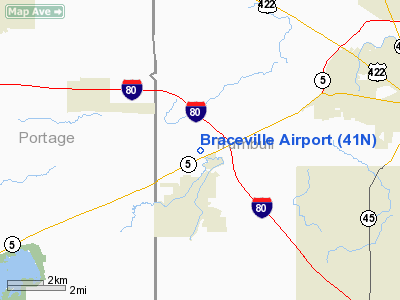
Location & QuickFacts
| FAA Information Effective: | 2008-09-25 |
| Airport Identifier: | 41N |
| Airport Status: | Operational |
| Longitude/Latitude: | 080-58-09.3260W/41-12-40.2030N
-80.969257/41.211168 (Estimated) |
| Elevation: | 900 ft / 274.32 m (Estimated) |
| Land: | 0 acres |
| From nearest city: | 2 nautical miles N of Newton Falls, OH |
| Location: | Trumbull County, OH |
| Magnetic Variation: | 07W (1985) |
Owner & Manager
| Ownership: | Privately owned |
| Owner: | Braceville Airport Llc |
| Address: | 4720 St Rt 5
Newton Falls, OH 44444 |
| Phone number: | 330-872-4062 |
| Manager: | Dan Clarke |
| Address: | Braceville Airport Llc
Newton Falls, OH 44444 |
| Phone number: | 330-872-4062 |
Airport Operations and Facilities
| Airport Use: | Open to public |
| Wind indicator: | Yes |
| Segmented Circle: | No |
| Control Tower: | No |
| Landing fee charge: | No |
| Sectional chart: | Detroit |
| Region: | AGL - Great Lakes |
| Boundary ARTCC: | ZOB - Cleveland |
| Tie-in FSS: | CLE - Cleveland |
| FSS on Airport: | No |
| FSS Toll Free: | 1-800-WX-BRIEF |
| NOTAMs Facility: | CLE (NOTAM-d service avaliable) |
Airport Communications
| CTAF: | 122.800 |
| Unicom: | 122.800 |
Runway Information
Runway 01/19
| Dimension: | 3000 x 30 ft / 914.4 x 9.1 m |
| Surface: | ASPH, Fair Condition |
| |
Runway 01 |
Runway 19 |
| Traffic Pattern: | Left | Left |
| Markings: | Basic, Good Condition | Basic, Good Condition |
| Displaced threshold: | 55.00 ft | 0.00 ft |
| Obstruction: | 20 ft bldg, 355.0 ft from runway, 115 ft left of centerline, 17:1 slope to clear | 60 ft trees, 1500.0 ft from runway, 21:1 slope to clear |
|
Radio Navigation Aids
| ID |
Type |
Name |
Ch |
Freq |
Var |
Dist |
| HBD | NDB | Hubbard | | 408.00 | 08W | 20.1 nm |
| AK | NDB | Akron | | 362.00 | 07W | 20.8 nm |
| UCP | NDB | Castle | | 272.00 | 09W | 27.5 nm |
| LQL | NDB | Lakeland | | 263.00 | 08W | 33.8 nm |
| BKL | NDB | Burke Lakefront | | 416.00 | 07W | 36.7 nm |
| EZE | NDB | Engel | | 226.00 | 07W | 37.9 nm |
| TSO | NDB | Tolson | | 395.00 | 07W | 39.3 nm |
| CL | NDB | Harri | | 344.00 | 07W | 45.6 nm |
| ACO | VOR/DME | Akron | 091X | 114.40 | 04W | 12.2 nm |
| CXR | VOR/DME | Chardon | 074X | 112.70 | 05W | 20.4 nm |
| LNN | VOR/DME | Lost Nation | 039X | 110.20 | 08W | 34.2 nm |
| JFN | VOR/DME | Jefferson | 099X | 115.20 | 05W | 34.5 nm |
| BSV | VOR/DME | Briggs | 071X | 112.40 | 04W | 35.2 nm |
| YNG | VORTAC | Youngstown | 027X | 109.00 | 05W | 15.1 nm |
| EWC | VORTAC | Ellwood City | 105X | 115.80 | 08W | 41.5 nm |
| CAK | VOT | Akron/canton Regional | | 110.60 | | 27.8 nm |
| CLE | VOT | Cleveland | | 110.40 | | 41.5 nm |
Remarks
- PRVDD CLEAR 20:1 APCHS; CLEAR RY SAFETY AREAS; AND AREA IS MARKED.
Images and information placed above are from
http://www.airport-data.com/airport/41N/
We thank them for the data!
| General Info
|
| Country |
United States
|
| State |
OHIO
|
| FAA ID |
41N
|
| Latitude |
41.211167
41° 12' 40.20" N
|
| Longitude |
-80.969258
080° 58' 09.33" W
|
| Elevation |
900 feet
274 meters
|
| Magnetic Variation |
008° W (01/06)
|
| Operating Agency |
PRIVATE
|
| Daylight Saving Time |
Second Sunday in March at 0200 to first Sunday in November at 0200 local time (Exception Arizona and that portion of Indiana in the Eastern Time Zone)
|
We don't guarantee the information is fresh and accurate. The data may
be wrong or outdated.
For more up-to-date information please refer to other sources.
|
|


