 |
|
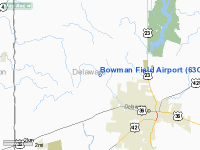
Location & QuickFacts
| FAA Information Effective: | 2008-09-25 |
| Airport Identifier: | 63OI |
| Airport Status: | Operational |
| Longitude/Latitude: | 083-08-09.6840W/40-20-06.2190N
-83.136023/40.335061 (Estimated) |
| Elevation: | 965 ft / 294.13 m (Estimated) |
| Land: | 0 acres |
| From nearest city: | 4 nautical miles NW of Delaware, OH |
| Location: | Delaware County, OH |
| Magnetic Variation: | 05W (1990) |
Owner & Manager
| Ownership: | Privately owned |
| Owner: | Stephen C Bowman |
| Address: | 1175 St Rt 203
Delaware, OH 43015 |
| Phone number: | 614-369-4011 |
| Manager: | Stephen C Bowman |
| Address: | 1175 St Rt 203
Delaware, OH 43015 |
| Phone number: | 614-369-4011 |
Airport Operations and Facilities
| Airport Use: | Private |
| Segmented Circle: | No |
| Control Tower: | No |
| Sectional chart: | Detroit |
| Region: | AGL - Great Lakes |
| Boundary ARTCC: | ZID - Indianapolis |
| Tie-in FSS: | DAY - Dayton |
| FSS on Airport: | No |
| FSS Toll Free: | 1-800-WX-BRIEF |
Runway Information
Runway 10/28
| Dimension: | 2000 x 40 ft / 609.6 x 12.2 m |
| Surface: | TURF, |
| |
Runway 10 |
Runway 28 |
| Traffic Pattern: | Left | Left |
| Displaced threshold: | 855.00 ft | 440.00 ft |
| Obstruction: | 30 ft pline | 22 ft pline, 0.0 ft from runway |
|
Radio Navigation Aids
| ID |
Type |
Name |
Ch |
Freq |
Var |
Dist |
| DLZ | NDB | Delaware | | 215.00 | 06W | 3.8 nm |
| MRT | NDB | Marysville | | 403.00 | 05W | 11.8 nm |
| DKG | NDB | Don Scott | | 348.00 | 05W | 15.5 nm |
| OS | NDB | Fuler | | 515.00 | 05W | 16.0 nm |
| MNN | NDB | Marion | | 201.00 | 05W | 17.2 nm |
| CHC | NDB | Grens | | 272.00 | 04W | 20.1 nm |
| RUV | NDB | Rushsylvania | | 326.00 | 05W | 25.5 nm |
| CM | NDB | Sumie | | 391.00 | 05W | 27.3 nm |
| UYF | NDB | London | | 263.00 | 06W | 28.5 nm |
| EDJ | NDB | Bellefontaine | | 242.00 | 05W | 31.1 nm |
| BU | NDB | Boutn | | 230.00 | 05W | 31.2 nm |
| HEH | NDB | Newark | | 524.00 | 06W | 36.0 nm |
| CCJ | NDB | Clark County | | 341.00 | 04W | 40.5 nm |
| MF | NDB | Manns | | 372.00 | 06W | 40.8 nm |
| CSS | NDB | Court House | | 414.00 | 05W | 45.7 nm |
| TII | NDB | Tiffin | | 269.00 | 05W | 46.0 nm |
| LYL | NDB | Lima | | 362.00 | 04W | 46.2 nm |
| BNR | NDB | Benton Ridge | | 334.00 | 05W | 47.9 nm |
| CYO | NDB | Circleville | | 366.00 | 05W | 49.3 nm |
| LCK | TACAN | Rickenbacker | 069X | | 05W | 33.1 nm |
| XSF | TACAN | Springfield | 065X | | 04W | 44.1 nm |
| BUD | VOR | Buckeye | | 109.80 | 05W | 17.2 nm |
| AOH | VOR | Allen County | | 108.40 | 04W | 44.1 nm |
| MAH | VOR | Marathon | | 114.90 | 05W | 47.4 nm |
| XUB | VOR | Yellow Bud | | 112.50 | 05W | 49.1 nm |
| SGH | VOR/DME | Springfield | 079X | 113.20 | 04W | 44.3 nm |
| TVT | VOR/DME | Tiverton | 112X | 116.50 | 03W | 46.8 nm |
| APE | VORTAC | Appleton | 114X | 116.70 | 06W | 27.5 nm |
| MFD | VORTAC | Mansfield | 025X | 108.80 | 03W | 40.6 nm |
| ROD | VORTAC | Rosewood | 122X | 117.50 | 05W | 41.7 nm |
| FDY | VORTAC | Findlay | 019X | 108.20 | 02W | 46.8 nm |
| CMH | VOT | Port Columbus | | 111.00 | | 23.5 nm |
Remarks
- OBJECTS EXIST WITHIN AIRSPACE NEEDED TO INSURE SAFE FLIGHT OPNS.
Images and information placed above are from
http://www.airport-data.com/airport/63OI/
We thank them for the data!
| General Info
|
| Country |
United States
|
| State |
OHIO
|
| FAA ID |
63OI
|
| Latitude |
40-20-06.219N
|
| Longitude |
083-08-09.684W
|
| Elevation |
965 feet
|
| Near City |
DELAWARE
|
We don't guarantee the information is fresh and accurate. The data may
be wrong or outdated.
For more up-to-date information please refer to other sources.
|
|


