 |
|
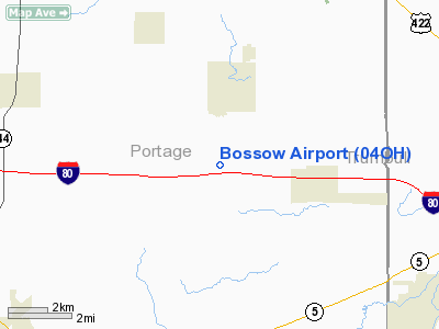
Location & QuickFacts
| FAA Information Effective: | 2008-09-25 |
| Airport Identifier: | 04OH |
| Airport Status: | Operational |
| Longitude/Latitude: | 081-06-02.3470W/41-14-51.7010N
-81.100652/41.247695 (Estimated) |
| Elevation: | 1080 ft / 329.18 m (Estimated) |
| Land: | 0 acres |
| From nearest city: | 2 nautical miles S of Garrettsville, OH |
| Location: | Portage County, OH |
| Magnetic Variation: | 07W (1985) |
Owner & Manager
| Ownership: | Privately owned |
| Owner: | Robert Bossow |
| Address: | 8308 Gotham Rd
Garrettsville, OH 44231 |
| Phone number: | 216-527-4335 |
| Manager: | Robert Bossow |
| Address: | 8308 Gotham Rd
Garrettsville, OH 44231 |
| Phone number: | 216-527-4335 |
Airport Operations and Facilities
| Airport Use: | Private
PERSONAL USE. |
| Wind indicator: | No |
| Segmented Circle: | No |
| Control Tower: | No |
| Landing fee charge: | No |
| Sectional chart: | Detroit |
| Region: | AGL - Great Lakes |
| Boundary ARTCC: | ZOB - Cleveland |
| Tie-in FSS: | CLE - Cleveland |
| FSS on Airport: | No |
| FSS Toll Free: | 1-800-WX-BRIEF |
Runway Information
Runway N/S
| Dimension: | 2200 x 70 ft / 670.6 x 21.3 m |
| Surface: | TURF, |
| |
Runway N |
Runway S |
| Traffic Pattern: | Left | Left |
|
Radio Navigation Aids
| ID |
Type |
Name |
Ch |
Freq |
Var |
Dist |
| AK | NDB | Akron | | 362.00 | 07W | 16.8 nm |
| HBD | NDB | Hubbard | | 408.00 | 08W | 26.4 nm |
| LQL | NDB | Lakeland | | 263.00 | 08W | 29.0 nm |
| BKL | NDB | Burke Lakefront | | 416.00 | 07W | 30.5 nm |
| EZE | NDB | Engel | | 226.00 | 07W | 31.6 nm |
| UCP | NDB | Castle | | 272.00 | 09W | 33.8 nm |
| CL | NDB | Harri | | 344.00 | 07W | 39.4 nm |
| TSO | NDB | Tolson | | 395.00 | 07W | 41.2 nm |
| ACO | VOR/DME | Akron | 091X | 114.40 | 04W | 9.6 nm |
| CXR | VOR/DME | Chardon | 074X | 112.70 | 05W | 16.4 nm |
| LNN | VOR/DME | Lost Nation | 039X | 110.20 | 08W | 29.3 nm |
| BSV | VOR/DME | Briggs | 071X | 112.40 | 04W | 34.0 nm |
| JFN | VOR/DME | Jefferson | 099X | 115.20 | 05W | 34.6 nm |
| DJB | VOR/DME | Dryer | 083X | 113.60 | 05W | 48.4 nm |
| YNG | VORTAC | Youngstown | 027X | 109.00 | 05W | 19.9 nm |
| EWC | VORTAC | Ellwood City | 105X | 115.80 | 08W | 47.6 nm |
| CAK | VOT | Akron/canton Regional | | 110.60 | | 25.2 nm |
| CLE | VOT | Cleveland | | 110.40 | | 35.2 nm |
Remarks
- PROVIDED RWY THRS ARE LCTD SO AS TO PROVIDE A MIN OF 20:1 OBSTN CLNC OVR ANY OBSTCL IN RWY APCH SFC. OHIO TURNPIKE IS 17' & GOTHAM RD 15' OBSTCL.
Images and information placed above are from
http://www.airport-data.com/airport/04OH/
We thank them for the data!
| General Info
|
| Country |
United States
|
| State |
OHIO
|
| FAA ID |
04OH
|
| Latitude |
41-14-51.701N
|
| Longitude |
081-06-02.347W
|
| Elevation |
1080 feet
|
| Near City |
GARRETTSVILLE
|
We don't guarantee the information is fresh and accurate. The data may
be wrong or outdated.
For more up-to-date information please refer to other sources.
|
|


