 |
|
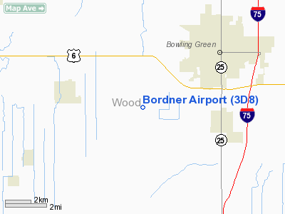
Location & QuickFacts
| FAA Information Effective: | 2008-09-25 |
| Airport Identifier: | 3D8 |
| Airport Status: | Closed Indefinitely |
| Longitude/Latitude: | 083-43-23.5000W/41-20-09.6000N
-83.723194/41.336000 (Estimated) |
| Elevation: | 690 ft / 210.31 m (Estimated) |
| Land: | 15 acres |
| From nearest city: | 4 nautical miles SW of Bowling Green, OH |
| Location: | Wood County, OH |
| Magnetic Variation: | 05W (1985) |
Owner & Manager
| Ownership: | Privately owned |
| Owner: | Bernie Steinbaugh |
| Address: | 16662 Hodgman Rd
Weston, OH 43569 |
| Phone number: | 419-353-4732 |
| Manager: | Bernie Steinbaugh |
| Address: | 16662 Hodgman Rd
Weston, OH 43569 |
| Phone number: | 419-353-4732 |
Airport Operations and Facilities
| Airport Use: | Open to public |
| Wind indicator: | Yes |
| Segmented Circle: | No |
| Control Tower: | No |
| Lighting Schedule: | PHONE REQ
FOR LIRL RY 09/27 CALL 419-352-5200. |
| Landing fee charge: | No |
| Sectional chart: | Detroit |
| Region: | AGL - Great Lakes |
| Boundary ARTCC: | ZOB - Cleveland |
| Tie-in FSS: | CLE - Cleveland |
| FSS on Airport: | No |
| FSS Toll Free: | 1-800-WX-BRIEF |
| NOTAMs Facility: | CLE (NOTAM-d service avaliable) |
Airport Communications
Airport Services
Runway Information
Runway 09/27
| Dimension: | 2703 x 30 ft / 823.9 x 9.1 m |
| Surface: | TURF, Fair Condition |
| Weight Limit: | Single wheel: 5000 lbs. |
| Edge Lights: | Low |
| |
Runway 09 |
Runway 27 |
| Longitude: | 083-43-40.6750W | 083-43-06.3048W |
| Latitude: | 41-20-09.8846N | 41-20-09.2303N |
| Elevation: | 684.00 ft | 690.00 ft |
| Alignment: | 91 | 127 |
| Traffic Pattern: | Right | Left |
| Runway End Identifier: | No | No |
| Centerline Lights: | No | No |
| Touchdown Lights: | No | No |
| Obstruction: | 29 ft pline, 48.0 ft from runway, 1:1 slope to clear | 43 ft trees, 840.0 ft from runway, 210 ft left of centerline, 19:1 slope to clear |
|
Radio Navigation Aids
| ID |
Type |
Name |
Ch |
Freq |
Var |
Dist |
| FZI | NDB | Fostoria | | 379.00 | 05W | 17.2 nm |
| BNR | NDB | Benton Ridge | | 334.00 | 05W | 19.1 nm |
| PDR | NDB | Ottawa | | 233.00 | 05W | 21.6 nm |
| USE | NDB | Fulton | | 375.00 | 05W | 24.7 nm |
| TII | NDB | Tiffin | | 269.00 | 05W | 27.3 nm |
| DFI | NDB | Defiance | | 246.00 | 05W | 31.8 nm |
| BYN | NDB | Bryan | | 260.00 | 04W | 34.6 nm |
| ADG | NDB | Adrian | | 278.00 | 06W | 35.8 nm |
| PCW | NDB | Port Clinton | | 423.00 | 06W | 40.0 nm |
| LYL | NDB | Lima | | 362.00 | 04W | 40.3 nm |
| TCU | NDB | Tecumseh | | 239.00 | 04W | 42.7 nm |
| VFU | NDB | Stanley | | 411.00 | 05W | 49.4 nm |
| TOL | TACAN | Toledo | 072X | | 05W | 15.9 nm |
| MAH | VOR | Marathon | | 114.90 | 05W | 19.5 nm |
| AOH | VOR | Allen County | | 108.40 | 04W | 39.4 nm |
| VWV | VOR/DME | Waterville | 078X | 113.10 | 02W | 7.9 nm |
| SKY | VOR/DME | Sandusky | 029X | 109.20 | 04W | 48.5 nm |
| FDY | VORTAC | Findlay | 019X | 108.20 | 02W | 22.9 nm |
| CRL | VORTAC | Carleton | 104X | 115.70 | 03W | 44.4 nm |
Remarks
- (ARPT STATUS) ARPT CLSD INDEFLY.
- RWY 9/27 NOVED N TO PRVD ADNL CLRNC FM ELEVATORS ON S SIDE. OBS IN APCH SLOPE ARE RMVD/LWRD OR RWY THR DSPLCD/MKD TO PRVD A MIN 20:1 APCH CLRNC OF OBS.
Images and information placed above are from
http://www.airport-data.com/airport/3D8/
We thank them for the data!
| General Info
|
| Country |
United States
|
| State |
OHIO
|
| FAA ID |
3D8
|
| Latitude |
41-20-09.600N
|
| Longitude |
083-43-23.500W
|
| Elevation |
690 feet
|
| Near City |
BOWLING GREEN
|
We don't guarantee the information is fresh and accurate. The data may
be wrong or outdated.
For more up-to-date information please refer to other sources.
|
|


