|
|
| Bolton Field |
 |
| IATA: none – ICAO: KTZR – FAA LID: TZR |
| Summary |
| Airport type |
Public |
| Operator |
Columbus Regional Airport Authority |
| Serves |
Columbus, Ohio |
| Elevation AMSL |
905 ft / 276 m |
| Coordinates |
39°54′04″N 083°08′13″W / 39.90111°N 83.13694°W / 39.90111; -83.13694 |
| Website |
columbusairports.com/bolton/ |
| Runways |
| Direction |
Length |
Surface |
| ft |
m |
| 4/22 |
5,500 |
1,676 |
Asphalt |
| Statistics (2003) |
| Aircraft operations |
74,511 |
| Based aircraft |
105 |
| Source: Federal Aviation Administration |
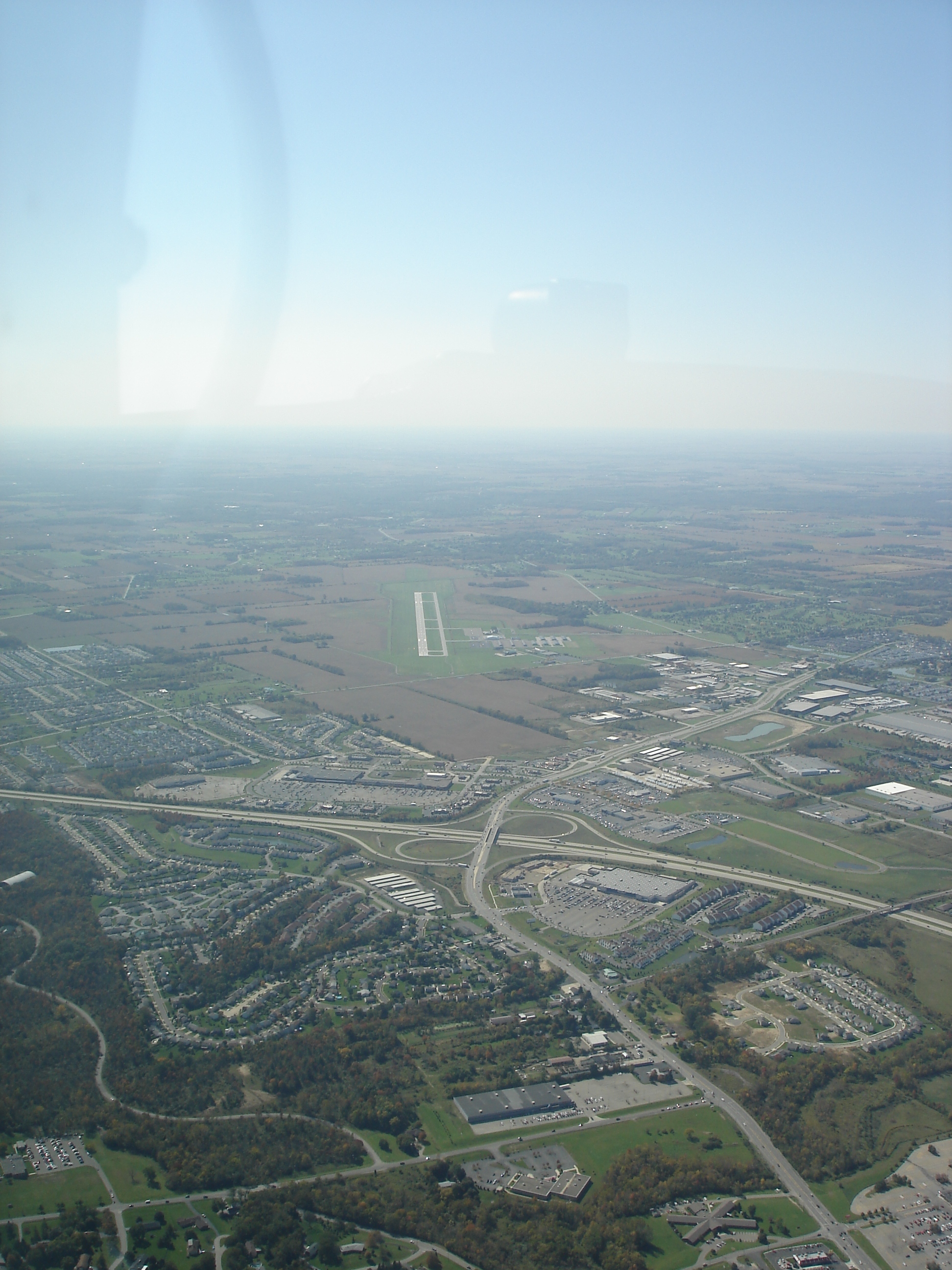
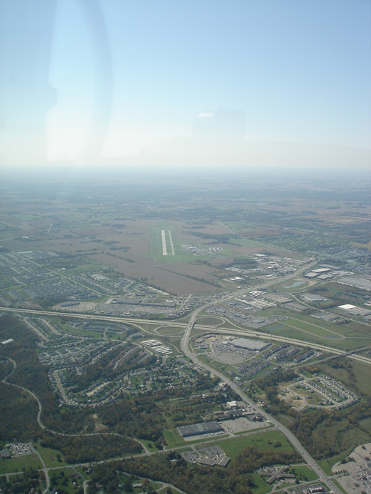
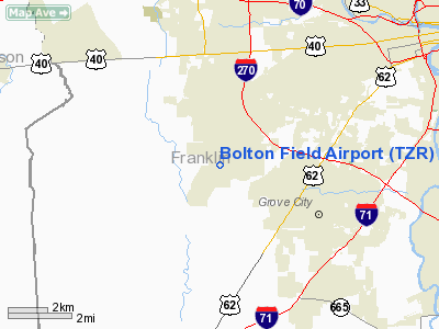
Bolton Field (ICAO: KTZR, FAA LID: TZR) is a public airport located eight miles (13 km) southwest of the central business district of Columbus, a city in Franklin County, Ohio, United States. It is a towered, class D, corporate and general aviation airport operated under the auspices of the Columbus Regional Airport Authority.
Although most U.S. airports use the same three-letter location identifier for the FAA and IATA, Bolton Field is assigned TZR by the FAA but has no designation from the IATA.
Facilities and aircraft
Bolton Field covers an area of 1,500 acres (607 ha) which contains one asphalt paved runway (4/22) measuring 5,500 x 100 ft (1,676 x 30 m). The airport has fuel services available. Planes can use tiedowns or hangars for parking.
For the 12-month period ending July 8, 2003, the airport had 74,511 aircraft operations, an average of 204 per day: 100% general aviation, <1% air taxi and <1% military. There are 105 aircraft based at this airport: 90% single engine, 5% multi-engine, 4% jet aircraft and 1% helicopters.
The above content comes from Wikipedia and is published under free licenses – click here to read more.
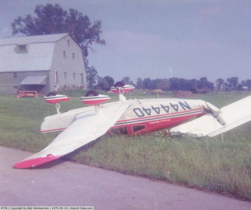 |
(Click on the photo to enlarge) |
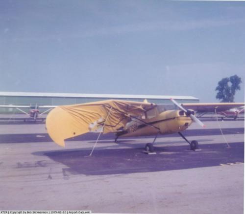 |
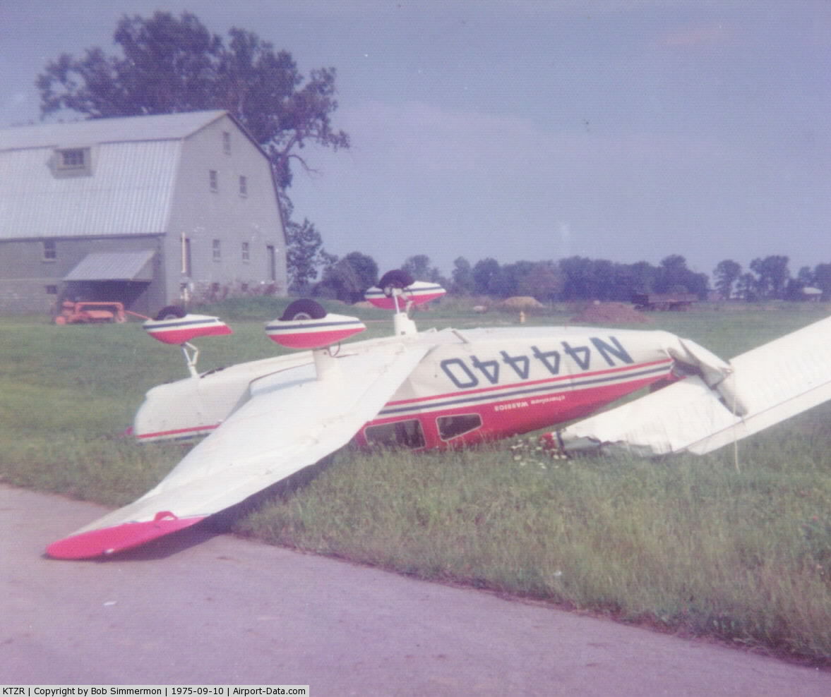
(Click on the photo to enlarge) |
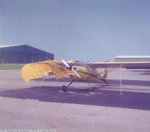 |
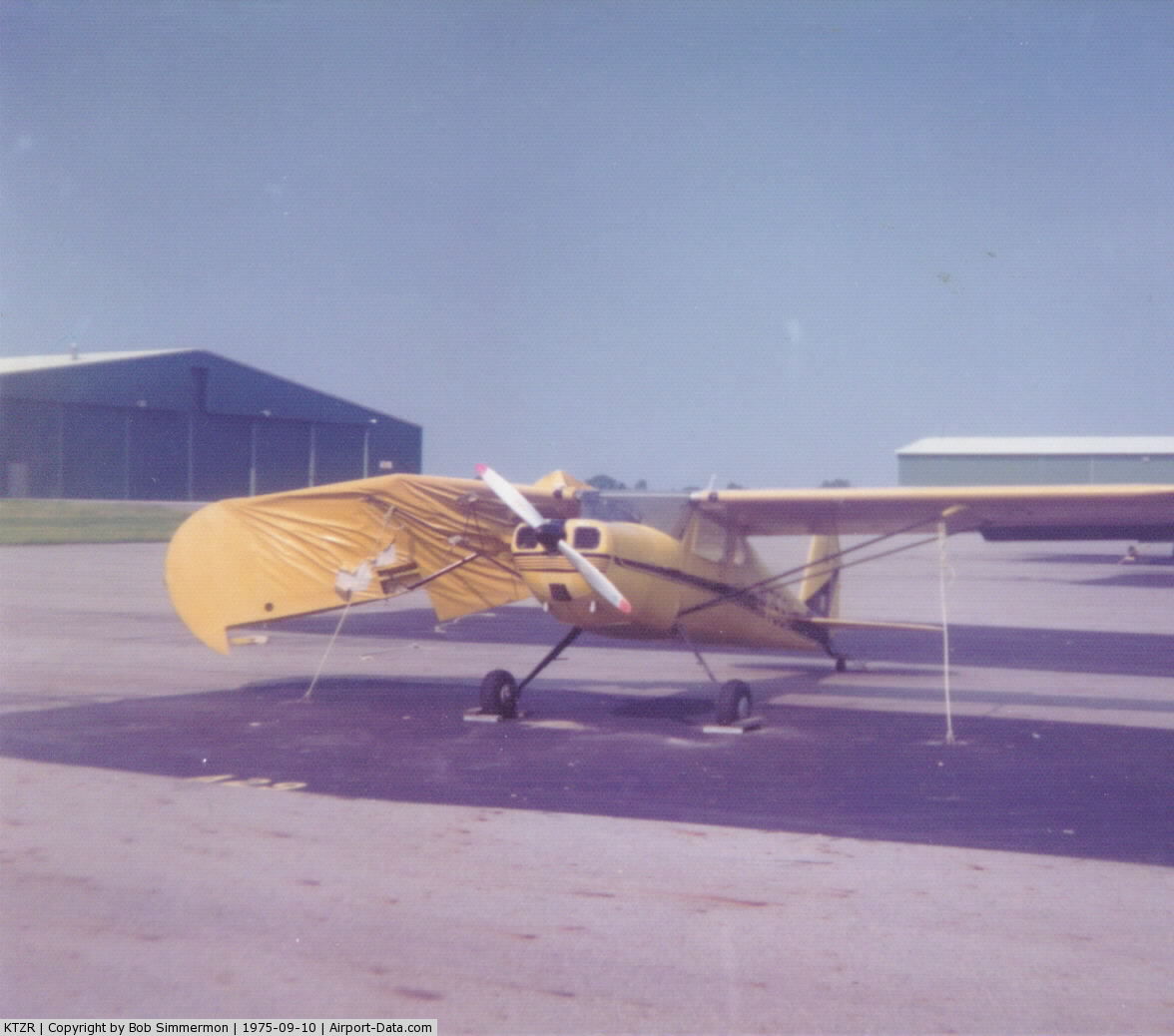
(Click on the photo to enlarge) |
Location & QuickFacts
| FAA Information Effective: | 2008-09-25 |
| Airport Identifier: | TZR |
| Airport Status: | Operational |
| Longitude/Latitude: | 083-08-12.8700W/39-54-04.2000N
-83.136908/39.901167 (Estimated) |
| Elevation: | 905 ft / 275.84 m (Surveyed) |
| Land: | 1500 acres |
| From nearest city: | 8 nautical miles SW of Columbus, OH |
| Location: | Franklin County, OH |
| Magnetic Variation: | 05W (1985) |
Owner & Manager
| Ownership: | Publicly owned |
| Owner: | Columbus Regional Arpt Auth |
| Address: | 4600 Intl Gateway
Columbus, OH 43219 |
| Phone number: | 614-239-4000 |
| Manager: | Mark Mulchaey |
| Address: | 2000 Norton Rd
Columbus, OH 43228 |
| Phone number: | 614-851-9900
24 HR EMERG OPNS 614-239-4029. |
Airport Operations and Facilities
| Airport Use: | Open to public |
| Wind indicator: | Yes |
| Segmented Circle: | Yes |
| Control Tower: | Yes |
| Lighting Schedule: | DUSK-DAWN
WHEN ATCT CLSD MIRL RY 04/22 PRESET MED INTST; TO INCR INTST ACTVT MALSR RY 04 & REIL RY 22 - CTAF. |
| Beacon Color: | Clear-Green (lighted land airport) |
| Landing fee charge: | No |
| Sectional chart: | Cincinnati |
| Region: | AGL - Great Lakes |
| Traffic Pattern Alt: | 800 ft |
| Boundary ARTCC: | ZID - Indianapolis |
| Tie-in FSS: | DAY - Dayton |
| FSS on Airport: | No |
| FSS Toll Free: | 1-800-WX-BRIEF |
| NOTAMs Facility: | TZR (NOTAM-d service avaliable) |
| Federal Agreements: | NGY |
Airport Communications
Airport Services
| Fuel available: | 100LLA1+ |
| Airframe Repair: | MAJOR |
| Power Plant Repair: | MAJOR |
| Bottled Oxygen: | HIGH |
| Bulk Oxygen: | NONE |
Runway Information
Runway 04/22
| Dimension: | 5500 x 100 ft / 1676.4 x 30.5 m |
| Surface: | ASPH, Fair Condition |
| Weight Limit: | Single wheel: 48000 lbs.
Dual wheel: 75000 lbs.
Dual tandem wheel: 150000 lbs. |
| Edge Lights: | Medium |
| |
Runway 04 |
Runway 22 |
| Longitude: | 083-08-31.6560W | 083-07-54.0780W |
| Latitude: | 39-53-41.2000N | 39-54-27.2070N |
| Elevation: | 902.00 ft | 0.00 ft |
| Alignment: | 32 | 127 |
| ILS Type: | ILS
| |
| Traffic Pattern: | Left | Left |
| Markings: | Precision instrument, Good Condition | Precision instrument, Good Condition |
| Crossing Height: | 40.00 ft | 31.00 ft |
| VASI: | 4-light PAPI on left side | 4-light PAPI on left side
RY 22 PAPI OTS INDEFLY. |
| Visual Glide Angle: | 3.00° | 3.00° |
| Approach lights: | MALSR | |
| Runway End Identifier: | | Yes |
| Obstruction: | , 50:1 slope to clear | 60 ft trees, 2865.0 ft from runway, 435 ft right of centerline, 44:1 slope to clear |
|
Radio Navigation Aids
| ID |
Type |
Name |
Ch |
Freq |
Var |
Dist |
| BU | NDB | Boutn | | 230.00 | 05W | 5.8 nm |
| CHC | NDB | Grens | | 272.00 | 04W | 8.2 nm |
| OS | NDB | Fuler | | 515.00 | 05W | 10.7 nm |
| DKG | NDB | Don Scott | | 348.00 | 05W | 11.1 nm |
| UYF | NDB | London | | 263.00 | 06W | 15.3 nm |
| CM | NDB | Sumie | | 391.00 | 05W | 18.3 nm |
| CSS | NDB | Court House | | 414.00 | 05W | 21.5 nm |
| MRT | NDB | Marysville | | 403.00 | 05W | 21.9 nm |
| DLZ | NDB | Delaware | | 215.00 | 06W | 22.6 nm |
| CYO | NDB | Circleville | | 366.00 | 05W | 23.9 nm |
| RZT | NDB | Ross County | | 236.00 | 05W | 28.3 nm |
| CCJ | NDB | Clark County | | 341.00 | 04W | 29.7 nm |
| HEH | NDB | Newark | | 524.00 | 06W | 31.9 nm |
| IL | NDB | Airbo | | 407.00 | 04W | 37.1 nm |
| XEN | NDB | Xenia | | 395.00 | 03W | 38.3 nm |
| RUV | NDB | Rushsylvania | | 326.00 | 05W | 41.5 nm |
| EDJ | NDB | Bellefontaine | | 242.00 | 05W | 42.0 nm |
| MNN | NDB | Marion | | 201.00 | 05W | 43.1 nm |
| EOP | NDB | Waverly | | 385.00 | 06W | 45.1 nm |
| HOC | NDB | Hillsboro | | 278.00 | 05W | 47.0 nm |
| HW | NDB | Cubla | | 299.00 | 04W | 47.5 nm |
| LCK | TACAN | Rickenbacker | 069X | | 05W | 11.1 nm |
| XSF | TACAN | Springfield | 065X | | 04W | 32.7 nm |
| FFO | TACAN | Patterson | 099X | | 04W | 42.7 nm |
| XUB | VOR | Yellow Bud | | 112.50 | 05W | 23.7 nm |
| BUD | VOR | Buckeye | | 109.80 | 05W | 43.1 nm |
| SGH | VOR/DME | Springfield | 079X | 113.20 | 04W | 32.9 nm |
| MXQ | VOR/DME | Midwest | 076X | 112.90 | 04W | 41.8 nm |
| APE | VORTAC | Appleton | 114X | 116.70 | 06W | 29.4 nm |
| ROD | VORTAC | Rosewood | 122X | 117.50 | 05W | 47.7 nm |
| CMH | VOT | Port Columbus | | 111.00 | | 12.9 nm |
| DAY | VOT | Dayton J M Cox-day | | 111.00 | | 49.9 nm |
Remarks
- HIGH TENSION PLINES/TOWERS NE-SE.
- BALLOON & BANNER ACTIVITY ON & INVOF ARPT.
- BIRDS & DEER & COYOTE ON & INVOF ARPT.
Images and information placed above are from
http://www.airport-data.com/airport/TZR/
We thank them for the data!
| General Info
|
| Country |
United States
|
| State |
OHIO
|
| FAA ID |
TZR
|
| Latitude |
39-54-04.200N
|
| Longitude |
083-08-12.870W
|
| Elevation |
905 feet
|
| Near City |
COLUMBUS
|
We don't guarantee the information is fresh and accurate. The data may
be wrong or outdated.
For more up-to-date information please refer to other sources.
|
|