 |
|
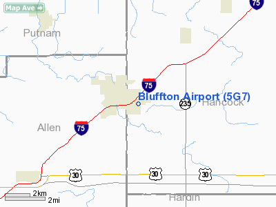
Location & QuickFacts
| FAA Information Effective: | 2008-09-25 |
| Airport Identifier: | 5G7 |
| Airport Status: | Operational |
| Longitude/Latitude: | 083-52-07.1000W/40-53-07.6000N
-83.868639/40.885444 (Estimated) |
| Elevation: | 851 ft / 259.38 m (Surveyed) |
| Land: | 100 acres |
| From nearest city: | 1 nautical miles SE of Bluffton, OH |
| Location: | Hancock County, OH |
| Magnetic Variation: | 05W (1985) |
Owner & Manager
| Ownership: | Publicly owned |
| Owner: | Village Of Bluffton |
| Address: | Rte 1
Bluffton, OH 45817 |
| Phone number: | 419-358-2066 |
| Manager: | Tina Roeder-anderson |
| Address: | 1080 Navajo Drive
Bluffton, OH 45817 |
| Phone number: | 419-358-7045 |
Airport Operations and Facilities
| Airport Use: | Open to public |
| Wind indicator: | Yes |
| Segmented Circle: | No |
| Control Tower: | No |
| Lighting Schedule: | DUSK-DAWN
ACTVT MIRL RY 05/23 & PAPI RY 23 REIL RY 23 - CTAF. |
| Beacon Color: | Clear-Green (lighted land airport) |
| Landing fee charge: | No |
| Sectional chart: | Detroit |
| Region: | AGL - Great Lakes |
| Traffic Pattern Alt: | 1000 ft |
| Boundary ARTCC: | ZOB - Cleveland |
| Tie-in FSS: | CLE - Cleveland |
| FSS on Airport: | No |
| FSS Toll Free: | 1-800-WX-BRIEF |
| NOTAMs Facility: | CLE (NOTAM-d service avaliable) |
| Federal Agreements: | NGY |
Airport Communications
| CTAF: | 122.800 |
| Unicom: | 122.800
UNICOM MONITORED IRREGULARLY. |
Airport Services
| Fuel available: | 100LLA |
| Airframe Repair: | MAJOR |
| Power Plant Repair: | MAJOR |
| Bottled Oxygen: | NONE |
| Bulk Oxygen: | NONE |
Runway Information
Runway 05/23
| Dimension: | 4126 x 75 ft / 1257.6 x 22.9 m |
| Surface: | ASPH, Good Condition |
| Weight Limit: | Single wheel: 12500 lbs. |
| Edge Lights: | Medium |
| |
Runway 05 |
Runway 23 |
| Longitude: | 083-52-28.1890W | 083-51-46.0180W |
| Latitude: | 40-52-54.9640N | 40-53-20.2080N |
| Elevation: | 850.00 ft | 847.00 ft |
| Alignment: | 52 | 127 |
| Traffic Pattern: | Left | Left |
| Markings: | Non-precision instrument, | Non-precision instrument, |
| VASI: | | 4-light PAPI on left side |
| Runway End Identifier: | No | Yes |
| Centerline Lights: | No | No |
| Touchdown Lights: | No | No |
| Obstruction: | 16 ft trees, 600.0 ft from runway, 25:1 slope to clear | 56 ft trees, 1595.0 ft from runway, 410 ft left of centerline, 24:1 slope to clear
RY 23 +10' CULTIVATION 201 FT FM 155 FT L
RY 23 +10 FT CULTIVATION 138 FT FM 250 FT L. |
|
Radio Navigation Aids
| ID |
Type |
Name |
Ch |
Freq |
Var |
Dist |
| PDR | NDB | Ottawa | | 233.00 | 05W | 10.0 nm |
| BNR | NDB | Benton Ridge | | 334.00 | 05W | 12.2 nm |
| LYL | NDB | Lima | | 362.00 | 04W | 13.0 nm |
| RUV | NDB | Rushsylvania | | 326.00 | 05W | 27.2 nm |
| FZI | NDB | Fostoria | | 379.00 | 05W | 28.1 nm |
| EDJ | NDB | Bellefontaine | | 242.00 | 05W | 31.0 nm |
| TII | NDB | Tiffin | | 269.00 | 05W | 32.6 nm |
| VFU | NDB | Stanley | | 411.00 | 05W | 33.9 nm |
| DFI | NDB | Defiance | | 246.00 | 05W | 37.0 nm |
| MNN | NDB | Marion | | 201.00 | 05W | 39.8 nm |
| CQA | NDB | Lakefield | | 205.00 | 04W | 39.9 nm |
| BYN | NDB | Bryan | | 260.00 | 04W | 44.8 nm |
| USE | NDB | Fulton | | 375.00 | 05W | 45.1 nm |
| MRT | NDB | Marysville | | 403.00 | 05W | 46.1 nm |
| TOL | TACAN | Toledo | 072X | | 05W | 42.7 nm |
| AOH | VOR | Allen County | | 108.40 | 04W | 11.6 nm |
| MAH | VOR | Marathon | | 114.90 | 05W | 12.1 nm |
| BUD | VOR | Buckeye | | 109.80 | 05W | 40.1 nm |
| VWV | VOR/DME | Waterville | 078X | 113.10 | 02W | 35.6 nm |
| FDY | VORTAC | Findlay | 019X | 108.20 | 02W | 6.6 nm |
| ROD | VORTAC | Rosewood | 122X | 117.50 | 05W | 36.8 nm |
Remarks
Images and information placed above are from
http://www.airport-data.com/airport/5G7/
We thank them for the data!
| General Info
|
| Country |
United States
|
| State |
OHIO
|
| FAA ID |
5G7
|
| Latitude |
40-53-07.600N
|
| Longitude |
083-52-07.100W
|
| Elevation |
851 feet
|
| Near City |
BLUFFTON
|
We don't guarantee the information is fresh and accurate. The data may
be wrong or outdated.
For more up-to-date information please refer to other sources.
|
|


