 |
|
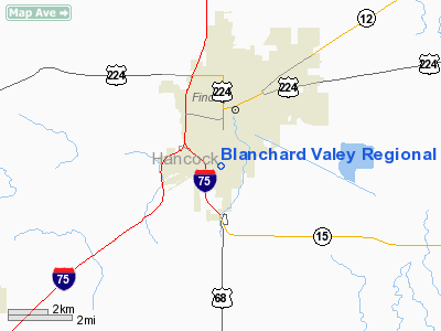
Blanchard Valey Rgnl Health Center Heliport |
Location & QuickFacts
| FAA Information Effective: | 2008-09-25 |
| Airport Identifier: | 89OH |
| Airport Status: | Operational |
| Longitude/Latitude: | 083-39-05.0000W/41-01-04.0000N
-83.651389/41.017778 (Estimated) |
| Elevation: | 860 ft / 262.13 m () |
| Land: | 0 acres |
| From nearest city: | 0 nautical miles S of Findlay, OH |
| Location: | Hancock County, OH |
| Magnetic Variation: | () |
Owner & Manager
| Ownership: | Privately owned |
| Owner: | Blanchard Valley Rgnl Health Center |
| Address: | 145 West Wallace St
Findlay, OH 45840 |
| Phone number: | 419-423-4500 |
| Manager: | Brandon M. Reis |
| Address: | 719 West Rose Way
Cincinnati, OH 45203 |
| Phone number: | 513-621-5260 |
Airport Operations and Facilities
| Airport Use: | Private |
| Segmented Circle: | No |
| Control Tower: | No |
| Sectional chart: | Detroit |
| Region: | AGL - Great Lakes |
| Boundary ARTCC: | ZOB - Cleveland |
| Tie-in FSS: | CLE - Cleveland |
| FSS Toll Free: | 1-800-WX-BRIEF |
Runway Information
Helipad H1
| Dimension: | 40 x 40 ft / 12.2 x 12.2 m |
| Surface: | CONC, |
| |
Runway H1 |
Runway |
| Traffic Pattern: | Left | Left |
|
Radio Navigation Aids
| ID |
Type |
Name |
Ch |
Freq |
Var |
Dist |
| BNR | NDB | Benton Ridge | | 334.00 | 05W | 0.8 nm |
| PDR | NDB | Ottawa | | 233.00 | 05W | 14.7 nm |
| FZI | NDB | Fostoria | | 379.00 | 05W | 15.5 nm |
| TII | NDB | Tiffin | | 269.00 | 05W | 20.7 nm |
| LYL | NDB | Lima | | 362.00 | 04W | 25.3 nm |
| RUV | NDB | Rushsylvania | | 326.00 | 05W | 33.6 nm |
| MNN | NDB | Marion | | 201.00 | 05W | 35.8 nm |
| EDJ | NDB | Bellefontaine | | 242.00 | 05W | 39.6 nm |
| DFI | NDB | Defiance | | 246.00 | 05W | 39.9 nm |
| USE | NDB | Fulton | | 375.00 | 05W | 41.7 nm |
| VFU | NDB | Stanley | | 411.00 | 05W | 44.7 nm |
| BYN | NDB | Bryan | | 260.00 | 04W | 46.1 nm |
| PCW | NDB | Port Clinton | | 423.00 | 06W | 46.4 nm |
| MRT | NDB | Marysville | | 403.00 | 05W | 49.5 nm |
| TOL | TACAN | Toledo | 072X | | 05W | 35.3 nm |
| MAH | VOR | Marathon | | 114.90 | 05W | 0.6 nm |
| AOH | VOR | Allen County | | 108.40 | 04W | 23.6 nm |
| BUD | VOR | Buckeye | | 109.80 | 05W | 36.0 nm |
| VWV | VOR/DME | Waterville | 078X | 113.10 | 02W | 26.1 nm |
| FDY | VORTAC | Findlay | 019X | 108.20 | 02W | 6.1 nm |
| ROD | VORTAC | Rosewood | 122X | 117.50 | 05W | 47.4 nm |
| MFD | VORTAC | Mansfield | 025X | 108.80 | 03W | 49.0 nm |
Remarks
- ROOFTOP HELIPAD.
- PRVDD ALL APCH/DEP ROUTES ARE CLEAR OF OBSTNS, AREA IS MARKED AND WIND INDICATOR MAINTAINED
Images and information placed above are from
http://www.airport-data.com/airport/89OH/
We thank them for the data!
| General Info
|
| Country |
United States
|
| State |
OHIO
|
| FAA ID |
89OH
|
| Latitude |
40-25-30.241N
|
| Longitude |
080-40-29.275W
|
| Elevation |
1180 feet
|
| Near City |
WINTERSVILLE
|
We don't guarantee the information is fresh and accurate. The data may
be wrong or outdated.
For more up-to-date information please refer to other sources.
|
|


