 |
|
Location & QuickFacts
| FAA Information Effective: | 2008-09-25 |
| Airport Identifier: | 94OI |
| Airport Status: | Operational |
| Longitude/Latitude: | 081-24-54.3970W/41-14-36.2010N
-81.415110/41.243389 (Estimated) |
| Elevation: | 1100 ft / 335.28 m (Estimated) |
| Land: | 0 acres |
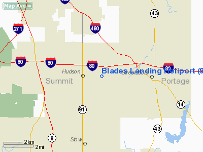
| From nearest city: | 2 nautical miles E of Hudson, OH |
| Location: | Summit County, OH |
| Magnetic Variation: | 07W (1985) |
Owner & Manager
| Ownership: | Privately owned |
| Owner: | Rosemary E. Zampelli |
| Address: | 1521 Georgetown Rd
Hudson, OH 44236 |
| Phone number: | 216-650-1488 |
| Address: |
|
Airport Operations and Facilities
| Airport Use: | Private
PERSONAL USE. |
| Wind indicator: | Yes |
| Segmented Circle: | No |
| Control Tower: | No |
| Sectional chart: | Detroit |
| Region: | AGL - Great Lakes |
| Boundary ARTCC: | ZOB - Cleveland |
| Tie-in FSS: | CLE - Cleveland |
| FSS Toll Free: | 1-800-WX-BRIEF |
Runway Information
Helipad H1
| Dimension: | 20 x 20 ft / 6.1 x 6.1 m |
| Surface: | CONC, |
| |
Runway H1 |
Runway |
| Traffic Pattern: | Left | Left |
|
Radio Navigation Aids
| ID |
Type |
Name |
Ch |
Freq |
Var |
Dist |
| AK | NDB | Akron | | 362.00 | 07W | 10.5 nm |
| EZE | NDB | Engel | | 226.00 | 07W | 20.3 nm |
| BKL | NDB | Burke Lakefront | | 416.00 | 07W | 20.5 nm |
| CL | NDB | Harri | | 344.00 | 07W | 25.5 nm |
| LQL | NDB | Lakeland | | 263.00 | 08W | 26.4 nm |
| HBD | NDB | Hubbard | | 408.00 | 08W | 40.3 nm |
| AAU | NDB | Ashland | | 329.00 | 07W | 41.5 nm |
| TSO | NDB | Tolson | | 395.00 | 07W | 43.7 nm |
| MLR | NDB | Millersburg/dcmsnd | | 382.00 | 06W | 47.0 nm |
| UCP | NDB | Castle | | 272.00 | 09W | 47.1 nm |
| ACO | VOR/DME | Akron | 091X | 114.40 | 04W | 12.6 nm |
| CXR | VOR/DME | Chardon | 074X | 112.70 | 05W | 20.0 nm |
| LNN | VOR/DME | Lost Nation | 039X | 110.20 | 08W | 26.5 nm |
| BSV | VOR/DME | Briggs | 071X | 112.40 | 04W | 30.2 nm |
| DJB | VOR/DME | Dryer | 083X | 113.60 | 05W | 34.4 nm |
| JFN | VOR/DME | Jefferson | 099X | 115.20 | 05W | 43.2 nm |
| YNG | VORTAC | Youngstown | 027X | 109.00 | 05W | 33.9 nm |
| CAK | VOT | Akron/canton Regional | | 110.60 | | 19.7 nm |
| CLE | VOT | Cleveland | | 110.40 | | 22.0 nm |
Remarks
- INGRESS/EGRESS 150 TO 240 AND 310 TO 090 USING THE TC PAD AS CENTER OF COMPASS ROSE; PAD IS APPROPRIATELY MARKED; WIND INDICATOR IS MAINTAINED.
Images and information placed above are from
http://www.airport-data.com/airport/94OI/
We thank them for the data!
| General Info
|
| Country |
United States
|
| State |
OHIO
|
| FAA ID |
94OI
|
| Latitude |
41-14-36.201N
|
| Longitude |
081-24-54.397W
|
| Elevation |
1100 feet
|
| Near City |
HUDSON
|
We don't guarantee the information is fresh and accurate. The data may
be wrong or outdated.
For more up-to-date information please refer to other sources.
|
|


