 |
|
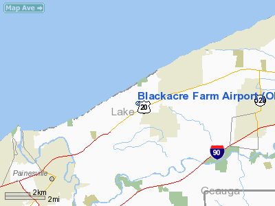
Location & QuickFacts
| FAA Information Effective: | 2008-09-25 |
| Airport Identifier: | OI69 |
| Airport Status: | Operational |
| Longitude/Latitude: | 081-10-01.3590W/41-46-42.1670N
-81.167044/41.778380 (Estimated) |
| Elevation: | 640 ft / 195.07 m (Estimated) |
| Land: | 42 acres |
| From nearest city: | 4 nautical miles SW of Painesville, OH |
| Location: | Lake County, OH |
| Magnetic Variation: | 07W (1985) |
Owner & Manager
| Ownership: | Privately owned |
| Owner: | Ronald S. Mosher |
| Address: | Perry, Oh 44081
Perry, OH 44077 |
| Phone number: | 216-352-8916 |
| Address: |
|
Airport Operations and Facilities
| Airport Use: | Private |
| Wind indicator: | Yes |
| Segmented Circle: | No |
| Control Tower: | No |
| Sectional chart: | Detroit |
| Region: | AGL - Great Lakes |
| Boundary ARTCC: | ZOB - Cleveland |
| Tie-in FSS: | CLE - Cleveland |
| FSS on Airport: | No |
| FSS Toll Free: | 1-800-WX-BRIEF |
Runway Information
Runway 18/36
| Dimension: | 2200 x 60 ft / 670.6 x 18.3 m |
| Surface: | TURF, |
| |
Runway 18 |
Runway 36 |
| Traffic Pattern: | Left | Left |
| Obstruction: | 150 ft pline | |
|
Radio Navigation Aids
| ID |
Type |
Name |
Ch |
Freq |
Var |
Dist |
| LQL | NDB | Lakeland | | 263.00 | 08W | 11.1 nm |
| BKL | NDB | Burke Lakefront | | 416.00 | 07W | 26.9 nm |
| EZE | NDB | Engel | | 226.00 | 07W | 30.4 nm |
| AK | NDB | Akron | | 362.00 | 07W | 43.7 nm |
| CL | NDB | Harri | | 344.00 | 07W | 44.6 nm |
| HBD | NDB | Hubbard | | 408.00 | 08W | 47.3 nm |
| LNN | VOR/DME | Lost Nation | 039X | 110.20 | 08W | 11.5 nm |
| CXR | VOR/DME | Chardon | 074X | 112.70 | 05W | 15.7 nm |
| JFN | VOR/DME | Jefferson | 099X | 115.20 | 05W | 18.8 nm |
| ACO | VOR/DME | Akron | 091X | 114.40 | 04W | 40.3 nm |
| YNG | VORTAC | Youngstown | 027X | 109.00 | 05W | 34.8 nm |
| ERI | VORTAC | Erie | 031X | 109.40 | 06W | 41.7 nm |
| CLE | VOT | Cleveland | | 110.40 | | 37.8 nm |
Remarks
- 150'PLINES OVER THLD NORTH END. LAND BY FLYING UNDER WIRES 15' TO 25' ABOVE GROUND WHEN UNDER WIRES.
- RWY SOFT WHEN WET.
- (E111-1) APCH/DEP ROUTE HEL OPNS ARE CONDUCTED IN AN AREA FROM 260-080 DEGS USING THE PAD AS THE CENTER OF A COMPASS ROSE; TAKEOFF/LNDG AREA IS APPROPLY MRKD & LGTD; NON-OBSTRUCING WIND INDCTR IS MAINTAINED ADJ TO THE TKOF/LNDG AREA.
- E111: AVAILBALE DATA INDICATES USABLE RWY LENGTH AND OBSTRUCTION CLEARANCES DO NOT OFFER AN ACCEPTABLE LEVEL OF SAFETY FOR ACFT OPNS.
Images and information placed above are from
http://www.airport-data.com/airport/OI69/
We thank them for the data!
| General Info
|
| Country |
United States
|
| State |
OHIO
|
| FAA ID |
OI69
|
| Latitude |
41-46-42.167N
|
| Longitude |
081-10-01.359W
|
| Elevation |
640 feet
|
| Near City |
PAINESVILLE
|
We don't guarantee the information is fresh and accurate. The data may
be wrong or outdated.
For more up-to-date information please refer to other sources.
|
|


