 |
|
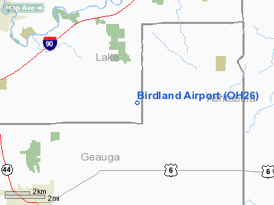
Location & QuickFacts
| FAA Information Effective: | 2008-09-25 |
| Airport Identifier: | OH26 |
| Airport Status: | Operational |
| Longitude/Latitude: | 081-06-22.3520W/41-39-23.1840N
-81.106209/41.656440 (Estimated) |
| Elevation: | 1160 ft / 353.57 m (Estimated) |
| Land: | 50 acres |
| From nearest city: | 3 nautical miles SW of Thompson, OH |
| Location: | Lake County, OH |
| Magnetic Variation: | 07W (1985) |
Owner & Manager
| Ownership: | Privately owned |
| Owner: | E. F. Fisher |
| Address: | 14760 Painesville-warren Rd
Thompson, OH 44086 |
| Phone number: | 216-254-4948 |
| Manager: | E. F. Fisher |
| Address: | 14760 Painesville-warren Rd
Thompson, OH 44086 |
| Phone number: | 216-254-4948 |
Airport Operations and Facilities
| Airport Use: | Private |
| Wind indicator: | Yes |
| Segmented Circle: | No |
| Control Tower: | No |
| Landing fee charge: | No |
| Sectional chart: | Detroit |
| Region: | AGL - Great Lakes |
| Boundary ARTCC: | ZOB - Cleveland |
| Tie-in FSS: | CLE - Cleveland |
| FSS on Airport: | No |
| FSS Toll Free: | 1-800-WX-BRIEF |
Airport Services
| Airframe Repair: | NONE |
| Power Plant Repair: | NONE |
Runway Information
Runway 18/36
| Dimension: | 2200 x 75 ft / 670.6 x 22.9 m |
| Surface: | TURF, |
| |
Runway 18 |
Runway 36 |
| Traffic Pattern: | Left | Left |
| Displaced threshold: | 500.00 ft | 0.00 ft |
| Runway End Identifier: | No | No |
| Centerline Lights: | No | No |
| Touchdown Lights: | No | No |
|
Radio Navigation Aids
| ID |
Type |
Name |
Ch |
Freq |
Var |
Dist |
| LQL | NDB | Lakeland | | 263.00 | 08W | 12.3 nm |
| BKL | NDB | Burke Lakefront | | 416.00 | 07W | 26.2 nm |
| EZE | NDB | Engel | | 226.00 | 07W | 29.5 nm |
| AK | NDB | Akron | | 362.00 | 07W | 37.5 nm |
| HBD | NDB | Hubbard | | 408.00 | 08W | 39.8 nm |
| CL | NDB | Harri | | 344.00 | 07W | 43.1 nm |
| UCP | NDB | Castle | | 272.00 | 09W | 49.2 nm |
| CXR | VOR/DME | Chardon | 074X | 112.70 | 05W | 8.8 nm |
| LNN | VOR/DME | Lost Nation | 039X | 110.20 | 08W | 12.8 nm |
| JFN | VOR/DME | Jefferson | 099X | 115.20 | 05W | 17.2 nm |
| ACO | VOR/DME | Akron | 091X | 114.40 | 04W | 33.3 nm |
| YNG | VORTAC | Youngstown | 027X | 109.00 | 05W | 27.6 nm |
| ERI | VORTAC | Erie | 031X | 109.40 | 06W | 42.4 nm |
| CLE | VOT | Cleveland | | 110.40 | | 36.5 nm |
| CAK | VOT | Akron/canton Regional | | 110.60 | | 47.0 nm |
Remarks
- (42-18) YELLOW DRUMS USED TO MARK DISPLACEMENT ON APCH END RWY 18.
- VFR ONLY
Images and information placed above are from
http://www.airport-data.com/airport/OH26/
We thank them for the data!
| General Info
|
| Country |
United States
|
| State |
OHIO
|
| FAA ID |
OH26
|
| Latitude |
41-39-23.184N
|
| Longitude |
081-06-22.352W
|
| Elevation |
1160 feet
|
| Near City |
THOMPSON
|
We don't guarantee the information is fresh and accurate. The data may
be wrong or outdated.
For more up-to-date information please refer to other sources.
|
|


