 |
|
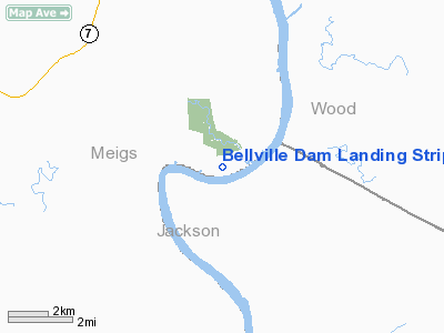
Bellville Dam Landing Strip Airport |
Location & QuickFacts
| FAA Information Effective: | 2008-09-25 |
| Airport Identifier: | 9OA3 |
| Airport Status: | Closed Indefinitely |
| Longitude/Latitude: | 081-46-39.4760W/39-05-00.2810N
-81.777632/39.083411 (Estimated) |
| Elevation: | 591 ft / 180.14 m (Estimated) |
| Land: | 10 acres |
| From nearest city: | 2 nautical miles E of Long Bottom, OH |
| Location: | Meigs County, OH |
| Magnetic Variation: | 06W (1985) |
Owner & Manager
| Ownership: | Privately owned |
| Owner: | Gary L. Wolf |
| Address: | Star Route
Pomeroy, OH 45769 |
| Phone number: | 614-985-3969 |
| Address: |
|
Airport Operations and Facilities
| Airport Use: | Private |
| Wind indicator: | Yes |
| Segmented Circle: | No |
| Control Tower: | No |
| Landing fee charge: | No |
| Sectional chart: | Cincinnati |
| Region: | AGL - Great Lakes |
| Boundary ARTCC: | ZID - Indianapolis |
| Tie-in FSS: | DAY - Dayton |
| FSS on Airport: | No |
| FSS Toll Free: | 1-800-WX-BRIEF |
Airport Services
| Airframe Repair: | NONE |
| Power Plant Repair: | NONE |
Runway Information
Runway 09/27
| Dimension: | 2000 x 50 ft / 609.6 x 15.2 m |
| Surface: | PSP, |
| |
Runway 09 |
Runway 27 |
| Traffic Pattern: | Left | Left |
| Obstruction: | 5 ft mound, 200.0 ft from runway | |
|
Radio Navigation Aids
| ID |
Type |
Name |
Ch |
Freq |
Var |
Dist |
| PKB | FAN MARKER | Marietta Ohio | | | 03W | 24.8 nm |
| UGS | NDB | University | | 250.00 | 06W | 19.3 nm |
| GAS | NDB | Gallipolis | | 420.00 | 07W | 23.4 nm |
| HRA | NDB | Zanesville | | 204.00 | 06W | 49.9 nm |
| HNN | VORTAC | Henderson | 106X | 115.90 | 03W | 23.0 nm |
| JPU | VORTAC | Parkersburg | 023X | 108.60 | 03W | 28.5 nm |
| HVQ | VORTAC | Charleston | 121X | 117.40 | 03W | 44.1 nm |
| CRW | VOT | Charleston Kanawha | | 108.80 | | 43.6 nm |
Remarks
- (ARPT STATUS) ARPT CLSD INDEFLY.
- VFR ONLY
Images and information placed above are from
http://www.airport-data.com/airport/9OA3/
We thank them for the data!
| General Info
|
| Country |
United States
|
| State |
OHIO
|
| FAA ID |
9OA3
|
| Latitude |
39-05-00.281N
|
| Longitude |
081-46-39.476W
|
| Elevation |
591 feet
|
| Near City |
LONG BOTTOM
|
We don't guarantee the information is fresh and accurate. The data may
be wrong or outdated.
For more up-to-date information please refer to other sources.
|
|


