 |
|
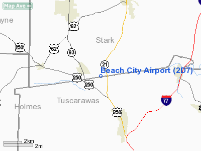
Location & QuickFacts
| FAA Information Effective: | 2008-09-25 |
| Airport Identifier: | 2D7 |
| Airport Status: | Operational |
| Longitude/Latitude: | 081-33-22.0160W/40-38-47.8250N
-81.556116/40.646618 (Estimated) |
| Elevation: | 984 ft / 299.92 m (Surveyed) |
| Land: | 13 acres |
| From nearest city: | 1 nautical miles E of Beach City, OH |
| Location: | Stark County, OH |
| Magnetic Variation: | 06W (1985) |
Owner & Manager
| Ownership: | Privately owned |
| Owner: | Beach City Arpt Inc |
| Address: | P.o. Box 82
Navarre, OH 44662 |
| Phone number: | 330-236-5041 |
| Manager: | Gary Slutz |
| Address: | 10431 Dolphin Street
Beach City, OH 44608 |
| Phone number: | 330-236-5041 |
Airport Operations and Facilities
| Airport Use: | Open to public |
| Wind indicator: | Yes |
| Segmented Circle: | No |
| Control Tower: | No |
| Lighting Schedule: | RDO-CTL
ACTVT LIRL 10/28 REIL 10 & 28 & ROTG BCN - 122.85. |
| Beacon Color: | Clear-Green (lighted land airport) |
| Landing fee charge: | No |
| Sectional chart: | Detroit |
| Region: | AGL - Great Lakes |
| Traffic Pattern Alt: | 816 ft |
| Boundary ARTCC: | ZOB - Cleveland |
| Tie-in FSS: | CLE - Cleveland |
| FSS on Airport: | No |
| FSS Toll Free: | 1-800-WX-BRIEF |
| NOTAMs Facility: | CLE (NOTAM-d service avaliable) |
Airport Communications
| CTAF: | 122.800 |
| Unicom: | 122.800 |
Airport Services
| Airframe Repair: | NONE |
| Power Plant Repair: | NONE |
| Bottled Oxygen: | NONE |
| Bulk Oxygen: | NONE |
Runway Information
Runway 10/28
| Dimension: | 3175 x 115 ft / 967.7 x 35.1 m |
| Surface: | TURF, Good Condition |
| Edge Lights: | Non-standard lighting system
NSTD LIRL; DSPLCD THLDS UNLIGHTED. |
| |
Runway 10 |
Runway 28 |
| Longitude: | 081-33-42.5950W | 081-33-01.4370W |
| Latitude: | 40-38-48.4310N | 40-38-47.2180N |
| Elevation: | 0.00 ft | 972.00 ft |
| Alignment: | 92 | 127 |
| Traffic Pattern: | Left | Left |
| Displaced threshold: | 425.00 ft | 734.00 ft |
| VASI: | 2-box on left side | 2-box on right side |
| Runway End Identifier: | Yes | Yes |
| Centerline Lights: | No | No |
| Touchdown Lights: | No | No |
| Obstruction: | 30 ft pline, 50 ft right of centerline
APCH RATIO 10:1 TO DSPLCD THLD OVER PLINE +30 FT; 303 FT FM 151 FT R. | 35 ft pline, 64.0 ft from runway, 132 ft left of centerline, 1:1 slope to clear
APCH RATIO 0:1 AT DSPLCD THLD DUE TO ADDITION +15 FT HGT 0 FT FM THLD 103 FT L. |
|
Radio Navigation Aids
| ID |
Type |
Name |
Ch |
Freq |
Var |
Dist |
| MLR | NDB | Millersburg/dcmsnd | | 382.00 | 06W | 15.8 nm |
| TSO | NDB | Tolson | | 395.00 | 07W | 22.4 nm |
| AK | NDB | Akron | | 362.00 | 07W | 26.6 nm |
| CFX | NDB | Cadiz | | 239.00 | 07W | 35.0 nm |
| AAU | NDB | Ashland | | 329.00 | 07W | 37.0 nm |
| MF | NDB | Manns | | 372.00 | 06W | 41.1 nm |
| CL | NDB | Harri | | 344.00 | 07W | 45.5 nm |
| HRA | NDB | Zanesville | | 204.00 | 06W | 47.5 nm |
| BSV | VOR/DME | Briggs | 071X | 112.40 | 04W | 8.0 nm |
| CTW | VOR/DME | Newcomerstown | 055X | 111.80 | 07W | 25.4 nm |
| TVT | VOR/DME | Tiverton | 112X | 116.50 | 03W | 28.4 nm |
| ACO | VOR/DME | Akron | 091X | 114.40 | 04W | 32.1 nm |
| ZZV | VOR/DME | Zanesville | 051X | 111.40 | 06W | 45.1 nm |
| MFD | VORTAC | Mansfield | 025X | 108.80 | 03W | 49.0 nm |
| CAK | VOT | Akron/canton Regional | | 110.60 | | 17.0 nm |
| CLE | VOT | Cleveland | | 110.40 | | 47.8 nm |
Remarks
- NO ULTRALIGHT ACFT 1 NM RADIUS.
- IN OPN PRIOR TO PART 157
Images and information placed above are from
http://www.airport-data.com/airport/2D7/
We thank them for the data!
| General Info
|
| Country |
United States
|
| State |
OHIO
|
| FAA ID |
2D7
|
| Latitude |
40-38-47.825N
|
| Longitude |
081-33-22.016W
|
| Elevation |
984 feet
|
| Near City |
BEACH CITY
|
We don't guarantee the information is fresh and accurate. The data may
be wrong or outdated.
For more up-to-date information please refer to other sources.
|
|


