 |
|
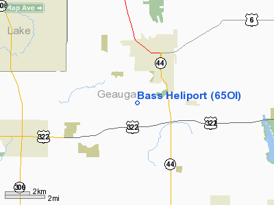
Location & QuickFacts
| FAA Information Effective: | 2008-09-25 |
| Airport Identifier: | 65OI |
| Airport Status: | Operational |
| Longitude/Latitude: | 081-13-33.3680W/41-32-48.1820N
-81.225936/41.546717 (Estimated) |
| Elevation: | 1180 ft / 359.66 m (Estimated) |
| Land: | 300 acres |
| From nearest city: | 3 nautical miles SW of Chardon, OH |
| Location: | Geauga County, OH |
| Magnetic Variation: | 07W (1990) |
Owner & Manager
| Ownership: | Privately owned |
| Owner: | Robert M Zella |
| Address: | 10634 Cedar Rd
Chesterland, OH 44026 |
| Phone number: | 216-632-5136 |
| Address: |
|
Airport Operations and Facilities
| Airport Use: | Private |
| Wind indicator: | Yes |
| Segmented Circle: | No |
| Control Tower: | No |
| Sectional chart: | Detroit |
| Region: | AGL - Great Lakes |
| Boundary ARTCC: | ZOB - Cleveland |
| Tie-in FSS: | CLE - Cleveland |
| FSS on Airport: | No |
| FSS Toll Free: | 1-800-WX-BRIEF |
Runway Information
Helipad H1
| Dimension: | 25 x 25 ft / 7.6 x 7.6 m |
| Surface: | TURF, |
| |
Runway H1 |
Runway |
| Traffic Pattern: | Left | Left |
|
Radio Navigation Aids
| ID |
Type |
Name |
Ch |
Freq |
Var |
Dist |
| LQL | NDB | Lakeland | | 263.00 | 08W | 10.7 nm |
| BKL | NDB | Burke Lakefront | | 416.00 | 07W | 19.7 nm |
| EZE | NDB | Engel | | 226.00 | 07W | 22.6 nm |
| AK | NDB | Akron | | 362.00 | 07W | 29.6 nm |
| CL | NDB | Harri | | 344.00 | 07W | 35.5 nm |
| HBD | NDB | Hubbard | | 408.00 | 08W | 39.3 nm |
| UCP | NDB | Castle | | 272.00 | 09W | 48.3 nm |
| CXR | VOR/DME | Chardon | 074X | 112.70 | 05W | 3.3 nm |
| LNN | VOR/DME | Lost Nation | 039X | 110.20 | 08W | 11.1 nm |
| JFN | VOR/DME | Jefferson | 099X | 115.20 | 05W | 25.0 nm |
| ACO | VOR/DME | Akron | 091X | 114.40 | 04W | 26.4 nm |
| DJB | VOR/DME | Dryer | 083X | 113.60 | 05W | 43.7 nm |
| BSV | VOR/DME | Briggs | 071X | 112.40 | 04W | 49.3 nm |
| YNG | VORTAC | Youngstown | 027X | 109.00 | 05W | 28.0 nm |
| CLE | VOT | Cleveland | | 110.40 | | 29.2 nm |
| CAK | VOT | Akron/canton Regional | | 110.60 | | 39.1 nm |
Remarks
- INGRESS/EGRESS: APPROACH/DEPARTURE ROUTE SATISFACTORY FROM 230 DEG CLOCKWISE TO 050 DEG AND FROM A TAKEOFF AND LANDING AREA OVER LAKE WITH HOVER TAXI TO TOUCHDOWN PAD, OR LIMITED INGRESS/EGRESS TO THE NORTH ONLY. THE NORTH ROUTES ARE SATISFACTORY FROM 320 DEG CLOCKWISE TO 020 DEG.
Images and information placed above are from
http://www.airport-data.com/airport/65OI/
We thank them for the data!
| General Info
|
| Country |
United States
|
| State |
OHIO
|
| FAA ID |
65OI
|
| Latitude |
41-32-48.182N
|
| Longitude |
081-13-33.368W
|
| Elevation |
1180 feet
|
| Near City |
CHARDON
|
We don't guarantee the information is fresh and accurate. The data may
be wrong or outdated.
For more up-to-date information please refer to other sources.
|
|


