 |
|
Location & QuickFacts
| FAA Information Effective: | 2008-09-25 |
| Airport Identifier: | 2D6 |
| Airport Status: | Operational |
| Longitude/Latitude: | 080-58-31.3440W/40-06-25.2510N
-80.975373/40.107014 (Estimated) |
| Elevation: | 1100 ft / 335.28 m (Estimated) |
| Land: | 0 acres |
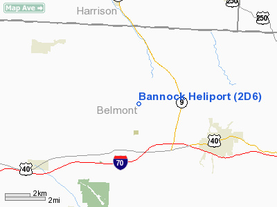
| From nearest city: | 0 nautical miles N of Bannock, OH |
| Location: | Belmont County, OH |
| Magnetic Variation: | 07W (1985) |
Owner & Manager
| Ownership: | Privately owned |
| Owner: | Ohio River Collieries Co |
| Address: | 70245 Bannock Uniontown Rd
St Clairsville, OH 43950 |
| Phone number: | 740-968-3504 |
| Manager: | Tom Gentile |
| Address: | 70245 Bannock Uniontown Road
St Clairsville, OH 43950 |
| Phone number: | 740-968-3504 |
Airport Operations and Facilities
| Airport Use: | Open to public |
| Wind indicator: | No |
| Segmented Circle: | No |
| Control Tower: | No |
| Sectional chart: | Detroit |
| Region: | AGL - Great Lakes |
| Boundary ARTCC: | ZOB - Cleveland |
| Tie-in FSS: | CLE - Cleveland |
| FSS on Airport: | No |
| FSS Toll Free: | 1-800-WX-BRIEF |
| NOTAMs Facility: | CLE (NOTAM-d service avaliable) |
Airport Communications
Airport Services
| Airframe Repair: | NONE |
| Power Plant Repair: | NONE |
| Bottled Oxygen: | NONE |
| Bulk Oxygen: | NONE |
Runway Information
Helipad H1
| Dimension: | 20 x 20 ft / 6.1 x 6.1 m |
| Surface: | CONC, Good Condition |
| |
Runway H1 |
Runway |
| Traffic Pattern: | Left | Left |
|
Radio Navigation Aids
| ID |
Type |
Name |
Ch |
Freq |
Var |
Dist |
| PKB | FAN MARKER | Marietta Ohio | | | 03W | 47.9 nm |
| CFX | NDB | Cadiz | | 239.00 | 07W | 8.0 nm |
| TSO | NDB | Tolson | | 395.00 | 07W | 27.8 nm |
| PNU | NDB | Washington County | | 255.00 | 08W | 37.4 nm |
| HRA | NDB | Zanesville | | 204.00 | 06W | 45.1 nm |
| MLR | NDB | Millersburg/dcmsnd | | 382.00 | 06W | 48.7 nm |
| AIR | VOR/DME | Bellaire | 118X | 117.10 | 07W | 9.1 nm |
| HLG | VOR/DME | Wheeling | 059X | 112.20 | 07W | 20.8 nm |
| CTW | VOR/DME | Newcomerstown | 055X | 111.80 | 07W | 24.2 nm |
| ZZV | VOR/DME | Zanesville | 051X | 111.40 | 06W | 43.4 nm |
| BSV | VOR/DME | Briggs | 071X | 112.40 | 04W | 43.4 nm |
| AGC | VOR/DME | Allegheny | 037X | 110.00 | 09W | 44.1 nm |
| MMJ | VORTAC | Montour | 057X | 112.00 | 08W | 42.5 nm |
| JPU | VORTAC | Parkersburg | 023X | 108.60 | 03W | 44.1 nm |
Remarks
- AIRSPACE ANALYSIS DETERMINATION CONDITIONS: INGRESS/EGRESS 195 DEG CLOCKWISE TO 190 DEG USING PAD AS COMPASS ROSE.
Images and information placed above are from
http://www.airport-data.com/airport/2D6/
We thank them for the data!
| General Info
|
| Country |
United States
|
| State |
OHIO
|
| FAA ID |
2D6
|
| Latitude |
40-06-25.251N
|
| Longitude |
080-58-31.344W
|
| Elevation |
1100 feet
|
| Near City |
BANNOCK
|
We don't guarantee the information is fresh and accurate. The data may
be wrong or outdated.
For more up-to-date information please refer to other sources.
|
|


