 |
|
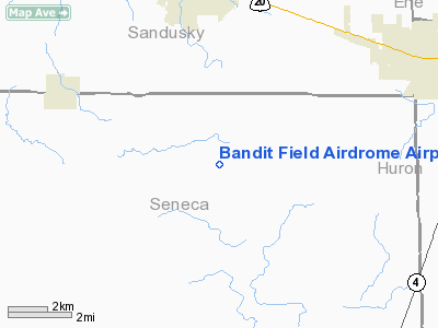
Bandit Field Airdrome Airport |
Location & QuickFacts
| FAA Information Effective: | 2008-09-25 |
| Airport Identifier: | 5D9 |
| Airport Status: | Operational |
| Longitude/Latitude: | 082-57-27.6860W/41-13-26.1950N
-82.957691/41.223943 (Estimated) |
| Elevation: | 805 ft / 245.36 m (Estimated) |
| Land: | 0 acres |
| From nearest city: | 5 nautical miles S of Clyde, OH |
| Location: | Seneca County, OH |
| Magnetic Variation: | 05W (1985) |
Owner & Manager
| Ownership: | Privately owned |
| Owner: | Michael Matesick |
| Address: | 6606 N. Twp Rd 78
Green Springs, OH 44836 |
| Phone number: | 419-483-3607 |
| Manager: | Michael Matesick |
| Address: | 6610 N Twp Rd 78
Green Springs, OH 44836 |
| Phone number: | 419-483-3607 |
Airport Operations and Facilities
| Airport Use: | Open to public |
| Wind indicator: | Yes |
| Segmented Circle: | No |
| Control Tower: | No |
| Landing fee charge: | No |
| Sectional chart: | Detroit |
| Region: | AGL - Great Lakes |
| Boundary ARTCC: | ZOB - Cleveland |
| Tie-in FSS: | CLE - Cleveland |
| FSS on Airport: | No |
| FSS Toll Free: | 1-800-WX-BRIEF |
| NOTAMs Facility: | CLE (NOTAM-d service avaliable) |
Airport Communications
Airport Services
| Airframe Repair: | MINOR |
| Power Plant Repair: | MINOR |
| Bottled Oxygen: | NONE |
| Bulk Oxygen: | NONE |
Runway Information
Runway 18/36
| Dimension: | 2576 x 80 ft / 785.2 x 24.4 m |
| Surface: | TURF, Good Condition |
| |
Runway 18 |
Runway 36 |
| Longitude: | 082-57-27.5200W | 082-57-27.8300W |
| Latitude: | 41-13-39.1800N | 41-13-13.2000N |
| Elevation: | 805.00 ft | 805.00 ft |
| Traffic Pattern: | Left | Left |
| Displaced threshold: | 275.00 ft
DSPLCD THLD MKD WITH RED/YELLOW PANELS. | 0.00 ft |
| Runway End Identifier: | No | No |
| Centerline Lights: | No | No |
| Touchdown Lights: | No | No |
| Obstruction: | 15 ft road, 24.0 ft from runway, 1:1 slope to clear
APCH RATIO 19:1 TO DSPLCD THLD. | , 50:1 slope to clear |
|
Radio Navigation Aids
| ID |
Type |
Name |
Ch |
Freq |
Var |
Dist |
| TII | NDB | Tiffin | | 269.00 | 05W | 13.6 nm |
| PCW | NDB | Port Clinton | | 423.00 | 06W | 18.2 nm |
| FZI | NDB | Fostoria | | 379.00 | 05W | 19.9 nm |
| BNR | NDB | Benton Ridge | | 334.00 | 05W | 34.4 nm |
| AAU | NDB | Ashland | | 329.00 | 07W | 35.5 nm |
| PT | NDB | Pelee Island | | 283.00 | 05W | 35.8 nm |
| MF | NDB | Manns | | 372.00 | 06W | 36.0 nm |
| MNN | NDB | Marion | | 201.00 | 05W | 36.8 nm |
| CL | NDB | Harri | | 344.00 | 07W | 45.4 nm |
| PDR | NDB | Ottawa | | 233.00 | 05W | 47.5 nm |
| TOL | TACAN | Toledo | 072X | | 05W | 44.0 nm |
| MAH | VOR | Marathon | | 114.90 | 05W | 34.4 nm |
| BUD | VOR | Buckeye | | 109.80 | 05W | 36.8 nm |
| SKY | VOR/DME | Sandusky | 029X | 109.20 | 04W | 18.6 nm |
| VWV | VOR/DME | Waterville | 078X | 113.10 | 02W | 33.6 nm |
| DJB | VOR/DME | Dryer | 083X | 113.60 | 05W | 36.8 nm |
| MFD | VORTAC | Mansfield | 025X | 108.80 | 03W | 27.1 nm |
| FDY | VORTAC | Findlay | 019X | 108.20 | 02W | 39.6 nm |
Remarks
- PVT RD CROSSES RY 18/36 540 FT N OF THE AER 36
- PVT RD XING RWY 500'N OF AER 36 CREATING UNSAFE COND FOR ACFT USING RWY.
Images and information placed above are from
http://www.airport-data.com/airport/5D9/
We thank them for the data!
| General Info
|
| Country |
United States
|
| State |
OHIO
|
| FAA ID |
5D9
|
| Latitude |
41-13-26.195N
|
| Longitude |
082-57-27.686W
|
| Elevation |
805 feet
|
| Near City |
CLYDE
|
We don't guarantee the information is fresh and accurate. The data may
be wrong or outdated.
For more up-to-date information please refer to other sources.
|
|


