 |
|
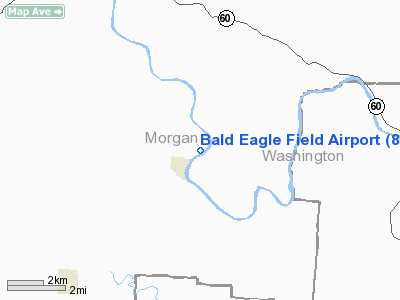
Location & QuickFacts
| FAA Information Effective: | 2008-09-25 |
| Airport Identifier: | 8OA7 |
| Airport Status: | Operational |
| Longitude/Latitude: | 081-46-51.4820W/39-33-23.2600N
-81.780967/39.556461 (Estimated) |
| Elevation: | 680 ft / 207.26 m (Estimated) |
| Land: | 4 acres |
| From nearest city: | 1 nautical miles NE of Stockport, OH |
| Location: | Morgan County, OH |
| Magnetic Variation: | 06W (1985) |
Owner & Manager
| Ownership: | Privately owned |
| Owner: | Dennis L. Jasper |
| Address: | Rt 1
Stockport, OH 43787 |
| Phone number: | 614-559-3983 |
| Manager: | Dennis L. Jasper |
| Address: | Rt 1
Stockport, OH 43787 |
| Phone number: | 614-559-3983 |
Airport Operations and Facilities
| Airport Use: | Private |
| Wind indicator: | Yes |
| Segmented Circle: | No |
| Control Tower: | No |
| Landing fee charge: | No |
| Sectional chart: | Cincinnati |
| Region: | AGL - Great Lakes |
| Boundary ARTCC: | ZID - Indianapolis |
| Tie-in FSS: | CLE - Cleveland |
| FSS on Airport: | No |
| FSS Toll Free: | 1-800-WX-BRIEF |
Airport Services
| Fuel available: | MOGAS |
| Airframe Repair: | NONE |
| Power Plant Repair: | NONE |
Runway Information
Runway 04/22
| Dimension: | 2260 x 65 ft / 688.8 x 19.8 m |
| Surface: | TURF, Good Condition |
| |
Runway 04 |
Runway 22 |
| Longitude: | 081-47-02.6100W | 081-46-40.5000W |
| Latitude: | 39-33-16.1500N | 39-33-30.5100N |
| Elevation: | 680.00 ft | 680.00 ft |
| Traffic Pattern: | Left | Left |
| Markings: | Nonstandard, Good Condition
04/22 OUTLINED WITH WHITE TIRES. | Nonstandard, Good Condition |
| Obstruction: | 40 ft trees, 480.0 ft from runway, 60 ft right of centerline, 12:1 slope to clear | 30 ft trees, 0.0 ft from runway, 125 ft left of centerline |
|
Radio Navigation Aids
| ID |
Type |
Name |
Ch |
Freq |
Var |
Dist |
| PKB | FAN MARKER | Marietta Ohio | | | 03W | 19.9 nm |
| HRA | NDB | Zanesville | | 204.00 | 06W | 22.0 nm |
| UGS | NDB | University | | 250.00 | 06W | 24.1 nm |
| HEH | NDB | Newark | | 524.00 | 06W | 42.3 nm |
| GAS | NDB | Gallipolis | | 420.00 | 07W | 46.9 nm |
| ZZV | VOR/DME | Zanesville | 051X | 111.40 | 06W | 23.7 nm |
| CTW | VOR/DME | Newcomerstown | 055X | 111.80 | 07W | 42.8 nm |
| JPU | VORTAC | Parkersburg | 023X | 108.60 | 03W | 20.1 nm |
| HNN | VORTAC | Henderson | 106X | 115.90 | 03W | 49.6 nm |
Remarks
Images and information placed above are from
http://www.airport-data.com/airport/8OA7/
We thank them for the data!
| General Info
|
| Country |
United States
|
| State |
OHIO
|
| FAA ID |
8OA7
|
| Latitude |
39-33-23.260N
|
| Longitude |
081-46-51.482W
|
| Elevation |
680 feet
|
| Near City |
STOCKPORT
|
We don't guarantee the information is fresh and accurate. The data may
be wrong or outdated.
For more up-to-date information please refer to other sources.
|
|


