 |
|
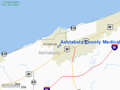
Ashtabula County Medical Center Ctr Heliport |
Location & QuickFacts
| FAA Information Effective: | 2008-09-25 |
| Airport Identifier: | 8OH0 |
| Airport Status: | Operational |
| Longitude/Latitude: | 080-47-37.7795W/41-52-48.6076N
-80.793828/41.880169 (Estimated) |
| Elevation: | 639 ft / 194.77 m (Surveyed) |
| Land: | 0 acres |
| From nearest city: | 0 nautical miles N of Ashtabula, OH |
| Location: | Ashtabula County, OH |
| Magnetic Variation: | 08W (1990) |
Owner & Manager
| Ownership: | Privately owned |
| Owner: | The Cleveland Clinic Foundation
ATTN: CHRISTOPHER MANACCI. |
| Address: | 9500 Euclid Ave
Cleveland, OH 44195 |
| Phone number: | 216-445-4595 |
| Manager: | Gerald Honeycutt
DIRECTOR OF FACILITIES MANAGEMENT. |
| Address: | 2420 Lake Avenue
Ashtaula, OH 44004 |
| Phone number: | 440-997-6269 |
Airport Operations and Facilities
| Airport Use: | Private
MEDICAL USE. |
| Wind indicator: | Yes |
| Segmented Circle: | No |
| Control Tower: | No |
| Lighting Schedule: | DUSK-DAWN |
| Beacon Color: | Clear-Yellow (lighted seaplan base) |
| Sectional chart: | Detroit |
| Region: | AGL - Great Lakes |
| Boundary ARTCC: | ZOB - Cleveland |
| Tie-in FSS: | CLE - Cleveland |
| FSS on Airport: | No |
| FSS Toll Free: | 1-800-WX-BRIEF |
Runway Information
Helipad H1
| Dimension: | 45 x 45 ft / 13.7 x 13.7 m |
| Surface: | CONC, |
| |
Runway H1 |
Runway |
| Traffic Pattern: | Left | Left |
|
Radio Navigation Aids
| ID |
Type |
Name |
Ch |
Freq |
Var |
Dist |
| LQL | NDB | Lakeland | | 263.00 | 08W | 28.8 nm |
| CQD | NDB | Cascade | | 372.00 | 08W | 34.0 nm |
| BKL | NDB | Burke Lakefront | | 416.00 | 07W | 44.4 nm |
| HBD | NDB | Hubbard | | 408.00 | 08W | 45.3 nm |
| EZE | NDB | Engel | | 226.00 | 07W | 47.9 nm |
| FKL | VOR | Franklin | | 109.60 | 06W | 49.8 nm |
| JFN | VOR/DME | Jefferson | 099X | 115.20 | 05W | 7.5 nm |
| CXR | VOR/DME | Chardon | 074X | 112.70 | 05W | 27.4 nm |
| LNN | VOR/DME | Lost Nation | 039X | 110.20 | 08W | 29.2 nm |
| YQO | VOR/DME | Aylmer | 089X | 114.20 | 08W | 49.9 nm |
| ACO | VOR/DME | Akron | 091X | 114.40 | 04W | 49.9 nm |
| ERI | VORTAC | Erie | 031X | 109.40 | 06W | 23.9 nm |
| YNG | VORTAC | Youngstown | 027X | 109.00 | 05W | 33.4 nm |
Remarks
- PRVDD ALL APCH/DEP ROUTE HELICOPTER OPNS ARE CONDUCTED IN AN AREA FROM 040-160 DEGS; TKOF/LNDG AREA IS APPROPRIATELY MARKED; A NON-OBSTRUCTING WIND INDICATOR IS MAINTAINED.
Images and information placed above are from
http://www.airport-data.com/airport/8OH0/
We thank them for the data!
| General Info
|
| Country |
United States
|
| State |
OHIO
|
| FAA ID |
8OH0
|
| Latitude |
41-52-49.190N
|
| Longitude |
080-47-37.310W
|
| Elevation |
640 feet
|
| Near City |
ASHTABULA
|
We don't guarantee the information is fresh and accurate. The data may
be wrong or outdated.
For more up-to-date information please refer to other sources.
|
|


