 |
|
Location & QuickFacts
| FAA Information Effective: | 2008-09-25 |
| Airport Identifier: | 3OH2 |
| Airport Status: | Operational |
| Longitude/Latitude: | 081-37-45.4510W/40-48-37.2030N
-81.629292/40.810334 (Estimated) |
| Elevation: | 1120 ft / 341.38 m (Estimated) |
| Land: | 4 acres |
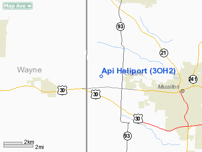
| From nearest city: | 2 nautical miles S of North Lawrence, OH |
| Location: | Stark County, OH |
| Magnetic Variation: | 06W (1985) |
Owner & Manager
| Ownership: | Privately owned |
| Owner: | Aerial Patrols Inc |
| Address: | 1754 Alabama Ave Nw
North Lawrence, OH 44666 |
| Phone number: | 216-837-3702 |
| Manager: | Terry Ewing |
| Address: | 1754 Alabama Ave Nw
North Lawrence, OH 44666 |
| Phone number: | 216-837-3702 |
Airport Operations and Facilities
| Airport Use: | Private |
| Wind indicator: | Yes |
| Segmented Circle: | No |
| Control Tower: | No |
| Sectional chart: | Detroit |
| Region: | AGL - Great Lakes |
| Boundary ARTCC: | ZOB - Cleveland |
| Tie-in FSS: | CLE - Cleveland |
| FSS on Airport: | No |
| FSS Toll Free: | 1-800-WX-BRIEF |
Runway Information
Helipad H1
| Dimension: | 30 x 30 ft / 9.1 x 9.1 m |
| Surface: | TURF, |
| |
Runway H1 |
Runway |
| Traffic Pattern: | Left | Left |
|
Radio Navigation Aids
| ID |
Type |
Name |
Ch |
Freq |
Var |
Dist |
| AK | NDB | Akron | | 362.00 | 07W | 19.1 nm |
| MLR | NDB | Millersburg/dcmsnd | | 382.00 | 06W | 19.6 nm |
| TSO | NDB | Tolson | | 395.00 | 07W | 29.2 nm |
| AAU | NDB | Ashland | | 329.00 | 07W | 29.8 nm |
| CL | NDB | Harri | | 344.00 | 07W | 35.2 nm |
| MF | NDB | Manns | | 372.00 | 06W | 37.2 nm |
| EZE | NDB | Engel | | 226.00 | 07W | 41.0 nm |
| BKL | NDB | Burke Lakefront | | 416.00 | 07W | 43.2 nm |
| CFX | NDB | Cadiz | | 239.00 | 07W | 44.5 nm |
| BSV | VOR/DME | Briggs | 071X | 112.40 | 04W | 9.9 nm |
| ACO | VOR/DME | Akron | 091X | 114.40 | 04W | 26.4 nm |
| TVT | VOR/DME | Tiverton | 112X | 116.50 | 03W | 31.0 nm |
| CTW | VOR/DME | Newcomerstown | 055X | 111.80 | 07W | 35.6 nm |
| DJB | VOR/DME | Dryer | 083X | 113.60 | 05W | 40.8 nm |
| CXR | VOR/DME | Chardon | 074X | 112.70 | 05W | 47.4 nm |
| MFD | VORTAC | Mansfield | 025X | 108.80 | 03W | 43.9 nm |
| CAK | VOT | Akron/canton Regional | | 110.60 | | 10.6 nm |
| CLE | VOT | Cleveland | | 110.40 | | 37.4 nm |
Remarks
- PRVDD ALL APCH/DEP ROUTES 200-250 DEGS & 300-150 DEGS; TAKEOFF/LNDG AREA APPROPRIATELY MKD; NON-OBSTRUCTING WIND INDICATOR.
Images and information placed above are from
http://www.airport-data.com/airport/3OH2/
We thank them for the data!
| General Info
|
| Country |
United States
|
| State |
OHIO
|
| FAA ID |
3OH2
|
| Latitude |
40-48-37.203N
|
| Longitude |
081-37-45.451W
|
| Elevation |
1120 feet
|
| Near City |
NORTH LAWRENCE
|
We don't guarantee the information is fresh and accurate. The data may
be wrong or outdated.
For more up-to-date information please refer to other sources.
|
|


