 |
|
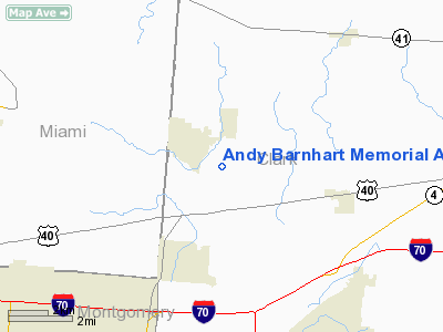
Andy Barnhart Memorial Airport |
Location & QuickFacts
| FAA Information Effective: | 2008-09-25 |
| Airport Identifier: | 3OH0 |
| Airport Status: | Operational |
| Longitude/Latitude: | 084-00-48.7660W/39-55-51.2120N
-84.013546/39.930892 (Estimated) |
| Elevation: | 895 ft / 272.80 m (Estimated) |
| Land: | 0 acres |
| From nearest city: | 1 nautical miles SE of New Carlisle, OH |
| Location: | Clark County, OH |
| Magnetic Variation: | 04W (1985) |
Owner & Manager
| Ownership: | Privately owned |
| Owner: | Flying Angels, Inc. |
| Address: | Box 7
New Carlisle, OH 45344 |
| Phone number: | 937-849-9643 |
| Manager: | George Coulthard |
| Address: | 226 Kenney
Medway, OH 45341 |
| Phone number: | 937-849-9643 |
Airport Operations and Facilities
| Airport Use: | Private |
| Wind indicator: | Yes |
| Segmented Circle: | No |
| Control Tower: | No |
| Lighting Schedule: | RDO-CTL
ACTVT LIRL RYS 09/27 & 10/28 - 122.9. |
| Beacon Color: | Clear-Green (lighted land airport) |
| Landing fee charge: | No |
| Sectional chart: | Cincinnati |
| Region: | AGL - Great Lakes |
| Boundary ARTCC: | ZID - Indianapolis |
| Tie-in FSS: | DAY - Dayton |
| FSS on Airport: | No |
| FSS Toll Free: | 1-800-WX-BRIEF
OR LOCAL CALL 322-4562. |
Airport Services
| Airframe Repair: | NONE |
| Power Plant Repair: | NONE |
Runway Information
Runway 09/27
| Dimension: | 2000 x 30 ft / 609.6 x 9.1 m |
| Surface: | ASPH, |
| Edge Lights: | Low |
| |
Runway 09 |
Runway 27 |
| Traffic Pattern: | Left | Left |
|
Runway 10/28
| Dimension: | 2000 x 150 ft / 609.6 x 45.7 m |
| Surface: | TURF, |
| Edge Lights: | Low |
| |
Runway 10 |
Runway 28 |
| Traffic Pattern: | Left | Left |
|
Radio Navigation Aids
| ID |
Type |
Name |
Ch |
Freq |
Var |
Dist |
| CCJ | NDB | Clark County | | 341.00 | 04W | 11.3 nm |
| XEN | NDB | Xenia | | 395.00 | 03W | 13.5 nm |
| UYF | NDB | London | | 263.00 | 06W | 25.2 nm |
| EDJ | NDB | Bellefontaine | | 242.00 | 05W | 28.0 nm |
| VES | NDB | Versailles | | 356.00 | 04W | 28.7 nm |
| IL | NDB | Airbo | | 407.00 | 04W | 29.3 nm |
| HKF | NDB | Hook Field | | 239.00 | 04W | 32.8 nm |
| CSS | NDB | Court House | | 414.00 | 05W | 34.9 nm |
| HW | NDB | Cubla | | 299.00 | 04W | 35.3 nm |
| MRT | NDB | Marysville | | 403.00 | 05W | 35.3 nm |
| RUV | NDB | Rushsylvania | | 326.00 | 05W | 35.5 nm |
| BU | NDB | Boutn | | 230.00 | 05W | 37.9 nm |
| OS | NDB | Fuler | | 515.00 | 05W | 38.5 nm |
| CQA | NDB | Lakefield | | 205.00 | 04W | 41.7 nm |
| HAO | NDB | Hamilton | | 260.00 | 04W | 42.3 nm |
| OXD | NDB | Oxford | | 282.00 | 04W | 43.6 nm |
| DKG | NDB | Don Scott | | 348.00 | 05W | 44.0 nm |
| ISZ | NDB | Cincinnati-blue Ash | | 388.00 | 04W | 44.5 nm |
| MDE | NDB | Madeira | | 379.00 | 04W | 45.4 nm |
| CHC | NDB | Grens | | 272.00 | 04W | 45.6 nm |
| LYL | NDB | Lima | | 362.00 | 04W | 46.5 nm |
| DLZ | NDB | Delaware | | 215.00 | 06W | 46.7 nm |
| LUK | NDB | Cincinnati | | 335.00 | 04W | 48.8 nm |
| HOC | NDB | Hillsboro | | 278.00 | 05W | 49.9 nm |
| FFO | TACAN | Patterson | 099X | | 04W | 7.0 nm |
| XSF | TACAN | Springfield | 065X | | 04W | 9.7 nm |
| AOH | VOR | Allen County | | 108.40 | 04W | 46.7 nm |
| SGH | VOR/DME | Springfield | 079X | 113.20 | 04W | 9.6 nm |
| DQN | VOR/DME | Dayton | 092X | 114.50 | 01W | 18.4 nm |
| MXQ | VOR/DME | Midwest | 076X | 112.90 | 04W | 31.7 nm |
| ROD | VORTAC | Rosewood | 122X | 117.50 | 05W | 21.5 nm |
| RID | VORTAC | Richmond | 043X | 110.60 | 03W | 39.5 nm |
| DAY | VOT | Dayton J M Cox-day | | 111.00 | | 9.7 nm |
Remarks
- FREQ 122.9 AVBL FOR COMMUNICATIONS WITH ARPT.
- VFR ONLY
Images and information placed above are from
http://www.airport-data.com/airport/3OH0/
We thank them for the data!
| General Info
|
| Country |
United States
|
| State |
OHIO
|
| FAA ID |
3OH0
|
| Latitude |
39-55-51.212N
|
| Longitude |
084-00-48.766W
|
| Elevation |
895 feet
|
| Near City |
NEW CARLISLE
|
We don't guarantee the information is fresh and accurate. The data may
be wrong or outdated.
For more up-to-date information please refer to other sources.
|
|


