 |
|
Location & QuickFacts
| FAA Information Effective: | 2008-09-25 |
| Airport Identifier: | OH61 |
| Airport Status: | Operational |
| Longitude/Latitude: | 082-44-16.6110W/39-38-07.2280N
-82.737947/39.635341 (Estimated) |
| Elevation: | 900 ft / 274.32 m (Estimated) |
| Land: | 0 acres |
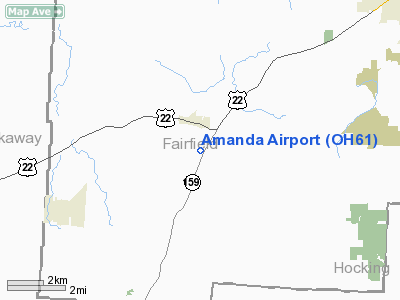
| From nearest city: | 1 nautical miles SE of Amanda, OH |
| Location: | Fairfield County, OH |
| Magnetic Variation: | 05W (1985) |
Owner & Manager
| Ownership: | Privately owned |
| Owner: | George R. Wharton |
| Address: | Box 367
Amanda, OH 43102 |
| Phone number: | 614-969-2842 |
| Address: |
|
Airport Operations and Facilities
| Airport Use: | Private |
| Wind indicator: | Yes |
| Segmented Circle: | No |
| Control Tower: | No |
| Sectional chart: | Cincinnati |
| Region: | AGL - Great Lakes |
| Boundary ARTCC: | ZID - Indianapolis |
| Tie-in FSS: | DAY - Dayton |
| FSS on Airport: | No |
| FSS Toll Free: | 1-800-WX-BRIEF |
Airport Services
Runway Information
Runway 18/36
| Dimension: | 2300 x 90 ft / 701.0 x 27.4 m |
| Surface: | TURF, |
| |
Runway 18 |
Runway 36 |
| Traffic Pattern: | Left | Left |
| Obstruction: | 20 ft pline, 1000.0 ft from runway | |
|
Radio Navigation Aids
| ID |
Type |
Name |
Ch |
Freq |
Var |
Dist |
| CYO | NDB | Circleville | | 366.00 | 05W | 13.1 nm |
| RZT | NDB | Ross County | | 236.00 | 05W | 17.9 nm |
| CM | NDB | Sumie | | 391.00 | 05W | 21.1 nm |
| BU | NDB | Boutn | | 230.00 | 05W | 24.3 nm |
| CHC | NDB | Grens | | 272.00 | 04W | 26.2 nm |
| HEH | NDB | Newark | | 524.00 | 06W | 26.7 nm |
| EOP | NDB | Waverly | | 385.00 | 06W | 29.6 nm |
| CSS | NDB | Court House | | 414.00 | 05W | 30.3 nm |
| DKG | NDB | Don Scott | | 348.00 | 05W | 31.0 nm |
| OS | NDB | Fuler | | 515.00 | 05W | 33.8 nm |
| UGS | NDB | University | | 250.00 | 06W | 36.4 nm |
| UYF | NDB | London | | 263.00 | 06W | 38.1 nm |
| HRA | NDB | Zanesville | | 204.00 | 06W | 41.2 nm |
| DLZ | NDB | Delaware | | 215.00 | 06W | 42.1 nm |
| MRT | NDB | Marysville | | 403.00 | 05W | 45.4 nm |
| HOC | NDB | Hillsboro | | 278.00 | 05W | 46.2 nm |
| IL | NDB | Airbo | | 407.00 | 04W | 47.1 nm |
| LCK | TACAN | Rickenbacker | 069X | | 05W | 13.6 nm |
| XUB | VOR | Yellow Bud | | 112.50 | 05W | 12.9 nm |
| ZZV | VOR/DME | Zanesville | 051X | 111.40 | 06W | 43.1 nm |
| APE | VORTAC | Appleton | 114X | 116.70 | 06W | 31.8 nm |
| CMH | VOT | Port Columbus | | 111.00 | | 22.6 nm |
Remarks
- PRVDD OBSTN IN RY APCH SLOPE SFC REMOVED/LOWERED OR THR DSPLCD & MKD TO PRVD MIN 20:1 APCH SFC CLNC OVER OBSTN; REF FAA AC 150/5300-4B.
Images and information placed above are from
http://www.airport-data.com/airport/OH61/
We thank them for the data!
| General Info
|
| Country |
United States
|
| State |
OHIO
|
| FAA ID |
OH61
|
| Latitude |
39-38-07.228N
|
| Longitude |
082-44-16.611W
|
| Elevation |
900 feet
|
| Near City |
AMANDA
|
We don't guarantee the information is fresh and accurate. The data may
be wrong or outdated.
For more up-to-date information please refer to other sources.
|
|


