 |
|
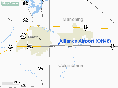
Location & QuickFacts
| FAA Information Effective: | 2008-09-25 |
| Airport Identifier: | OH48 |
| Airport Status: | Operational |
| Longitude/Latitude: | 081-03-54.3430W/40-54-20.2100N
-81.065095/40.905614 (Estimated) |
| Elevation: | 1077 ft / 328.27 m (Estimated) |
| Land: | 13 acres |
| From nearest city: | 1 nautical miles SE of Alliance, OH |
| Location: | Mahoning County, OH |
| Magnetic Variation: | 07W (1985) |
Owner & Manager
| Ownership: | Privately owned |
| Owner: | Terry Weyer |
| Address: | Po Box 204
Wadsworth, OH 44281 |
| Phone number: | 330-336-3227 |
| Manager: | Terry Weyer |
| Address: | 21776 Harrisburg Westville Ne
Alliance, OH 44601 |
Airport Operations and Facilities
| Airport Use: | Private |
| Segmented Circle: | No |
| Control Tower: | No |
| Landing fee charge: | No |
| Sectional chart: | Detroit |
| Region: | AGL - Great Lakes |
| Boundary ARTCC: | ZOB - Cleveland |
| Tie-in FSS: | CLE - Cleveland |
| FSS on Airport: | No |
| FSS Toll Free: | 1-800-WX-BRIEF |
Airport Services
| Airframe Repair: | NONE |
| Power Plant Repair: | NONE |
Runway Information
Runway 18/36
| Dimension: | 2300 x 75 ft / 701.0 x 22.9 m |
| Surface: | TURF, |
| |
Runway 18 |
Runway 36 |
| Traffic Pattern: | Left | Left |
| Obstruction: | 200 ft stack, 500.0 ft from runway | 30 ft pline |
|
Radio Navigation Aids
| ID |
Type |
Name |
Ch |
Freq |
Var |
Dist |
| AK | NDB | Akron | | 362.00 | 07W | 17.6 nm |
| TSO | NDB | Tolson | | 395.00 | 07W | 20.6 nm |
| HBD | NDB | Hubbard | | 408.00 | 08W | 28.4 nm |
| UCP | NDB | Castle | | 272.00 | 09W | 30.3 nm |
| CFX | NDB | Cadiz | | 239.00 | 07W | 40.3 nm |
| MLR | NDB | Millersburg/dcmsnd | | 382.00 | 06W | 42.8 nm |
| EZE | NDB | Engel | | 226.00 | 07W | 46.0 nm |
| BKL | NDB | Burke Lakefront | | 416.00 | 07W | 46.2 nm |
| CL | NDB | Harri | | 344.00 | 07W | 48.3 nm |
| LQL | NDB | Lakeland | | 263.00 | 08W | 48.8 nm |
| ACO | VOR/DME | Akron | 091X | 114.40 | 04W | 13.6 nm |
| BSV | VOR/DME | Briggs | 071X | 112.40 | 04W | 19.4 nm |
| CXR | VOR/DME | Chardon | 074X | 112.70 | 05W | 37.0 nm |
| CTW | VOR/DME | Newcomerstown | 055X | 111.80 | 07W | 44.8 nm |
| HLG | VOR/DME | Wheeling | 059X | 112.20 | 07W | 44.9 nm |
| LNN | VOR/DME | Lost Nation | 039X | 110.20 | 08W | 49.0 nm |
| YNG | VORTAC | Youngstown | 027X | 109.00 | 05W | 31.1 nm |
| EWC | VORTAC | Ellwood City | 105X | 115.80 | 08W | 39.1 nm |
| MMJ | VORTAC | Montour | 057X | 112.00 | 08W | 47.0 nm |
| CAK | VOT | Akron/canton Regional | | 110.60 | | 17.1 nm |
| CLE | VOT | Cleveland | | 110.40 | | 46.7 nm |
Remarks
- USE AT OWN RISK. DO NOT USE IN WET SEASON.
- IN OPERATION PRIOR TO 1959.
Images and information placed above are from
http://www.airport-data.com/airport/OH48/
We thank them for the data!
| General Info
|
| Country |
United States
|
| State |
OHIO
|
| FAA ID |
OH48
|
| Latitude |
40-54-20.210N
|
| Longitude |
081-03-54.343W
|
| Elevation |
1077 feet
|
| Near City |
ALLIANCE
|
We don't guarantee the information is fresh and accurate. The data may
be wrong or outdated.
For more up-to-date information please refer to other sources.
|
|


