 |
|
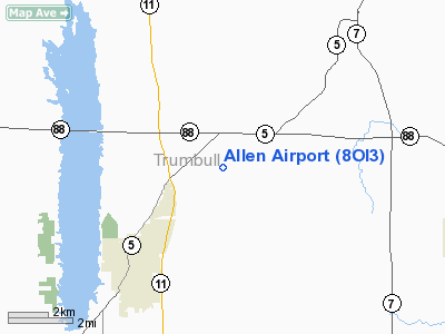
Location & QuickFacts
| FAA Information Effective: | 2008-09-25 |
| Airport Identifier: | 8OI3 |
| Airport Status: | Operational |
| Longitude/Latitude: | 080-40-08.2790W/41-22-24.2000N
-80.668966/41.373389 (Estimated) |
| Elevation: | 1105 ft / 336.80 m (Surveyed) |
| Land: | 110 acres |
| From nearest city: | 4 nautical miles NE of Cortland, OH |
| Location: | Trumbull County, OH |
| Magnetic Variation: | 07W (1985) |
Owner & Manager
| Ownership: | Privately owned |
| Owner: | Russell & Larry Allen |
| Address: | 5645 Kingsville Rd.
Cortland, OH 44410 |
| Phone number: | 216-924-2463 |
| Manager: | Russell & Larry Allen |
| Address: | 5645 Kingsville Rd.
Cortland, OH 44410 |
| Phone number: | 216-924-4361 |
Airport Operations and Facilities
| Airport Use: | Private |
| Wind indicator: | Yes |
| Segmented Circle: | No |
| Control Tower: | No |
| Landing fee charge: | No |
| Sectional chart: | Detroit |
| Region: | AGL - Great Lakes |
| Boundary ARTCC: | ZOB - Cleveland |
| Tie-in FSS: | CLE - Cleveland |
| FSS on Airport: | No |
| FSS Toll Free: | 1-800-WX-BRIEF |
Runway Information
Runway 09/27
| Dimension: | 2700 x 120 ft / 823.0 x 36.6 m |
| Surface: | TURF, |
| |
Runway 09 |
Runway 27 |
| Traffic Pattern: | Left | Left |
|
Radio Navigation Aids
| ID |
Type |
Name |
Ch |
Freq |
Var |
Dist |
| HBD | NDB | Hubbard | | 408.00 | 08W | 14.6 nm |
| UCP | NDB | Castle | | 272.00 | 09W | 24.0 nm |
| LQL | NDB | Lakeland | | 263.00 | 08W | 37.0 nm |
| AK | NDB | Akron | | 362.00 | 07W | 37.3 nm |
| BKL | NDB | Burke Lakefront | | 416.00 | 07W | 45.8 nm |
| EZE | NDB | Engel | | 226.00 | 07W | 48.0 nm |
| FKL | VOR | Franklin | | 109.60 | 06W | 36.8 nm |
| JFN | VOR/DME | Jefferson | 099X | 115.20 | 05W | 23.5 nm |
| CXR | VOR/DME | Chardon | 074X | 112.70 | 05W | 23.9 nm |
| ACO | VOR/DME | Akron | 091X | 114.40 | 04W | 28.9 nm |
| LNN | VOR/DME | Lost Nation | 039X | 110.20 | 08W | 37.4 nm |
| YNG | VORTAC | Youngstown | 027X | 109.00 | 05W | 2.6 nm |
| EWC | VORTAC | Ellwood City | 105X | 115.80 | 08W | 38.9 nm |
| ERI | VORTAC | Erie | 031X | 109.40 | 06W | 42.2 nm |
| CAK | VOT | Akron/canton Regional | | 110.60 | | 44.5 nm |
Remarks
- PROVIDE PLINE ON EAST END BE BURIED, OR THRESHOLD DISPLACED TO PROVIDE A 20:1 CLEARANCE OVER PLINE.
Images and information placed above are from
http://www.airport-data.com/airport/8OI3/
We thank them for the data!
| General Info
|
| Country |
United States
|
| State |
OHIO
|
| FAA ID |
8OH8
|
| Latitude |
41-40-05.198N
|
| Longitude |
080-41-08.286W
|
| Elevation |
985 feet
|
| Near City |
DORSET
|
We don't guarantee the information is fresh and accurate. The data may
be wrong or outdated.
For more up-to-date information please refer to other sources.
|
|


