 |
|
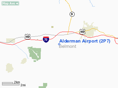
Location & QuickFacts
| FAA Information Effective: | 2008-09-25 |
| Airport Identifier: | 2P7 |
| Airport Status: | Operational |
| Longitude/Latitude: | 080-57-47.5420W/40-03-24.7540N
-80.963206/40.056876 (Estimated) |
| Elevation: | 1187 ft / 361.80 m (Surveyed) |
| Land: | 180 acres |
| From nearest city: | 3 nautical miles SW of St Clairsville, OH |
| Location: | Belmont County, OH |
| Magnetic Variation: | 04W (1965) |
Owner & Manager
| Ownership: | Privately owned |
| Owner: | Virginia Alderman |
| Address: | 67160 Arpt Rd, Rt 3
St. Clairsville, OH 43950 |
| Phone number: | 740-695-0908 |
| Manager: | Virginia Alderman |
| Address: | Airport Rd, Rt 3
St. Clairsville, OH 43950 |
| Phone number: | 740-695-0908 |
Airport Operations and Facilities
| Airport Use: | Open to public |
| Wind indicator: | Yes |
| Segmented Circle: | No |
| Control Tower: | No |
| Lighting Schedule: | RDO-CTL
ACTVT ROTG BCN - CTAF. |
| Beacon Color: | Clear-Green (lighted land airport) |
| Landing fee charge: | Yes |
| Sectional chart: | Detroit |
| Region: | AGL - Great Lakes |
| Boundary ARTCC: | ZOB - Cleveland |
| Tie-in FSS: | CLE - Cleveland |
| FSS on Airport: | No |
| FSS Toll Free: | 1-800-WX-BRIEF |
| NOTAMs Facility: | CLE (NOTAM-d service avaliable) |
Airport Communications
Airport Services
| Airframe Repair: | NONE |
| Power Plant Repair: | NONE |
| Bottled Oxygen: | NONE |
| Bulk Oxygen: | NONE |
Runway Information
Runway 01/19
| Dimension: | 2843 x 50 ft / 866.5 x 15.2 m |
| Surface: | ASPH, Fair Condition |
| Edge Lights: | Low |
| |
Runway 01 |
Runway 19 |
| Longitude: | 080-57-49.1810W | 080-57-45.8070W |
| Latitude: | 40-03-10.7280N | 40-03-38.6980N |
| Elevation: | 1163.00 ft | 1187.00 ft |
| Alignment: | 5 | 127 |
| Traffic Pattern: | Left | Left |
| Markings: | Basic, Good Condition | Basic, Good Condition |
| Obstruction: | 38 ft trees, 385.0 ft from runway, 137 ft left of centerline, 4:1 slope to clear | 30 ft trees, 201.0 ft from runway, 50 ft right of centerline
+9 FT BARN 160 FT FM RY END 120 FT L; +30 FT TREES 157 FT FM 125 FT R 200 FT FM 20 FT R. |
|
Radio Navigation Aids
| ID |
Type |
Name |
Ch |
Freq |
Var |
Dist |
| PKB | FAN MARKER | Marietta Ohio | | | 03W | 45.4 nm |
| CFX | NDB | Cadiz | | 239.00 | 07W | 11.1 nm |
| TSO | NDB | Tolson | | 395.00 | 07W | 30.8 nm |
| PNU | NDB | Washington County | | 255.00 | 08W | 37.2 nm |
| HRA | NDB | Zanesville | | 204.00 | 06W | 45.0 nm |
| AIR | VOR/DME | Bellaire | 118X | 117.10 | 07W | 7.1 nm |
| HLG | VOR/DME | Wheeling | 059X | 112.20 | 07W | 21.9 nm |
| CTW | VOR/DME | Newcomerstown | 055X | 111.80 | 07W | 25.8 nm |
| ZZV | VOR/DME | Zanesville | 051X | 111.40 | 06W | 43.4 nm |
| AGC | VOR/DME | Allegheny | 037X | 110.00 | 09W | 44.4 nm |
| BSV | VOR/DME | Briggs | 071X | 112.40 | 04W | 46.4 nm |
| JPU | VORTAC | Parkersburg | 023X | 108.60 | 03W | 41.6 nm |
| MMJ | VORTAC | Montour | 057X | 112.00 | 08W | 43.8 nm |
Remarks
- SOUTH HALF OR RAMP - POOR CONDTION - BROKEN PAVEMENT.
- PRVDD OBS ARE LWRD/RMVD SO AS TO PRVD A 20:1 APP CLRNC, AN OBS FREE PRIM SFC 125'EA SIDE OF CL IS MAINTD.
Images and information placed above are from
http://www.airport-data.com/airport/2P7/
We thank them for the data!
| General Info
|
| Country |
United States
|
| State |
OHIO
|
| FAA ID |
2P7
|
| Latitude |
40-03-24.754N
|
| Longitude |
080-57-47.542W
|
| Elevation |
1187 feet
|
| Near City |
ST CLAIRSVILLE
|
We don't guarantee the information is fresh and accurate. The data may
be wrong or outdated.
For more up-to-date information please refer to other sources.
|
|


