 |
|
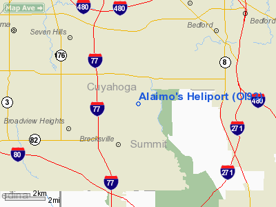
Location & QuickFacts
| FAA Information Effective: | 2008-09-25 |
| Airport Identifier: | OI93 |
| Airport Status: | Operational |
| Longitude/Latitude: | 081-36-36.4430W/41-20-24.1940N
-81.610123/41.340054 (Estimated) |
| Elevation: | 760 ft / 231.65 m (Estimated) |
| Land: | 0 acres |
| From nearest city: | 0 nautical miles N of Brecksville, OH |
| Location: | Cuyahoga County, OH |
| Magnetic Variation: | 07W (1985) |
Owner & Manager
| Ownership: | Privately owned |
| Owner: | Jeffrey M. Alaimo |
| Address: | 10605 Greenhaven Parkway
Brecksville, OH 44141 |
| Phone number: | 216-381-1717 |
| Address: |
|
Airport Operations and Facilities
| Airport Use: | Private |
| Segmented Circle: | No |
| Control Tower: | No |
| Sectional chart: | Detroit |
| Region: | AGL - Great Lakes |
| Boundary ARTCC: | ZOB - Cleveland |
| Tie-in FSS: | CLE - Cleveland |
| FSS on Airport: | No |
| FSS Toll Free: | 1-800-WX-BRIEF |
Runway Information
Helipad H1
| Dimension: | 30 x 30 ft / 9.1 x 9.1 m |
| Surface: | TURF, |
| |
Runway H1 |
Runway |
| Traffic Pattern: | Left | Left |
|
Radio Navigation Aids
| ID |
Type |
Name |
Ch |
Freq |
Var |
Dist |
| EZE | NDB | Engel | | 226.00 | 07W | 10.3 nm |
| BKL | NDB | Burke Lakefront | | 416.00 | 07W | 11.6 nm |
| CL | NDB | Harri | | 344.00 | 07W | 16.0 nm |
| AK | NDB | Akron | | 362.00 | 07W | 19.1 nm |
| LQL | NDB | Lakeland | | 263.00 | 08W | 23.1 nm |
| AAU | NDB | Ashland | | 329.00 | 07W | 36.9 nm |
| MLR | NDB | Millersburg/dcmsnd | | 382.00 | 06W | 49.4 nm |
| CXR | VOR/DME | Chardon | 074X | 112.70 | 05W | 22.8 nm |
| LNN | VOR/DME | Lost Nation | 039X | 110.20 | 08W | 23.0 nm |
| ACO | VOR/DME | Akron | 091X | 114.40 | 04W | 23.2 nm |
| DJB | VOR/DME | Dryer | 083X | 113.60 | 05W | 24.9 nm |
| BSV | VOR/DME | Briggs | 071X | 112.40 | 04W | 36.9 nm |
| JFN | VOR/DME | Jefferson | 099X | 115.20 | 05W | 46.3 nm |
| SKY | VOR/DME | Sandusky | 029X | 109.20 | 04W | 47.5 nm |
| YNG | VORTAC | Youngstown | 027X | 109.00 | 05W | 42.2 nm |
| CLE | VOT | Cleveland | | 110.40 | | 11.6 nm |
| CAK | VOT | Akron/canton Regional | | 110.60 | | 26.6 nm |
Remarks
- E111: DUE TO LACK OF EMERG SITES IN THE AREA.
Images and information placed above are from
http://www.airport-data.com/airport/OI93/
We thank them for the data!
| General Info
|
| Country |
United States
|
| State |
OHIO
|
| FAA ID |
OI93
|
| Latitude |
41-20-24.194N
|
| Longitude |
081-36-36.443W
|
| Elevation |
760 feet
|
| Near City |
BRECKSVILLE
|
We don't guarantee the information is fresh and accurate. The data may
be wrong or outdated.
For more up-to-date information please refer to other sources.
|
|


