 |
|
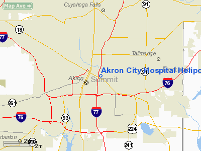
Akron City Hospital Heliport |
Location & QuickFacts
| FAA Information Effective: | 2008-09-25 |
| Airport Identifier: | 88OI |
| Airport Status: | Operational |
| Longitude/Latitude: | 081-30-01.0000W/41-04-52.0000N
-81.500278/41.081111 (Estimated) |
| Elevation: | 1368 ft / 416.97 m (Estimated) |
| Land: | 0 acres |
| From nearest city: | 1 nautical miles E of Akron, OH |
| Location: | Summit County, OH |
| Magnetic Variation: | 06W (1985) |
Owner & Manager
| Ownership: | Privately owned |
| Owner: | Akron City Hospital |
| Address: | 525 East Market St
Akron, OH 44309-2090 |
| Phone number: | 330-375-3277 |
| Manager: | Howard Hunt |
| Address: | 525 East Market St
Akron, OH 44309-2090 |
| Phone number: | 330-375-3277 |
Airport Operations and Facilities
| Airport Use: | Private
MEDICAL USE. |
| Wind indicator: | Yes |
| Segmented Circle: | No |
| Control Tower: | No |
| Lighting Schedule: | RDO-CTL
ACTVT ROTG BCN - 125.025. |
| Beacon Color: | Clear-Green-Yellow (heliport) |
| Landing fee charge: | No |
| Sectional chart: | Detroit |
| Region: | AGL - Great Lakes |
| Boundary ARTCC: | ZOB - Cleveland |
| Tie-in FSS: | CLE - Cleveland |
| FSS Toll Free: | 1-800-WX-BRIEF |
Runway Information
Helipad H1
| Dimension: | 50 x 90 ft / 15.2 x 27.4 m |
| Surface: | nstd,
METAL ROOFTOP HELIDECK. |
| |
Runway H1 |
Runway |
| Traffic Pattern: | Left | Left |
|
Radio Navigation Aids
| ID |
Type |
Name |
Ch |
Freq |
Var |
Dist |
| AK | NDB | Akron | | 362.00 | 07W | 5.2 nm |
| CL | NDB | Harri | | 344.00 | 07W | 26.1 nm |
| EZE | NDB | Engel | | 226.00 | 07W | 26.5 nm |
| BKL | NDB | Burke Lakefront | | 416.00 | 07W | 27.9 nm |
| AAU | NDB | Ashland | | 329.00 | 07W | 34.9 nm |
| LQL | NDB | Lakeland | | 263.00 | 08W | 36.6 nm |
| MLR | NDB | Millersburg/dcmsnd | | 382.00 | 06W | 36.6 nm |
| TSO | NDB | Tolson | | 395.00 | 07W | 36.6 nm |
| HBD | NDB | Hubbard | | 408.00 | 08W | 44.1 nm |
| MF | NDB | Manns | | 372.00 | 06W | 46.9 nm |
| UCP | NDB | Castle | | 272.00 | 09W | 49.3 nm |
| ACO | VOR/DME | Akron | 091X | 114.40 | 04W | 13.6 nm |
| BSV | VOR/DME | Briggs | 071X | 112.40 | 04W | 20.7 nm |
| CXR | VOR/DME | Chardon | 074X | 112.70 | 05W | 30.3 nm |
| DJB | VOR/DME | Dryer | 083X | 113.60 | 05W | 34.2 nm |
| LNN | VOR/DME | Lost Nation | 039X | 110.20 | 08W | 36.6 nm |
| TVT | VOR/DME | Tiverton | 112X | 116.50 | 03W | 47.1 nm |
| YNG | VORTAC | Youngstown | 027X | 109.00 | 05W | 40.2 nm |
| CAK | VOT | Akron/canton Regional | | 110.60 | | 10.3 nm |
| CLE | VOT | Cleveland | | 110.40 | | 25.3 nm |
Remarks
- PROVIDED INGRESS/EGRESS 340 TO 360 USING TD PAD AS CENTER OF COMPAS ROSE; PAD APPROPRIATELY MKD; WIND INDICATOR MAINTAINED; FIRE PROTECTION PROVIDED IAW LOCAL FIRE CODE AND/OR AC150/5390-13.
Images and information placed above are from
http://www.airport-data.com/airport/88OI/
We thank them for the data!
| General Info
|
| Country |
United States
|
| State |
OHIO
|
| FAA ID |
88OI
|
| Latitude |
41-04-50.201N
|
| Longitude |
081-30-02.414W
|
| Elevation |
1120 feet
|
| Near City |
AKRON
|
We don't guarantee the information is fresh and accurate. The data may
be wrong or outdated.
For more up-to-date information please refer to other sources.
|
|


