|
 |
|
||||
|
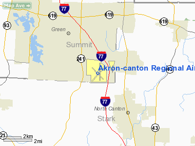
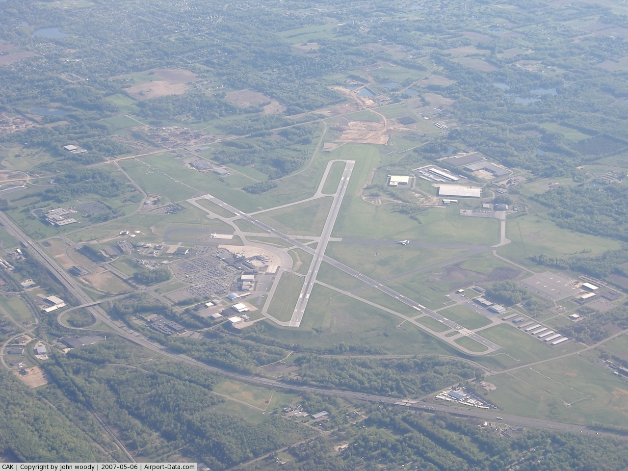
Akron-Canton Airport (IATA: CAK, ICAO: KCAK, FAA LID: CAK) is a commercial Class C airport located in the city of Green, in southern Summit County, Ohio (a very small portion of both runways extend into Stark County,) roughly 10 miles (16 km) southeast of Akron, Ohio, roughly 10 nautical miles (19 km) northwest of Canton, Ohio, and roughly 45 miles (72 km) south of Cleveland, Ohio. The airport is jointly operated by Summit County and Stark County. Money for the airport was initially allocated during World War II for defense purposes, but the construction stalled over a controversy relating to whether public funding of airport construction would be appropriate. As a result, private funding was essential to the initial construction of the airport, particularly in purchasing the land. The airport was dedicated on October 13, 1946, but permanent terminal facilities were not built until 1955. The airport has two runways - 7,601, and 7,598 feet (2,317 and 2,316 m) long, both 150 feet (46 m) wide. Passenger growthIn 2005, 1.43 million passengers flew through Akron-Canton , over three times the number just ten years earlier. It is one of the fastest-growing airports in the Midwest, and attracts passengers not only from the Akron/Canton area, but also from the Cleveland metropolitan area. The number of passengers who use the airport has grown every year since 1995 except for 2001. The lack of growth was largely blamed on the September 11, 2001 terrorist attacks which slowed air travel nationwide. The airport markets itself as "A better way to go", noting the ease of the Akron-Canton Airport in comparison to Cleveland Hopkins International Airport some 40 miles (64 km) north. The airport essentially serves as a secondary "reliever" airport for Northeast Ohio. Although the majority of the airport's traffic growth has been in the commercial sector, over 75% of all air traffic at Akron-Canton is still general aviation, since general aviation is all but nonexistent at nearby Cleveland-Hopkins International Airport. The largest airline in passenger volume at Akron-Canton is by far AirTran Airways, and is largely responsible for most of the airport's growth. Other airlines that service the airport are Frontier Airlines, Delta Connection, US Airways Express, and United Express. Akron-Canton Airport doubled passenger ridership from 2000 to 2006, largely because of new flights added by AirTran Airways and Frontier Airlines. Also during that time, CAK represented 20% of all air travel growth in the state of Ohio. The airport experienced its best year ever in 2008 when 1,469,196 customers traveled to and from CAK beating the old record set in 2006 by more than 30,000 people – a 2 percent increase. The record number is also a 5.6 percent increase from 2007 beating it by more than 77,000 customers. Current Expansion
The airport kicked off CAK 2018, its 10-year, $110-million Capital Improvement Plan in March 2008. The plan is the most ambitious capital improvement plan in Akron-Canton Airport’s history and calls for 10 projects in the next 10 years. One of those projects, a runway expansion, has already begun. Runway 5/23 will be extended from 7,600 ft (2,300 m). to 8,200 ft (2,500 m). Once completed, the runways will allow aircraft to fly farther – non-stop to anywhere in the U.S. and throughout Mexico and Canada. The safety area at the north end of the runway will be upgraded and an Instrument Landing System will be relocated. This project is expected to be completed in late 2010. Other projects includes expanding aircraft parking and general aviation area, replacing aircraft rescue and fire fighting maintenance facility, a new customs and border patrol facility, expand auto parking lots, a widened entrance road, expanded ticket wing and TSA screening area, expanded upper level concourse and the construction of Port Green Industrial Park, 213 acres (0.86 km) will be developed into 10-12 business sites bringing up to 1,000 high paying jobs to northeast Ohio. Once completed, Akron-Canton will offer international flights in and out of the country. Last ExpansionIn 2006, the airport completed a major expansion and renovation of the terminal, including the addition of a new terminal wing off the main concourse-bring the number of gates to 11 (up from 9), new baggage areas, a food court, and improved aesthetics. The new wing of the terminal opened to passengers in May, 2006 and is home to AirTran Airways and Frontier Airlines. Airlines and destinations
Ground transportationAkron-Canton Airport is served by a number of taxicab and shuttle services. It is also served regularly by one route from each of the region's two public transit providers, Akron Metro Regional Transit route 110, and Canton-based Stark Area Regional Transit Authority (SARTA) route 106, the latter providing service every hour for most of the day while the former providing service 5 times a day. The above content comes from Wikipedia and is published under free licenses – click here to read more.
Location & QuickFacts
Owner & Manager
Airport Operations and Facilities
Airport Communications
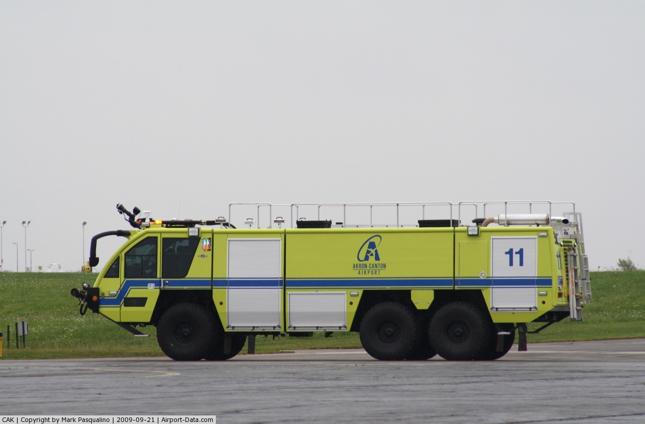
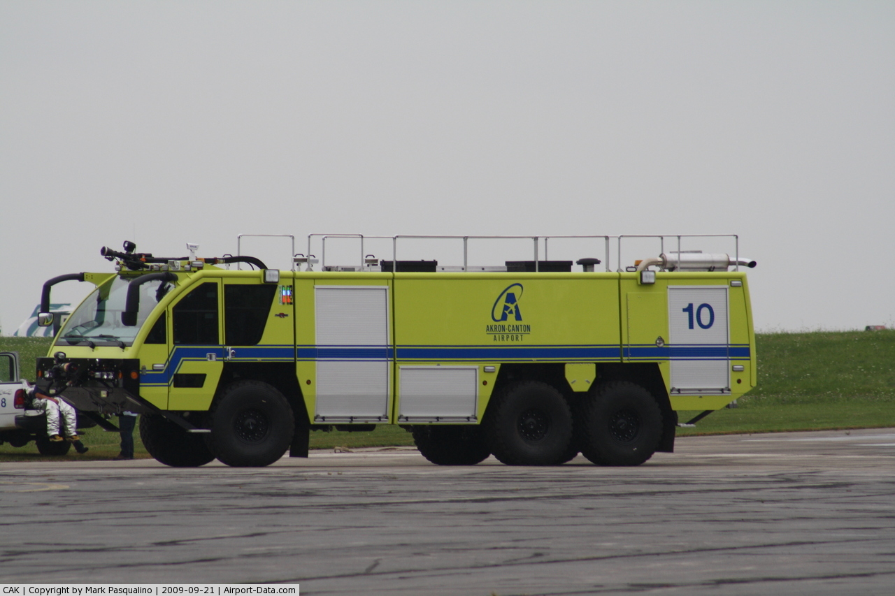
Airport Services
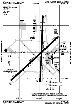
Runway InformationRunway 01/19
Runway 05/23
Radio Navigation Aids
Remarks
Images and information placed above are from We thank them for the data!
We don't guarantee the information is fresh and accurate. The data may
be wrong or outdated.
|
||||||||||||||||||||||||||||||||||||||||||||||||||||||||||||||||||||||||||||||||||||||||||||||||||||||||||||||||||||||||||||||||||||||||||||||||||||||||||||||||||||||||||||||||||||||||||||||||||||||||||||||||||||||||||||||||||||||||||||||||||||||||||||||||||||||||||||||||||||||||||||||||||||||||||||||||||||||||||||||||||||||||||||||||||||||||||||||||||||||||||||||||||||||||||||||||||||||||||||||||||||||||||||||||||||||||||||||||||||||||||||||||||||||||||||||||||||||||||||||||||||||||||||||||||||||||||||||

 |
|
Copyright 2004-2026 © by Airports-Worldwide.com, Vyshenskoho st. 36, Lviv 79010, Ukraine Legal Disclaimer |