 |
|
Location & QuickFacts
| FAA Information Effective: | 2008-09-25 |
| Airport Identifier: | 19OI |
| Airport Status: | Operational |
| Longitude/Latitude: | 080-42-19.2820W/40-22-50.9430N
-80.705356/40.380817 (Estimated) |
| Elevation: | 1218 ft / 371.25 m (Estimated) |
| Land: | 1 acres |
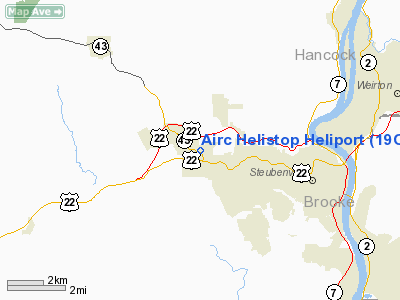
| From nearest city: | 1 nautical miles NW of Wintersville, OH |
| Location: | Jefferson County, OH |
| Magnetic Variation: | 07W (1985) |
Owner & Manager
| Ownership: | Privately owned |
| Owner: | Am Indus & Resources Corp |
| Address: | 201 Luray Dr
Wintersville, OH 43952 |
| Phone number: | 614-264-7704 |
| Manager: | Mark Peklinsky |
| Address: | 201 Luray Dr
Wintersville, OH 43952 |
| Phone number: | 614-264-7704 |
Airport Operations and Facilities
| Airport Use: | Private
PERSONAL USE. |
| Wind indicator: | Yes |
| Segmented Circle: | No |
| Control Tower: | No |
| Lighting Schedule: | PHONE REQ
FOR PERIMETER LGTS, PHONE 614-264-7704. |
| Landing fee charge: | No |
| Sectional chart: | Detroit |
| Region: | AGL - Great Lakes |
| Boundary ARTCC: | ZOB - Cleveland |
| Tie-in FSS: | CLE - Cleveland |
| FSS on Airport: | No |
| FSS Toll Free: | 1-800-WX-BRIEF |
Runway Information
Helipad H1
| Dimension: | 25 x 25 ft / 7.6 x 7.6 m |
| Surface: | ASPH,
PAD WITHIN 150' X 150' TURF LNDG AREA. |
| Edge Lights: | Low
PERIMETER LGTS. |
| |
Runway H1 |
Runway |
| Traffic Pattern: | Left | Left |
|
Radio Navigation Aids
| ID |
Type |
Name |
Ch |
Freq |
Var |
Dist |
| CFX | NDB | Cadiz | | 239.00 | 07W | 16.6 nm |
| TSO | NDB | Tolson | | 395.00 | 07W | 20.2 nm |
| PNU | NDB | Washington County | | 255.00 | 08W | 28.7 nm |
| UCP | NDB | Castle | | 272.00 | 09W | 40.8 nm |
| MKP | NDB | Mc Keesport | | 287.00 | 07W | 42.4 nm |
| HBD | NDB | Hubbard | | 408.00 | 08W | 47.1 nm |
| HLG | VOR/DME | Wheeling | 059X | 112.20 | 07W | 9.6 nm |
| AIR | VOR/DME | Bellaire | 118X | 117.10 | 07W | 22.5 nm |
| AGC | VOR/DME | Allegheny | 037X | 110.00 | 09W | 31.1 nm |
| CTW | VOR/DME | Newcomerstown | 055X | 111.80 | 07W | 36.5 nm |
| BSV | VOR/DME | Briggs | 071X | 112.40 | 04W | 39.6 nm |
| ACO | VOR/DME | Akron | 091X | 114.40 | 04W | 49.2 nm |
| MMJ | VORTAC | Montour | 057X | 112.00 | 08W | 24.3 nm |
| EWC | VORTAC | Ellwood City | 105X | 115.80 | 08W | 34.9 nm |
| CAK | VOT | Akron/canton Regional | | 110.60 | | 46.5 nm |
Remarks
- PRVDD ALL INGRESS/EGRESS OPNS ARE IN AREA FM 310 DEG CLKWS TO 355 DEG AND 020 DEG CLKWS TO O50 DEG FM LNDG PAD.
Images and information placed above are from
http://www.airport-data.com/airport/19OI/
We thank them for the data!
| General Info
|
| Country |
United States
|
| State |
OHIO
|
| FAA ID |
19OI
|
| Latitude |
40-22-50.943N
|
| Longitude |
080-42-19.282W
|
| Elevation |
1218 feet
|
| Near City |
WINTERSVILLE
|
We don't guarantee the information is fresh and accurate. The data may
be wrong or outdated.
For more up-to-date information please refer to other sources.
|
|


