 |
|
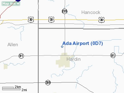
| Ada Airport |
| IATA: none – ICAO: none – FAA LID: 0D7 |
| Summary |
| Airport type |
Public |
| Owner |
Kevin A. Mierzejewski |
| Serves |
Ada, Ohio |
| Elevation AMSL |
949 ft / 289 m |
| Coordinates |
40°47′26″N 083°49′45″W / 40.79056°N 83.82917°W / 40.79056; -83.82917 |
| Runways |
| Direction |
Length |
Surface |
| ft |
m |
| 9/27 |
1,955 |
596 |
Turf |
| Statistics (2008) |
| Aircraft operations |
555 |
| Based aircraft |
17 |
| Source: Federal Aviation Administration |
Ada Airport (FAA LID: 0D7) is a privately-owned, public-use airport located one nautical mile (1.85 km) northwest of the central business district of Ada, a village in Hardin County, Ohio, United States.
Facilities and aircraft
Ada Airport covers an area of 70 acres (28 ha) at an elevation of 949 feet (289 m) above mean sea level. It has one runway designated 9/27 with a turf surface measuring 1,955 by 110 feet (596 x 34 m). The airport is unattended.
For the 12-month period ending July 8, 2008, the airport had 555 aircraft operations, an average of 46 per month: 99% general aviation and 1% military. At that time there were 17 aircraft based at this airport: 82% single-engine and 18% ultralight.
Remarks:
- Deer on and in the vicinity of airport.
- Marked pline 720 feet (220 m) from runway 27 threshold.
- Ultralight activity on and in the vicinity of airport.
- Built before 1959.
The above content comes from Wikipedia and is published under free licenses – click here to read more.
Location & QuickFacts
| FAA Information Effective: | 2008-09-25 |
| Airport Identifier: | 0D7 |
| Airport Status: | Operational |
| Longitude/Latitude: | 083-49-44.7740W/40-47-26.1890N
-83.829104/40.790608 (Estimated) |
| Elevation: | 949 ft / 289.26 m (Surveyed) |
| Land: | 70 acres |
| From nearest city: | 1 nautical miles NW of Ada, OH |
| Location: | Hardin County, OH |
| Magnetic Variation: | 05W (1985) |
Owner & Manager
| Ownership: | Privately owned |
| Owner: | Kevin A. Mierzejewski |
| Address: | 1665 Pevee Road
Ada, OH 45810 |
| Phone number: | 419-649-4184 |
| Manager: | Kevin A. Mierzejewski |
| Address: | 2646 Airport Rd
Ada, OH 45810 |
| Phone number: | 419-649-4184 |
Airport Operations and Facilities
| Airport Use: | Open to public |
| Wind indicator: | Yes |
| Segmented Circle: | No |
| Control Tower: | No |
| Landing fee charge: | No |
| Sectional chart: | Detroit |
| Region: | AGL - Great Lakes |
| Boundary ARTCC: | ZID - Indianapolis |
| Tie-in FSS: | DAY - Dayton |
| FSS on Airport: | No |
| FSS Toll Free: | 1-800-WX-BRIEF |
| NOTAMs Facility: | DAY (NOTAM-d service avaliable) |
Airport Communications
| CTAF: | 122.800 |
| Unicom: | 122.800 |
Runway Information
Runway 09/27
| Dimension: | 1955 x 110 ft / 595.9 x 33.5 m |
| Surface: | TURF, Good Condition |
| |
Runway 09 |
Runway 27 |
| Longitude: | 083-49-57.5100W | 083-49-31.8300W |
| Latitude: | 40-47-26.1700N | 40-47-26.1700N |
| Elevation: | 949.00 ft | 949.00 ft |
| Traffic Pattern: | Left | Left |
| Runway End Identifier: | No | No |
| Centerline Lights: | No | No |
| Touchdown Lights: | No | No |
| Obstruction: | 55 ft tree, 93 ft left of centerline | 40 ft tree, 10.0 ft from runway, 101 ft right of centerline |
|
Radio Navigation Aids
| ID |
Type |
Name |
Ch |
Freq |
Var |
Dist |
| LYL | NDB | Lima | | 362.00 | 04W | 10.2 nm |
| BNR | NDB | Benton Ridge | | 334.00 | 05W | 15.6 nm |
| PDR | NDB | Ottawa | | 233.00 | 05W | 15.9 nm |
| RUV | NDB | Rushsylvania | | 326.00 | 05W | 21.2 nm |
| EDJ | NDB | Bellefontaine | | 242.00 | 05W | 25.2 nm |
| FZI | NDB | Fostoria | | 379.00 | 05W | 31.0 nm |
| TII | NDB | Tiffin | | 269.00 | 05W | 33.7 nm |
| VFU | NDB | Stanley | | 411.00 | 05W | 36.0 nm |
| MNN | NDB | Marion | | 201.00 | 05W | 36.1 nm |
| CQA | NDB | Lakefield | | 205.00 | 04W | 38.3 nm |
| MRT | NDB | Marysville | | 403.00 | 05W | 40.4 nm |
| DFI | NDB | Defiance | | 246.00 | 05W | 42.5 nm |
| DLZ | NDB | Delaware | | 215.00 | 06W | 45.3 nm |
| VES | NDB | Versailles | | 356.00 | 04W | 47.3 nm |
| TOL | TACAN | Toledo | 072X | | 05W | 48.3 nm |
| AOH | VOR | Allen County | | 108.40 | 04W | 8.1 nm |
| MAH | VOR | Marathon | | 114.90 | 05W | 15.4 nm |
| BUD | VOR | Buckeye | | 109.80 | 05W | 36.4 nm |
| VWV | VOR/DME | Waterville | 078X | 113.10 | 02W | 40.6 nm |
| FDY | VORTAC | Findlay | 019X | 108.20 | 02W | 10.4 nm |
| ROD | VORTAC | Rosewood | 122X | 117.50 | 05W | 31.8 nm |
Remarks
- DEER ON & INVOF ARPT.
- MKD PLINE 720 FT FM RWY 27 THR.
- ULTRALIGHT ACTIVITY ON AND INVOF OF ARPT.
- BUILT BEFORE 1959.
Images and information placed above are from
http://www.airport-data.com/airport/0D7/
We thank them for the data!
| General Info
|
| Country |
United States
|
| State |
OHIO
|
| FAA ID |
0D7
|
| Latitude |
40-47-26.189N
|
| Longitude |
083-49-44.774W
|
| Elevation |
949 feet
|
| Near City |
ADA
|
We don't guarantee the information is fresh and accurate. The data may
be wrong or outdated.
For more up-to-date information please refer to other sources.
|
|


