 |
|
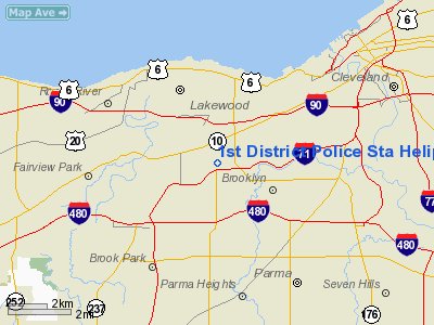
1st District Police Sta Heliport |
Location & QuickFacts
| FAA Information Effective: | 2008-09-25 |
| Airport Identifier: | OI50 |
| Airport Status: | Operational |
| Longitude/Latitude: | 081-46-44.4820W/41-26-53.1800N
-81.779023/41.448106 (Estimated) |
| Elevation: | 783 ft / 238.66 m (Estimated) |
| Land: | 0 acres |
| From nearest city: | 0 nautical miles N of Cleveland, OH |
| Location: | Cuyahoga County, OH |
| Magnetic Variation: | 07W (1985) |
Owner & Manager
| Ownership: | Publicly owned |
| Owner: | Cleveland Public Safety Dept |
| Address: | 1300 Ontario Ave
Cleveland, OH 44111 |
| Manager: | Commanding Officer |
| Address: | 3895 W 130th St
Cleveland, OH 44111 |
| Phone number: | 216-623-5105 |
Airport Operations and Facilities
| Airport Use: | Private |
| Segmented Circle: | No |
| Control Tower: | No |
| Landing fee charge: | No |
| Sectional chart: | Detroit |
| Region: | AGL - Great Lakes |
| Boundary ARTCC: | ZOB - Cleveland |
| Tie-in FSS: | CLE - Cleveland |
| FSS on Airport: | No |
| FSS Toll Free: | 1-800-WX-BRIEF |
Runway Information
Helipad H1
| Dimension: | 40 x 40 ft / 12.2 x 12.2 m |
| Surface: | CONC, |
| |
Runway H1 |
Runway |
| Traffic Pattern: | Left | Left |
|
Radio Navigation Aids
| ID |
Type |
Name |
Ch |
Freq |
Var |
Dist |
| EZE | NDB | Engel | | 226.00 | 07W | 3.5 nm |
| BKL | NDB | Burke Lakefront | | 416.00 | 07W | 7.1 nm |
| CL | NDB | Harri | | 344.00 | 07W | 10.6 nm |
| LQL | NDB | Lakeland | | 263.00 | 08W | 22.8 nm |
| AK | NDB | Akron | | 362.00 | 07W | 28.8 nm |
| AAU | NDB | Ashland | | 329.00 | 07W | 36.2 nm |
| PT | NDB | Pelee Island | | 283.00 | 05W | 44.7 nm |
| PCW | NDB | Port Clinton | | 423.00 | 06W | 49.3 nm |
| DJB | VOR/DME | Dryer | 083X | 113.60 | 05W | 18.1 nm |
| LNN | VOR/DME | Lost Nation | 039X | 110.20 | 08W | 22.6 nm |
| CXR | VOR/DME | Chardon | 074X | 112.70 | 05W | 28.0 nm |
| ACO | VOR/DME | Akron | 091X | 114.40 | 04W | 33.1 nm |
| SKY | VOR/DME | Sandusky | 029X | 109.20 | 04W | 39.5 nm |
| BSV | VOR/DME | Briggs | 071X | 112.40 | 04W | 45.3 nm |
| JFN | VOR/DME | Jefferson | 099X | 115.20 | 05W | 50.0 nm |
| CLE | VOT | Cleveland | | 110.40 | | 3.9 nm |
| CAK | VOT | Akron/canton Regional | | 110.60 | | 35.4 nm |
Remarks
Images and information placed above are from
http://www.airport-data.com/airport/OI50/
We thank them for the data!
| General Info
|
| Country |
United States
|
| State |
OHIO
|
| FAA ID |
OI50
|
| Latitude |
41-26-53.180N
|
| Longitude |
081-46-44.482W
|
| Elevation |
783 feet
|
| Near City |
CLEVELAND
|
We don't guarantee the information is fresh and accurate. The data may
be wrong or outdated.
For more up-to-date information please refer to other sources.
|
|


