 |
|
Location & QuickFacts
| FAA Information Effective: | 2008-09-25 |
| Airport Identifier: | ND78 |
| Airport Status: | Operational |
| Longitude/Latitude: | 097-32-13.3310W/47-02-23.9220N
-97.537036/47.039978 (Estimated) |
| Elevation: | 1210 ft / 368.81 m (Estimated) |
| Land: | 0 acres |
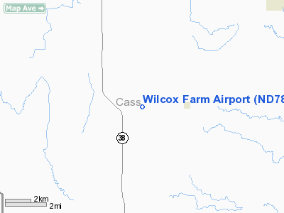
| From nearest city: | 2 nautical miles W of Ayr, ND |
| Location: | Cass County, ND |
| Magnetic Variation: | 07E (1985) |
Owner & Manager
| Ownership: | Privately owned |
| Owner: | Larry Wilcox |
| Address: | 13973 26r St, Se
Ayr, ND 58007-9741 |
| Phone number: | 701-633-5598 |
| Address: |
|
Airport Operations and Facilities
| Airport Use: | Private |
| Wind indicator: | No |
| Segmented Circle: | No |
| Control Tower: | No |
| Landing fee charge: | No |
| Sectional chart: | Twin Cities |
| Region: | AGL - Great Lakes |
| Boundary ARTCC: | ZMP - Minneapolis |
| Tie-in FSS: | GFK - Grand Forks |
| FSS on Airport: | No |
| FSS Toll Free: | 1-800-WX-BRIEF |
Airport Services
| Airframe Repair: | NONE |
| Power Plant Repair: | NONE |
Runway Information
Runway N/S
| Dimension: | 2600 x 50 ft / 792.5 x 15.2 m |
| Surface: | TURF, |
| |
Runway N |
Runway S |
| Traffic Pattern: | Left | Left |
|
Radio Navigation Aids
| ID |
Type |
Name |
Ch |
Freq |
Var |
Dist |
| VCY | NDB | Valley City | | 382.00 | 07E | 18.3 nm |
| AA | NDB | Kenie | | 365.00 | 06E | 29.6 nm |
| GWR | NDB | Gwinner | | 278.00 | 07E | 49.3 nm |
| JMS | VOR/DME | Jamestown | 092X | 114.50 | 10E | 47.3 nm |
| FAR | VORTAC | Fargo | 109X | 116.20 | 09E | 33.0 nm |
Remarks
Images and information placed above are from
http://www.airport-data.com/airport/ND78/
We thank them for the data!
|
|


