 |
|
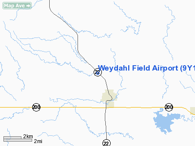
Location & QuickFacts
| FAA Information Effective: | 2008-09-25 |
| Airport Identifier: | 9Y1 |
| Airport Status: | Operational |
| Longitude/Latitude: | 102-46-14.6710W/47-23-34.0490N
-102.770742/47.392791 (Estimated) |
| Elevation: | 2256 ft / 687.63 m (Estimated) |
| Land: | 70 acres |
| From nearest city: | 2 nautical miles NW of Killdeer, ND |
| Location: | Dunn County, ND |
| Magnetic Variation: | 11E (1985) |
Owner & Manager
| Ownership: | Publicly owned |
| Owner: | City Of Killdeer |
| Address: | Box 270
Killdeer, ND 58640 |
| Phone number: | 701-764-5678
CITY POLICE PHONE |
| Address: | Box 270
|
| Phone number: | 701-764-5295
CITY POLICE OR CTC CITY HALL 701-764-5295 |
Airport Operations and Facilities
| Airport Use: | Open to public |
| Wind indicator: | Yes |
| Segmented Circle: | No |
| Control Tower: | No |
| Lighting Schedule: | RDO-CTL
ACTVT LIRL RY 12/30 - CTAF |
| Landing fee charge: | No |
| Sectional chart: | Billings |
| Region: | AGL - Great Lakes |
| Boundary ARTCC: | ZMP - Minneapolis |
| Tie-in FSS: | GFK - Grand Forks |
| FSS on Airport: | No |
| FSS Toll Free: | 1-800-WX-BRIEF |
| NOTAMs Facility: | GFK (NOTAM-d service avaliable) |
Airport Communications
Airport Services
| Airframe Repair: | NONE |
| Power Plant Repair: | NONE |
| Bottled Oxygen: | NONE |
| Bulk Oxygen: | NONE |
Runway Information
Runway 12/30
| Dimension: | 4200 x 50 ft / 1280.2 x 15.2 m |
| Surface: | ASPH, Poor Condition
RY 12/30 ASPH SFC POOR DUE TO NUMEROUS CRACKS & DEPRESSIONS WITH SURFACE LIMITED TO SMALL ACFT BELOW 5000 LBS GROSS WEIGHT.
ASPH POOR NUMEROUS CRACKS. |
| Surface Treatment: | Aggregate Friction Seal Coat |
| Weight Limit: | Single wheel: 5000 lbs. |
| Edge Lights: | Low |
| |
Runway 12 |
Runway 30 |
| Longitude: | 102-46-35.7000W | 102-45-51.1600W |
| Latitude: | 47-23-45.0000N | 47-23-16.6500N |
| Elevation: | 2260.00 ft | 2240.00 ft |
| Traffic Pattern: | Left | Left |
| Markings: | Numbers only, Fair Condition | Numbers only, Fair Condition |
| Obstruction: | 4 ft fence, 325.0 ft from runway, 125 ft left of centerline, 31:1 slope to clear | 15 ft trees, 450.0 ft from runway, 150 ft right of centerline, 16:1 slope to clear |
|
Radio Navigation Aids
| ID |
Type |
Name |
Ch |
Freq |
Var |
Dist |
| PSH | NDB | Parshall | | 379.00 | 11E | 41.5 nm |
| DIK | VORTAC | Dickinson | 076X | 112.90 | 14E | 32.0 nm |
Remarks
- +500' KILLDEER MTNS 5 MILES NORTHWEST OF AIRPORT.
- TO CONFIRM IRREGULAR SNOW REMOVAL PHONE 701-764-5295/5678 OR CELL CITY MAINTENANCE 260-2317.
Images and information placed above are from
http://www.airport-data.com/airport/9Y1/
We thank them for the data!
|
|


