 |
|
| Washburn Municipal Airport |
| IATA: none – ICAO: none – FAA LID: 5C8 |
| Summary |
| Airport type |
Public |
| Owner |
Washburn Airport Authority |
| Location |
Washburn, North Dakota |
| Elevation AMSL |
1,905 ft / 581 m |
| Coordinates |
47°21′11″N 101°01′39″W / 47.35306°N 101.0275°W / 47.35306; -101.0275 |
| Runways |
| Direction |
Length |
Surface |
| ft |
m |
| 8/26 |
3,700 |
1,128 |
Concrete |
| 17/35 |
2,235 |
681 |
Turf |
| Statistics (2007) |
| Aircraft operations |
1,700 |
| Source: Federal Aviation Administration |
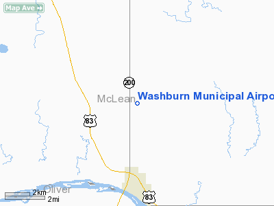
Washburn Municipal Airport (FAA LID: 5C8) is a public airport located four miles (6.5 km) north of the central business district of Washburn, in McLean County, North Dakota, United States. It is owned by the Washburn Airport Authority.
Facilities and aircraft
Washburn Municipal Airport covers an area of 40 acres (16 ha) which contains two runways:
- Runway 8/26: 3,700 x 60 ft (1,128 x 18 m), Surface: Concrete
- Runway 17/35: 2,235 x 120 ft (681 x 37 m), Surface: Turf
For the 12-month period ending July 31, 2007, the airport had 1,700 aircraft operations: 76% general aviation, 18% air taxi, and 6% military.
The above content comes from Wikipedia and is published under free licenses – click here to read more.
Location & QuickFacts
| FAA Information Effective: | 2008-09-25 |
| Airport Identifier: | 5C8 |
| Airport Status: | Operational |
| Longitude/Latitude: | 101-01-38.5250W/47-21-10.9800N
-101.027368/47.353050 (Estimated) |
| Elevation: | 1905 ft / 580.64 m (Surveyed) |
| Land: | 40 acres |
| From nearest city: | 4 nautical miles N of Washburn, ND |
| Location: | Mc Lean County, ND |
| Magnetic Variation: | 10E (1985) |
Owner & Manager
| Ownership: | Publicly owned |
| Owner: | Washburn Airport Authority |
| Address: | Box 403
Washburn, ND 58577
TREASURER FOR AIRPORT AUTHORITY MARK LOUTZENHEISER |
| Phone number: | 701-315-0860 |
| Manager: | Ron Becker
CHAIRMAN OF AIRPORT AUTHORITY |
| Address: | Box 403
Washburn, ND 58577 |
| Phone number: | 701-315-0860
ARPT MGR HOME PHONE 701-462-8623 OR ADDL CONTACT ED BARNHARDT 701-462-3374 OR 462-8353 |
Airport Operations and Facilities
| Airport Use: | Open to public |
| Wind indicator: | Yes |
| Segmented Circle: | Yes |
| Control Tower: | No |
| Lighting Schedule: | DUSK-DAWN
ACTIVATE MIRL RY 08/26 & PAPI RYS 08 & 26 CTAF. LOW INTST NOT AVBL. |
| Beacon Color: | Clear-Green (lighted land airport) |
| Landing fee charge: | No |
| Sectional chart: | Billings |
| Region: | AGL - Great Lakes |
| Boundary ARTCC: | ZMP - Minneapolis |
| Tie-in FSS: | GFK - Grand Forks |
| FSS on Airport: | No |
| FSS Toll Free: | 1-800-WX-BRIEF |
| NOTAMs Facility: | GFK (NOTAM-d service avaliable) |
| Federal Agreements: | N |
Airport Communications
Airport Services
| Airframe Repair: | NONE |
| Power Plant Repair: | NONE |
| Bottled Oxygen: | NONE |
| Bulk Oxygen: | NONE |
Runway Information
Runway 08/26
| Dimension: | 3700 x 60 ft / 1127.8 x 18.3 m |
| Surface: | CONC, Good Condition |
| Edge Lights: | Medium |
| |
Runway 08 |
Runway 26 |
| Longitude: | 101-02-03.5300W | 101-01-02.7000W |
| Latitude: | 47-21-00.4800N | 47-21-06.2800N |
| Elevation: | 1905.00 ft | 1904.00 ft |
| Traffic Pattern: | Left | Left |
| Markings: | Basic, Good Condition | Basic, Good Condition |
| Crossing Height: | 25.00 ft | 25.00 ft |
| VASI: | 2-light PAPI on left side | 2-light PAPI on left side |
| Visual Glide Angle: | 3.00° | 3.00° |
| Obstruction: | 14 ft road, 490.0 ft from runway, 20:1 slope to clear | , 50:1 slope to clear |
|
Runway 17/35
| Dimension: | 2235 x 120 ft / 681.2 x 36.6 m |
| Surface: | TURF, Fair Condition |
| |
Runway 17 |
Runway 35 |
| Longitude: | 101-01-30.9200W | 101-01-34.9700W |
| Latitude: | 47-21-25.1700N | 47-21-06.5600N |
| Elevation: | 1905.00 ft | 1905.00 ft |
| Traffic Pattern: | Left | Left |
| Runway End Identifier: | No | No |
| Centerline Lights: | No | No |
| Touchdown Lights: | No | No |
| Obstruction: | 17 ft road, 310.0 ft from runway, 18:1 slope to clear | , 50:1 slope to clear |
|
Radio Navigation Aids
| ID |
Type |
Name |
Ch |
Freq |
Var |
Dist |
| BI | NDB | Jadan | | 230.00 | 11E | 42.3 nm |
| BIS | VOR/DME | Bismarck | 112X | 116.50 | 12E | 38.5 nm |
Remarks
- +700' SMOKE STACK OF POWER PLANT LOCATED 6 MI WNW OF ARPT.
- WATERFOWL,BLACKBIRDS, DEER AND ANTELOPE ON AND INVOF OF ARPT.
- CFM WINTER CONDS WITH MGR AFTER MAJOR STORM PRIOR TO USE.
- RY 17/35 HAS WATER PONDING DURG SPRING THAW OR AFT HVY RAINS ON SOUTH HALF OF RY.
- EXISTED PRIOR TO 1959.
Images and information placed above are from
http://www.airport-data.com/airport/5C8/
We thank them for the data!
|
|


