 |
|
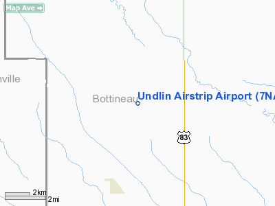
Location & QuickFacts
| FAA Information Effective: | 2008-09-25 |
| Airport Identifier: | 7NA2 |
| Airport Status: | Operational |
| Longitude/Latitude: | 101-21-01.5760W/48-41-16.0750N
-101.350438/48.687799 (Estimated) |
| Elevation: | 1575 ft / 480.06 m (Estimated) |
| Land: | 2 acres |
| From nearest city: | 4 nautical miles NE of Lansford, ND |
| Location: | Bottineau County, ND |
| Magnetic Variation: | 11E (1986) |
Owner & Manager
| Ownership: | Privately owned |
| Owner: | Curtis Undlin |
| Address: | 8741 29th Ave Nw
Lansford, ND 58570 |
| Phone number: | 701-784-5888 |
| Manager: | Curtis Undlin |
| Address: | 8741 29th Ave Nw
Lansford, ND 58570 |
| Phone number: | 701-784-5888 |
Airport Operations and Facilities
| Airport Use: | Private |
| Wind indicator: | No |
| Segmented Circle: | No |
| Control Tower: | No |
| Landing fee charge: | No |
| Sectional chart: | Billings |
| Region: | AGL - Great Lakes |
| Boundary ARTCC: | ZMP - Minneapolis |
| Tie-in FSS: | GFK - Grand Forks |
| FSS on Airport: | No |
| FSS Toll Free: | 1-800-WX-BRIEF |
Airport Communications
Runway Information
Runway 14/32
| Dimension: | 1830 x 50 ft / 557.8 x 15.2 m |
| Surface: | TURF, |
| |
Runway 14 |
Runway 32 |
| Traffic Pattern: | Left | Left |
|
Radio Navigation Aids
| ID |
Type |
Name |
Ch |
Freq |
Var |
Dist |
| HBC | NDB | Mohall | | 350.00 | 11E | 8.7 nm |
| MIB | TACAN | Deering | 096X | | 10E | 16.4 nm |
| MOT | VORTAC | Minot | 118X | 117.10 | 13E | 25.8 nm |
Images and information placed above are from
http://www.airport-data.com/airport/7NA2/
We thank them for the data!
|
|


