 |
|
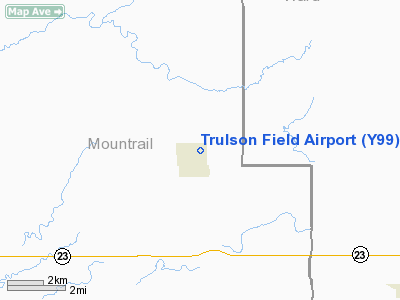
Location & QuickFacts
| FAA Information Effective: | 2008-09-25 |
| Airport Identifier: | Y99 |
| Airport Status: | Operational |
| Longitude/Latitude: | 101-57-11.6010W/48-01-50.0450N
-101.953223/48.030568 (Estimated) |
| Elevation: | 2105 ft / 641.60 m (Estimated) |
| Land: | 10 acres |
| From nearest city: | 1 nautical miles NE of Plaza, ND |
| Location: | Mountrail County, ND |
| Magnetic Variation: | 11E (1985) |
Owner & Manager
| Ownership: | Publicly owned |
| Owner: | Plaza Municipal Arpt Auth
JAY HARSTAD, CHAIRMAN OF ARPT AUTH. |
| Address: | 5690 67th Ave Nw
Plaza, ND 58771 |
| Phone number: | 701-497-3387 |
| Manager: | Unknown |
| Address: |
|
Airport Operations and Facilities
| Airport Use: | Open to public |
| Wind indicator: | Yes |
| Segmented Circle: | No |
| Control Tower: | No |
| Lighting Schedule: | PHONE REQ
FOR LIRL RY 08/26 CALL 701-497-3791/3394/3753 OR 453-3387. |
| Landing fee charge: | No |
| Sectional chart: | Billings |
| Region: | AGL - Great Lakes |
| Boundary ARTCC: | ZMP - Minneapolis |
| Tie-in FSS: | GFK - Grand Forks |
| FSS on Airport: | No |
| FSS Toll Free: | 1-800-WX-BRIEF |
| NOTAMs Facility: | GFK (NOTAM-d service avaliable) |
Airport Communications
Airport Services
| Airframe Repair: | NONE |
| Power Plant Repair: | NONE |
| Bottled Oxygen: | NONE |
| Bulk Oxygen: | NONE |
Runway Information
Runway 08/26
| Dimension: | 3200 x 60 ft / 975.4 x 18.3 m |
| Surface: | TURF, Poor Condition
TURF SFC HAS NUMEROUS LARGE HOLES; GRASS CLUMPS; AND ROLLING; NORTH HALF SMOOTHER THAN REST. |
| Edge Lights: | Low |
| |
Runway 08 |
Runway 26 |
| Longitude: | 101-57-27.7000W | 101-56-40.6000W |
| Latitude: | 48-01-49.5000N | 48-01-49.5000N |
| Elevation: | 2092.00 ft | 2099.00 ft |
| Traffic Pattern: | Left | Left |
| Obstruction: | 30 ft tree, 400.0 ft from runway, 120 ft right of centerline, 13:1 slope to clear | 15 ft road, 300.0 ft from runway, 20:1 slope to clear |
|
Radio Navigation Aids
| ID |
Type |
Name |
Ch |
Freq |
Var |
Dist |
| PSH | NDB | Parshall | | 379.00 | 11E | 9.3 nm |
| HBC | NDB | Mohall | | 350.00 | 11E | 47.1 nm |
| MIB | TACAN | Deering | 096X | | 10E | 33.0 nm |
| MOT | VORTAC | Minot | 118X | 117.10 | 13E | 30.1 nm |
Remarks
- SNOW REMOVAL IREG; CONFIRM WINTER COND WITH CHAIRMAN; CALL 701-453-3387; PRIOR REQUEST ONLY. SNOW REMOVAL LIMITED TO EMERGENCIES.
- RY 08/26 CULTIVATED FIELD 40 FT LEFT & RIGHT OF RY CNTRLN FOR ENTIRE LENGTH.
- ACFT USING TWY TO RWY 08 PENETRATES APCH SFC.
- LANDFILL 2500' FM RY 08 THR ON CL - BIRDS POSSIBLE.
- PRVDD ALL TFC OPNS ARE CONDD TO N OF RWY 8/26, ALL TURNS TO RGT WHEN LNDG/DPTG RWY 26 & ALL TURNS TO LFT WHEN LNDG/DPTG RWY 8.
Images and information placed above are from
http://www.airport-data.com/airport/Y99/
We thank them for the data!
|
|


