 |
|
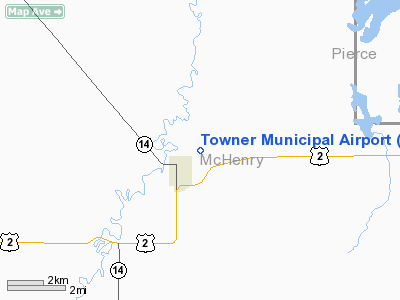
Location & QuickFacts
| FAA Information Effective: | 2008-09-25 |
| Airport Identifier: | D61 |
| Airport Status: | Operational |
| Longitude/Latitude: | 100-23-31.4840W/48-21-29.9950N
-100.392079/48.358332 (Estimated) |
| Elevation: | 1484 ft / 452.32 m (Estimated) |
| Land: | 140 acres |
| From nearest city: | 1 nautical miles NE of Towner, ND |
| Location: | Mc Henry County, ND |
| Magnetic Variation: | 09E (1985) |
Owner & Manager
| Ownership: | Publicly owned |
| Owner: | Towner Arpt Authority |
| Address: | Box 330
Towner, ND 58788 |
| Phone number: | 701-537-5137 |
| Manager: | Richard Gunter |
| Address: | Box 330
Towner, ND 58788 |
| Phone number: | 701-537-5137
ADDL CTC WINSTON PRATTENGER 701-537-5944 |
Airport Operations and Facilities
| Airport Use: | Open to public |
| Wind indicator: | Yes |
| Segmented Circle: | No |
| Control Tower: | No |
| Lighting Schedule: | DUSK-DAWN
ACTVT LIRL RY 16/34 - CTAF. |
| Beacon Color: | Clear-Green (lighted land airport) |
| Landing fee charge: | No |
| Sectional chart: | Twin Cities |
| Region: | AGL - Great Lakes |
| Boundary ARTCC: | ZMP - Minneapolis |
| Tie-in FSS: | GFK - Grand Forks |
| FSS on Airport: | No |
| FSS Toll Free: | 1-800-WX-BRIEF |
| NOTAMs Facility: | GFK (NOTAM-d service avaliable) |
Airport Communications
| CTAF: | 122.800 |
| Unicom: | 122.800 |
Airport Services
| Airframe Repair: | NONE |
| Power Plant Repair: | NONE |
Runway Information
Runway 03/21
| Dimension: | 2900 x 150 ft / 883.9 x 45.7 m |
| Surface: | TURF, Good Condition |
| |
Runway 03 |
Runway 21 |
| Longitude: | 100-23-54.5000W | 100-23-29.3100W |
| Latitude: | 48-21-19.9900N | 48-21-43.1800N |
| Elevation: | 1475.00 ft | 1484.00 ft |
| Traffic Pattern: | Left | Left |
| Runway End Identifier: | No | No |
| Centerline Lights: | No | No |
| Touchdown Lights: | No | No |
| Obstruction: | 17 ft road, 1.0 ft from runway | , 50:1 slope to clear |
|
Runway 16/34
| Dimension: | 3200 x 100 ft / 975.4 x 30.5 m |
| Surface: | TURF, Good Condition |
| Edge Lights: | Low |
| |
Runway 16 |
Runway 34 |
| Longitude: | 100-23-55.8600W | 100-23-39.9900W |
| Latitude: | 48-21-49.2500N | 48-21-19.4900N |
| Elevation: | 1482.00 ft | 1475.00 ft |
| Traffic Pattern: | Left | Left |
| Obstruction: | 4 ft fence, 1.0 ft from runway, 125 ft right of centerline | 17 ft road, 30.0 ft from runway, 1:1 slope to clear |
|
Helipad H1
| Dimension: | 30 x 30 ft / 9.1 x 9.1 m |
| Surface: | CONC, |
| |
Runway H1 |
Runway |
| Traffic Pattern: | Left | Left |
|
Radio Navigation Aids
| ID |
Type |
Name |
Ch |
Freq |
Var |
Dist |
| RUG | NDB | Rugby | | 212.00 | 08E | 14.7 nm |
| RLL | NDB | Rolla | | 263.00 | 09E | 44.1 nm |
| MIB | TACAN | Deering | 096X | | 10E | 39.0 nm |
| MOT | VORTAC | Minot | 118X | 117.10 | 13E | 36.3 nm |
Remarks
- 3' DITCH SE END OF RWY 16/34 & SW END OF RWY 03/21.
- RWY 16/34 HAS 50' STOPWAY NW END & 130' STOPWAY SE END.
- CFM WINTER COND AFTER SNOWSTORM WITH AMGR 701-537-5137/3519.
Images and information placed above are from
http://www.airport-data.com/airport/D61/
We thank them for the data!
|
|


