 |
|
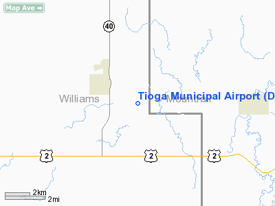
Location & QuickFacts
| FAA Information Effective: | 2008-09-25 |
| Airport Identifier: | D60 |
| Airport Status: | Operational |
| Longitude/Latitude: | 102-53-52.7470W/48-22-49.9170N
-102.897985/48.380532 (Estimated) |
| Elevation: | 2266 ft / 690.68 m (Surveyed) |
| Land: | 400 acres |
| From nearest city: | 2 nautical miles SE of Tioga, ND |
| Location: | Williams County, ND |
| Magnetic Variation: | 10E (2000) |
Owner & Manager
| Ownership: | Publicly owned |
| Owner: | Tioga Arpt Authority |
| Address: | Box 428
Tioga, ND 58852 |
| Phone number: | 701-664-2220 |
| Manager: | Gene Knutson
CHAIRMAN TIOGA ARPT AUTH. |
| Address: | Box 428
Tioga, ND 58852 |
| Phone number: | 701-664-2220
ADL MGRS CELL PHONE 701-641-3277/3276 |
Airport Operations and Facilities
| Airport Use: | Open to public |
| Wind indicator: | Yes |
| Segmented Circle: | Yes |
| Control Tower: | No |
| Lighting Schedule: | DUSK-DAWN
RY 12/30 MIRL PRESET LOW INTSTY; TO INCR INTST ACTVT PAPI RYS 12 & 30 - CTAF. |
| Beacon Color: | Clear-Green (lighted land airport) |
| Landing fee charge: | No |
| Sectional chart: | Billings |
| Region: | AGL - Great Lakes |
| Boundary ARTCC: | ZMP - Minneapolis |
| Tie-in FSS: | GFK - Grand Forks |
| FSS on Airport: | No |
| FSS Toll Free: | 1-800-WX-BRIEF |
| NOTAMs Facility: | GFK (NOTAM-d service avaliable) |
| Federal Agreements: | NGY |
Airport Communications
Airport Services
| Fuel available: | 100LLA
FOR FUEL & ARPT SVC CTC 701-664-2220/2760 OR 641-3277/3276 |
| Airframe Repair: | MAJOR |
| Power Plant Repair: | MAJOR |
| Bottled Oxygen: | LOW |
| Bulk Oxygen: | NONE |
Runway Information
Runway 03/21
| Dimension: | 3200 x 120 ft / 975.4 x 36.6 m |
| Surface: | TURF, Fair Condition
SFC UNEVEN DUE TO GRASS CLUMPS ESPECIALLY S HALF. |
| |
Runway 03 |
Runway 21 |
| Longitude: | 102-54-08.6560W | 102-53-37.6560W |
| Latitude: | 48-22-39.5770N | 48-23-03.5770N |
| Elevation: | 2255.00 ft | 2236.00 ft |
| Traffic Pattern: | Left | Left |
| Obstruction: | 12 ft road, 300.0 ft from runway, 25:1 slope to clear | , 50:1 slope to clear |
|
Runway 12/30
| Dimension: | 4501 x 75 ft / 1371.9 x 22.9 m |
| Surface: | ASPH, Good Condition
SFC UNEVEN DUE TO GRASS CLUMPS ESPECIALLY S HALF. |
| Weight Limit: | Single wheel: 12500 lbs. |
| Edge Lights: | Medium |
| |
Runway 12 |
Runway 30 |
| Longitude: | 102-54-16.7080W | 102-53-28.1470W |
| Latitude: | 48-23-03.9290N | 48-22-33.5090N |
| Elevation: | 2239.00 ft | 2266.00 ft |
| Alignment: | 127 | 127 |
| Traffic Pattern: | Left | Left |
| Markings: | Non-precision instrument, Good Condition | Non-precision instrument, Good Condition |
| Crossing Height: | 25.00 ft | 25.00 ft |
| VASI: | 2-light PAPI on left side | 2-light PAPI on left side |
| Visual Glide Angle: | 3.00° | 3.00° |
| Obstruction: | , 50:1 slope to clear | 37 ft road, 1300.0 ft from runway, 425 ft left of centerline, 29:1 slope to clear |
|
Radio Navigation Aids
| ID |
Type |
Name |
Ch |
Freq |
Var |
Dist |
| ISN | NDB | Williston | | 275.00 | 15E | 30.9 nm |
| PSH | NDB | Parshall | | 379.00 | 11E | 40.5 nm |
| ISN | VORTAC | Williston | 110X | 116.30 | 12E | 34.9 nm |
Remarks
- NUMEROUS TOWERS APRX 2 MILES NORTH, SOUTH AND WEST OF ARPT (+236' TWR, 10,500' WEST OF RWY 12/30; +330' TOWER, 13500' SOUTH & WEST OF RWY; +612' TWR 3 MILES SOUTH & WEST OF RWY).
- CONFIRM SNOW REMOVAL ON TURF RY 03/21 AFTER MAJOR STORM 701-664-2220 OR 701-641-3277.
- RY 03/21 INTERSECTION SOFT WHEN WET.
Images and information placed above are from
http://www.airport-data.com/airport/D60/
We thank them for the data!
|
|


