 |
|
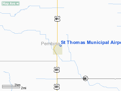
Location & QuickFacts
| FAA Information Effective: | 2008-09-25 |
| Airport Identifier: | 4S5 |
| Airport Status: | Operational |
| Longitude/Latitude: | 097-26-21.2920W/48-37-34.9610N
-97.439248/48.626378 (Estimated) |
| Elevation: | 837 ft / 255.12 m (Estimated) |
| Land: | 50 acres |
| From nearest city: | 1 nautical miles N of St Thomas, ND |
| Location: | Pembina County, ND |
| Magnetic Variation: | 07E (1985) |
Owner & Manager
| Ownership: | Publicly owned |
| Owner: | St. Thomas Airport Authority
DARREL BJORNSON-CHRMN APT AUTH |
| Address: | Box 170
St Thomas, ND 58276 |
| Phone number: | 701-257-6804 |
| Manager: | Ernest Blair |
| Address: | Box 322
St Thomas, ND 58276 |
| Phone number: | 701-257-6629
MGRS CELL PHONE 701-520-1597 |
Airport Operations and Facilities
| Airport Use: | Open to public |
| Wind indicator: | Yes |
| Segmented Circle: | No |
| Control Tower: | No |
| Lighting Schedule: | RDO-CTL
ACTVT LIRL RY 17/35 - 122.8. |
| Landing fee charge: | No |
| Sectional chart: | Twin Cities |
| Region: | AGL - Great Lakes |
| Boundary ARTCC: | ZMP - Minneapolis |
| Tie-in FSS: | GFK - Grand Forks |
| FSS on Airport: | No |
| FSS Toll Free: | 1-800-WX-BRIEF |
| NOTAMs Facility: | GFK (NOTAM-d service avaliable) |
Airport Communications
Airport Services
| Airframe Repair: | MINOR |
| Power Plant Repair: | MINOR |
Runway Information
Runway 17/35
| Dimension: | 2600 x 50 ft / 792.5 x 15.2 m |
| Surface: | ASPH, Fair Condition |
| Surface Treatment: | Aggregate Friction Seal Coat |
| Weight Limit: | Single wheel: 5000 lbs. |
| Edge Lights: | Non-standard lighting system
NSTD LIRL DUE TO FIXTURES & LCTD 15 FT FM RY EDGE. |
| |
Runway 17 |
Runway 35 |
| Longitude: | 097-23-50.2900W | 097-23-50.2900W |
| Latitude: | 48-38-14.1100N | 48-37-48.4600N |
| Elevation: | 835.00 ft | 837.00 ft |
| Alignment: | 127 | 0 |
| Traffic Pattern: | Left | Left |
| Displaced threshold: | 280.00 ft
DSPLCD THLD MKD WITH GREEN LGTS - NIGHT OPNS ONLY. | 70.00 ft
DSPLCD THLD MKD WITH GREEN LGTS - NIGHT OPNS ONLY. |
| Obstruction: | 80 ft trees, 2600.0 ft from runway, 30:1 slope to clear
+16' ROAD DIST 300' FM DSPLCD THLD; APCH RATIO FM DSPLCD THLD 18:1.
+16' ROAD, DIST 20', E-W ROAD PARALLEL TO RY END. | 80 ft trees, 2800.0 ft from runway, 32:1 slope to clear
+16' ROAD 100' FM DSPLCD THLD APCH RATIO 6:1.
+16' ROAD DIST 30', E-W ROAD PARALLEL TO THLD. |
|
Radio Navigation Aids
| ID |
Type |
Name |
Ch |
Freq |
Var |
Dist |
| RDR | TACAN | Red River | 111X | | 06E | 40.2 nm |
| GFK | VOR/DME | Grand Forks | 090X | 114.30 | 09E | 41.6 nm |
| HML | VORTAC | Humboldt | 071X | 112.40 | 09E | 19.4 nm |
Remarks
- CONFIRM WINTER COND & SNOW REMOVAL WITH AMGR CALL 701-257-6629/6446/6804.
- +60' TREES 125' R OF CL AT RY 35 END PENETRATE TRNSL SFC.
- RY 17/35 EXPECT TURBULENCE WHEN EXECUTING CROSS-WIND LNDGS.
Images and information placed above are from
http://www.airport-data.com/airport/4S5/
We thank them for the data!
| General Info
|
| Country |
United States
|
| State |
NORTH DAKOTA
|
| FAA ID |
4S5
|
| Latitude |
48-37-34.961N
|
| Longitude |
097-26-21.292W
|
| Elevation |
837 feet
|
| Near City |
ST THOMAS
|
We don't guarantee the information is fresh and accurate. The data may
be wrong or outdated.
For more up-to-date information please refer to other sources.
|
|


