 |
|
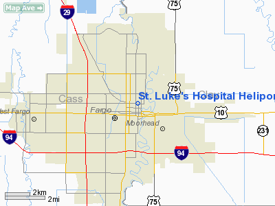
St. Luke's Hospital Heliport |
Location & QuickFacts
| FAA Information Effective: | 2008-09-25 |
| Airport Identifier: | ND48 |
| Airport Status: | Operational |
| Longitude/Latitude: | 096-47-08.2910W/46-53-00.8700N
-96.785636/46.883575 (Estimated) |
| Elevation: | 975 ft / 297.18 m (Estimated) |
| Land: | 0 acres |
| From nearest city: | 1 nautical miles S of Fargo, ND |
| Location: | Cass County, ND |
| Magnetic Variation: | 06E (1990) |
Owner & Manager
| Ownership: | Privately owned |
| Owner: | Meritcare Hospital |
| Address: | 801 Broadway North
Fargo, ND 58122-0140 |
| Phone number: | 701-234-6054 |
| Manager: | Dan Ehlen |
| Address: | 801 Broadway North
Fargo, ND 58122-0140 |
| Phone number: | 701-234-6054 |
Airport Operations and Facilities
| Airport Use: | Private
MEDICAL USE. |
| Wind indicator: | Yes |
| Segmented Circle: | No |
| Control Tower: | No |
| Lighting Schedule: | DUSK-DAWN |
| Beacon Color: | Clear-Green-Yellow (heliport) |
| Sectional chart: | Twin Cities |
| Region: | AGL - Great Lakes |
| Boundary ARTCC: | ZMP - Minneapolis |
| Tie-in FSS: | GFK - Grand Forks |
| FSS Toll Free: | 1-800-WX-BRIEF |
Runway Information
Helipad H1
| Dimension: | 30 x 30 ft / 9.1 x 9.1 m |
| Surface: | CONC, |
| |
Runway H1 |
Runway |
| Traffic Pattern: | Left | Left |
|
Radio Navigation Aids
| ID |
Type |
Name |
Ch |
Freq |
Var |
Dist |
| AA | NDB | Kenie | | 365.00 | 06E | 7.7 nm |
| BWP | NDB | Breckenridge-wahpeton | | 233.00 | 05E | 39.1 nm |
| VCY | NDB | Valley City | | 382.00 | 07E | 46.4 nm |
| DTL | VOR/DME | Detroit Lakes | 049X | 111.20 | 05E | 37.1 nm |
| FFM | VOR/DME | Fergus Falls | 041X | 110.40 | 05E | 44.2 nm |
| FAR | VORTAC | Fargo | 109X | 116.20 | 09E | 8.3 nm |
Remarks
- PRVDD APCH/DEP RTE OPS FM 320 TO 130; TKOF/LDG AREA MKD; THE CORNERS OF HELI STORAGE BLDG & HOSP ELEVATOR SHAFT BE MKD & LGTD; & WIND IND MAINTAINED.
Images and information placed above are from
http://www.airport-data.com/airport/ND48/
We thank them for the data!
| General Info
|
| Country |
United States
|
| State |
NORTH DAKOTA
|
| FAA ID |
ND48
|
| Latitude |
46-53-00.870N
|
| Longitude |
096-47-08.291W
|
| Elevation |
975 feet
|
| Near City |
FARGO
|
We don't guarantee the information is fresh and accurate. The data may
be wrong or outdated.
For more up-to-date information please refer to other sources.
|
|


