 |
|
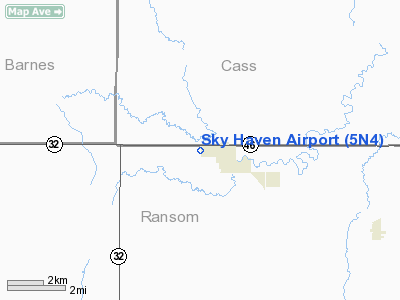
Location & QuickFacts
| FAA Information Effective: | 2008-09-25 |
| Airport Identifier: | 5N4 |
| Airport Status: | Operational |
| Longitude/Latitude: | 097-37-13.3530W/46-37-37.9010N
-97.620376/46.627195 (Estimated) |
| Elevation: | 1147 ft / 349.61 m (Estimated) |
| Land: | 200 acres |
| From nearest city: | 1 nautical miles W of Enderlin, ND |
| Location: | Ransom County, ND |
| Magnetic Variation: | 07E (1985) |
Owner & Manager
| Ownership: | Publicly owned |
| Owner: | Enderlin Airport Authority
CHAIRMAN OF ARPT AUTH. |
| Address: | 13847 52nd St Se
Enderlin, ND 58027 |
| Phone number: | 701-437-2267 |
| Manager: | Dave Nudell |
| Address: | 13847 52nd St Se
Enderlin, ND 58027 |
| Phone number: | 701-799-6086
ADDL CTC HUBERT BLEESE 701-437-3851 OR ARPT AUTH SEC/TREAS RAY BROWN 437-3300/3418. |
Airport Operations and Facilities
| Airport Use: | Open to public |
| Wind indicator: | Yes |
| Segmented Circle: | No |
| Control Tower: | No |
| Lighting Schedule: | RDO-CTL
ACTVT LIRL RY 12/30 - CTAF. |
| Landing fee charge: | No |
| Sectional chart: | Twin Cities |
| Region: | AGL - Great Lakes |
| Traffic Pattern Alt: | 653 ft |
| Boundary ARTCC: | ZMP - Minneapolis |
| Tie-in FSS: | GFK - Grand Forks |
| FSS on Airport: | No |
| FSS Toll Free: | 1-800-WX-BRIEF |
| NOTAMs Facility: | GFK (NOTAM-d service avaliable) |
Airport Communications
Airport Services
| Airframe Repair: | NONE |
| Power Plant Repair: | NONE |
| Bottled Oxygen: | NONE |
| Bulk Oxygen: | NONE |
Runway Information
Runway 03/21
| Dimension: | 2157 x 23 ft / 657.5 x 7.0 m |
| Surface: | ASPH-TURF, Fair Condition
HAS AN ASPH OVERLAY 1320' X 23'. RY TO BE USED FOR TWY ONLY EXCP EMERG DALGT CROSSWIND OPNS.
ASPHALT SFC ROLLING DURING SPRING FROST. |
| Weight Limit: | Single wheel: 8000 lbs. |
| |
Runway 03 |
Runway 21 |
| Longitude: | 097-37-00.0000W | 097-36-40.3100W |
| Latitude: | 46-37-30.0000N | 46-37-46.4100N |
| Elevation: | 1140.00 ft | 1125.00 ft |
| Traffic Pattern: | Left | Left |
| Markings: | None, | None, |
| Runway End Identifier: | No | No |
| Centerline Lights: | No | No |
| Touchdown Lights: | No | No |
| Obstruction: | 25 ft trees, 1200.0 ft from runway, 200 ft right of centerline, 40:1 slope to clear | 70 ft trees, 1100.0 ft from runway, 12:1 slope to clear
+20' ROAD 550' FM THR 150'R, APCH RATIO 17:1. |
|
Runway 12/30
| Dimension: | 2861 x 40 ft / 872.0 x 12.2 m |
| Surface: | ASPH, Fair Condition
HAS AN ASPH OVERLAY 1320' X 23'. RY TO BE USED FOR TWY ONLY EXCP EMERG DALGT CROSSWIND OPNS.
ASPHALT SFC ROLLING DURING SPRING FROST. |
| Weight Limit: | Single wheel: 8000 lbs. |
| Edge Lights: | Low |
| |
Runway 12 |
Runway 30 |
| Longitude: | 097-37-10.1800W | 097-36-43.0000W |
| Latitude: | 46-37-41.1400N | 46-37-20.0000N |
| Elevation: | 1135.00 ft | 1137.00 ft |
| Traffic Pattern: | Left | Left |
| Markings: | None, | None, |
| Runway End Identifier: | No | No |
| Centerline Lights: | No | No |
| Touchdown Lights: | No | No |
| Obstruction: | 20 ft road, 375.0 ft from runway, 140 ft left of centerline, 8:1 slope to clear
+50 FT TREE 1600 FT FROM THR ON CNTRLN APCH RATIO 28:1; +25 FT TREE 700 FT FROM THR APCH RATIO 28:1. | 8 ft gnd, 500.0 ft from runway, 50 ft left of centerline, 37:1 slope to clear |
|
Radio Navigation Aids
| ID |
Type |
Name |
Ch |
Freq |
Var |
Dist |
| VCY | NDB | Valley City | | 382.00 | 07E | 19.3 nm |
| GWR | NDB | Gwinner | | 278.00 | 07E | 24.3 nm |
| AA | NDB | Kenie | | 365.00 | 06E | 40.3 nm |
| BWP | NDB | Breckenridge-wahpeton | | 233.00 | 05E | 48.0 nm |
| BTN | NDB | Britton | | 386.00 | 06E | 48.8 nm |
| JMS | VOR/DME | Jamestown | 092X | 114.50 | 10E | 47.3 nm |
| FAR | VORTAC | Fargo | 109X | 116.20 | 09E | 32.6 nm |
Remarks
- ELECTRICAL HOOKUP FOR ACFT FOR WINTERTIME USE NEXT TO PILOT LOUNGE.
- RY 12/30 THR LGTS 97' OUTSIDE RY 12 END; 86' OUTSIDE RY 30 END; LGTS 28' FM RY EDGES.
- NO SNOW REMOVAL AVBL ON RY 03/21.
- SNOW RMVL IREG - CONFIRM WITH CITY MAINTENANCE 701-437-2078, STEVE SCHMITZ.
- RY 21 THR 2' DROPOFF.
- CULTIVATED FIELD AT RY 12 THLD OUTBOUND.
Images and information placed above are from
http://www.airport-data.com/airport/5N4/
We thank them for the data!
| General Info
|
| Country |
United States
|
| State |
NORTH DAKOTA
|
| FAA ID |
5N4
|
| Latitude |
46-37-37.901N
|
| Longitude |
097-37-13.353W
|
| Elevation |
1147 feet
|
| Near City |
ENDERLIN
|
We don't guarantee the information is fresh and accurate. The data may
be wrong or outdated.
For more up-to-date information please refer to other sources.
|
|


