 |
|
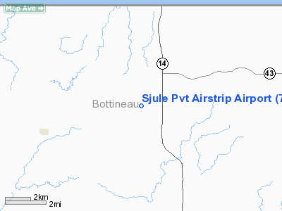
Sjule Pvt Airstrip Airport |
Location & QuickFacts
| FAA Information Effective: | 2008-09-25 |
| Airport Identifier: | 7NA9 |
| Airport Status: | Operational |
| Longitude/Latitude: | 100-34-40.5400W/48-55-42.0540N
-100.577928/48.928348 (Estimated) |
| Elevation: | 1680 ft / 512.06 m (Estimated) |
| Land: | 2 acres |
| From nearest city: | 5 nautical miles NE of Souris, ND |
| Location: | Bottineau County, ND |
| Magnetic Variation: | 10E (1986) |
Owner & Manager
| Ownership: | Privately owned |
| Owner: | Thomas R. Sjule |
| Address: | Rt 2, Box 54
Souris, ND 58783 |
| Phone number: | 701-228-3444 |
| Manager: | Thomas R. Sjule |
| Address: | Rt 2, Box 54
Souris, ND 58783 |
| Phone number: | 701-228-3444 |
Airport Operations and Facilities
| Airport Use: | Private |
| Segmented Circle: | No |
| Control Tower: | No |
| Sectional chart: | Twin Cities |
| Region: | AGL - Great Lakes |
| Boundary ARTCC: | ZMP - Minneapolis |
| Tie-in FSS: | GFK - Grand Forks |
| FSS on Airport: | No |
| FSS Toll Free: | 1-800-WX-BRIEF |
Runway Information
Runway 17/35
| Dimension: | 3900 x 100 ft / 1188.7 x 30.5 m |
| Surface: | TURF, |
| |
Runway 17 |
Runway 35 |
| Traffic Pattern: | Left | Left |
|
Radio Navigation Aids
| ID |
Type |
Name |
Ch |
Freq |
Var |
Dist |
| RLL | NDB | Rolla | | 263.00 | 09E | 38.2 nm |
| HBC | NDB | Mohall | | 350.00 | 11E | 39.2 nm |
| RUG | NDB | Rugby | | 212.00 | 08E | 39.2 nm |
| MIB | TACAN | Deering | 096X | | 10E | 43.9 nm |
| MOT | VORTAC | Minot | 118X | 117.10 | 13E | 49.1 nm |
Images and information placed above are from
http://www.airport-data.com/airport/7NA9/
We thank them for the data!
| General Info
|
| Country |
United States
|
| State |
NORTH DAKOTA
|
| FAA ID |
7NA9
|
| Latitude |
48-55-42.054N
|
| Longitude |
100-34-40.540W
|
| Elevation |
1680 feet
|
| Near City |
SOURIS
|
We don't guarantee the information is fresh and accurate. The data may
be wrong or outdated.
For more up-to-date information please refer to other sources.
|
|


