 |
|
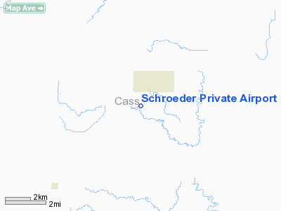
Schroeder Private Airport |
Location & QuickFacts
| FAA Information Effective: | 2008-09-25 |
| Airport Identifier: | 38ND |
| Airport Status: | Operational |
| Longitude/Latitude: | 097-24-04.3190W/47-05-52.9250N
-97.401200/47.098035 (Estimated) |
| Elevation: | 1140 ft / 347.47 m (Estimated) |
| Land: | 0 acres |
| From nearest city: | 2 nautical miles SW of Erie, ND |
| Location: | Cass County, ND |
| Magnetic Variation: | 06E (1985) |
Owner & Manager
| Ownership: | Privately owned |
| Owner: | Robert Schroeder |
| Address: |
Erie, ND 58029 |
| Phone number: | 701-668-2719 |
| Manager: | Robert Schroeder |
| Address: |
Erie, ND 58029 |
| Phone number: | 701-668-2719 |
Airport Operations and Facilities
| Airport Use: | Private |
| Wind indicator: | Yes |
| Segmented Circle: | No |
| Control Tower: | No |
| Landing fee charge: | No |
| Sectional chart: | Twin Cities |
| Region: | AGL - Great Lakes |
| Boundary ARTCC: | ZMP - Minneapolis |
| Tie-in FSS: | GFK - Grand Forks |
| FSS on Airport: | No |
| FSS Toll Free: | 1-800-WX-BRIEF |
Runway Information
Runway 12/30
| Dimension: | 1800 x 50 ft / 548.6 x 15.2 m |
| Surface: | TURF, |
| |
Runway 12 |
Runway 30 |
| Traffic Pattern: | Left | Left |
| Obstruction: | 50 ft trees, 300.0 ft from runway | |
|
Radio Navigation Aids
| ID |
Type |
Name |
Ch |
Freq |
Var |
Dist |
| AA | NDB | Kenie | | 365.00 | 06E | 24.6 nm |
| VCY | NDB | Valley City | | 382.00 | 07E | 24.9 nm |
| FAR | VORTAC | Fargo | 109X | 116.20 | 09E | 30.6 nm |
Remarks
- FILED FOR RECORD PURPOSES ONLY.
Images and information placed above are from
http://www.airport-data.com/airport/38ND/
We thank them for the data!
| General Info
|
| Country |
United States
|
| State |
NORTH DAKOTA
|
| FAA ID |
38ND
|
| Latitude |
47-05-52.925N
|
| Longitude |
097-24-04.319W
|
| Elevation |
1140 feet
|
| Near City |
ERIE
|
We don't guarantee the information is fresh and accurate. The data may
be wrong or outdated.
For more up-to-date information please refer to other sources.
|
|


